
Video (7:00):
Good Friday evening!
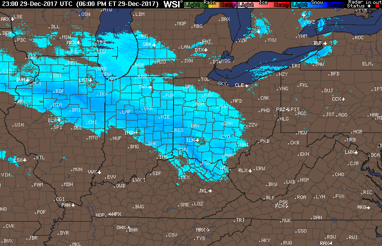
We are still tracking the snow falling across the region tonight. As of now, the forecast looks to be on track. Here is a look at the most recent radar loop:
Snow will begin to wind down from west to east around 9 PM EST for Laporte and by 11 PM EST for Fort Wayne.
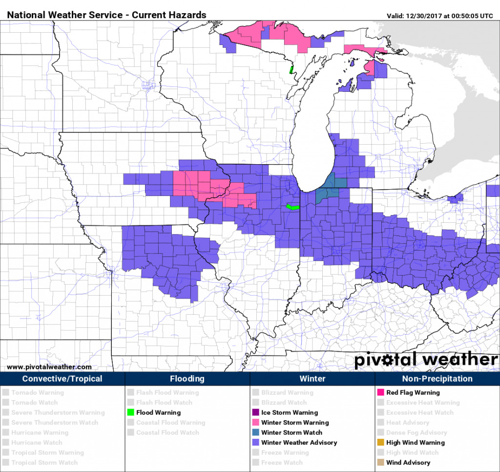
We then turn our attention to lake effect snow which will be cranking up as the arctic front passes the area tonight. Winter Storm Watches have been posted for La Porte and St. Joseph counties.
 As a deep layer of cold arctic air moves from the northwest across generally warm lake temperatures, it will produce an extremely favorable environment for lake effect snow banding, specifically for the La Porte District. Here is the simulated radar between 2AM EST tonight to Sunday Night. Note, with the exception some possible breaks on Sunday, the lake effect machine never really shuts down.
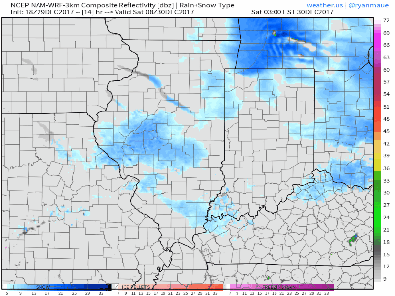
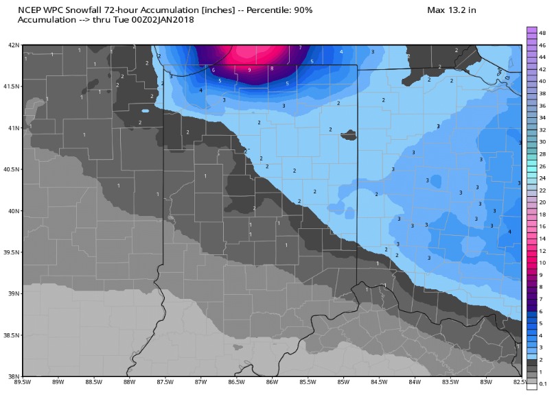
This consistent stream of moisture from the lake will lead to heavy snowfall accumulations by Sunday night. Here’s a look at the general idea for snow totals over the next 72 hours.
Part of the reason this lake effect snow will be so potent is because of strong northwest winds that will filter into the area tomorrow. 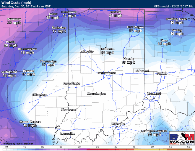
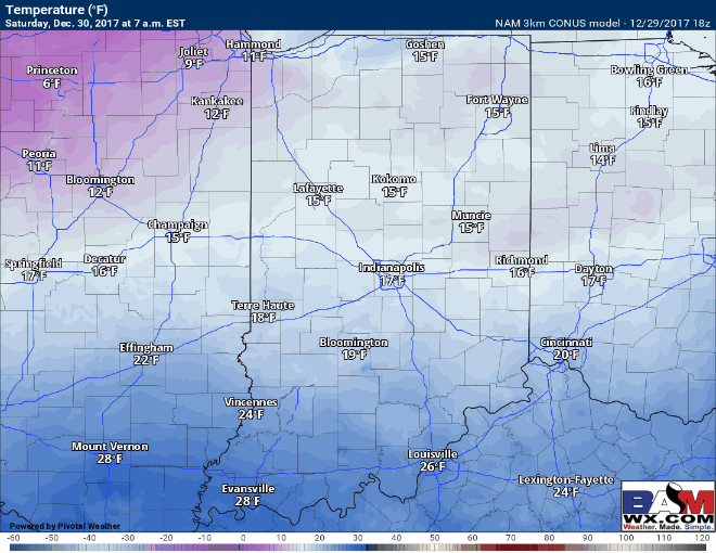
Unfortunately, temperatures will be brutally cold this weekend. Here’s a look at temperatures between 7AM tomorrow and Sunday night. Cold temperatures will allow for high snow to liquid ratios and with strong winds on Saturday, wind chills will be well below zero at times.
We are also watching a piece of energy that could bring additional light snowfall on Sunday morning, especially for the southern portions of La Porte and St. Joseph districts. We will watch it and update throughout the weekend on this potential. Have a great weekend.