
Video (5:00):
Good Friday morning everyone!
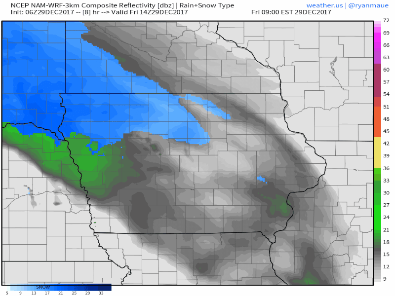
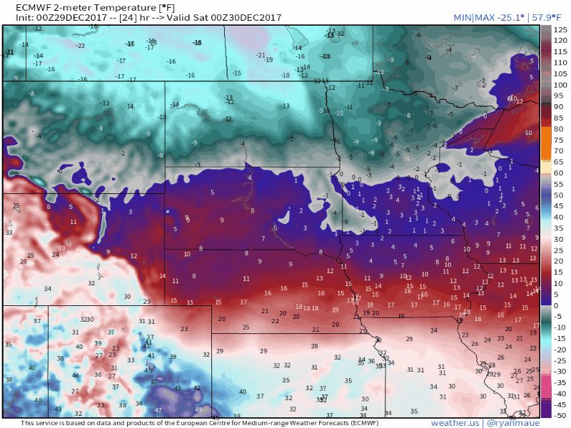
Snow is currently falling in the extreme northeast corner of Nebraska and Northern Iowa. Temperatures are in the teens for most of the region, but there are some single digits in areas where snow is falling in Northern Iowa.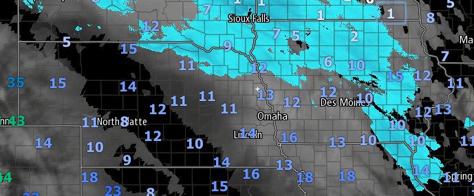
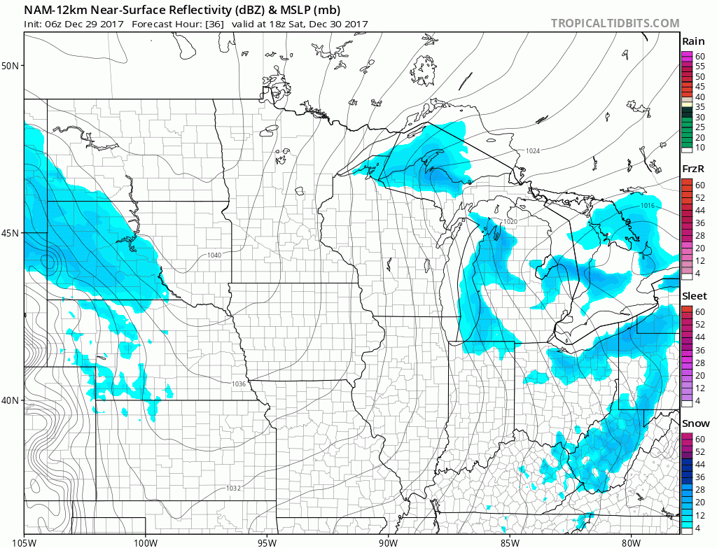
This system will continue to put down a swath of accumulating snow, primarily for Iowa, today. Most of Nebraska will stay dry, but some accumulations can be expected in the extreme northeast corner of the state. Snow should begin to exit the area from northwest to southeast in the evening hours with all snow east of Iowa by midnight.
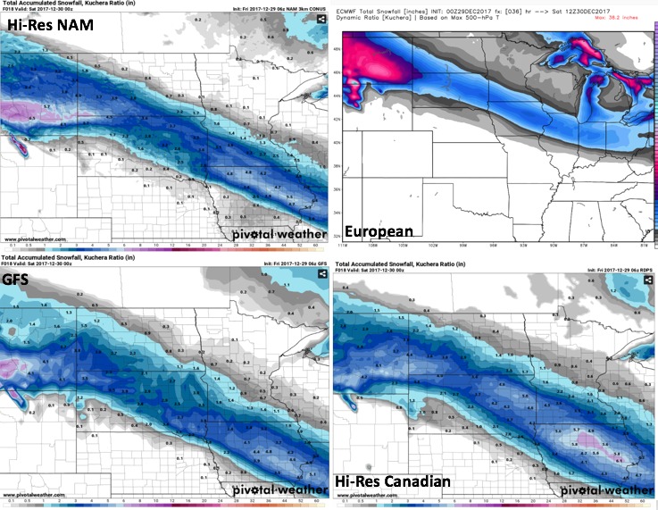
Accumulations for this system could be quite impressive for some areas. Areas in Central Iowa could pick up 4-6 inches in spots.
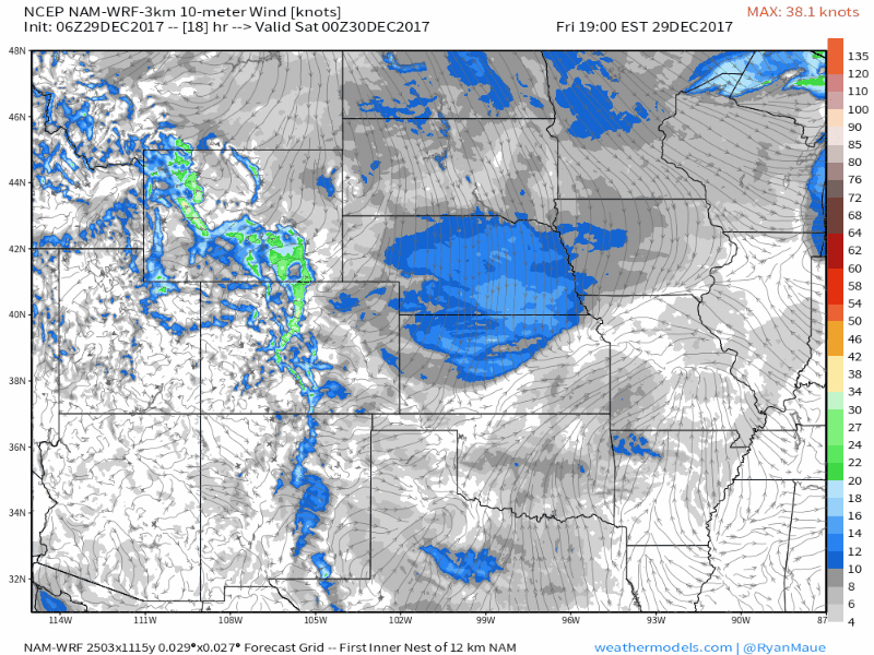
Behind this system Friday night into Saturday winds will pick up and cause issues with blowing and drifting snow in Iowa.
A piece of energy will dive into the Central US on Saturday, which could produce some additional snow showers and light accumulations Saturday night.
Temperatures will also become dangerously cold this weekend and into next week as the arctic front passes tonight. With a solid snowpack in place for much of Nebraska and Iowa, nighttime temperatures will drop well below zero every night until next Tuesday. Here’s a look at the expected temperatures from Friday night to Tuesday afternoon.
If you have any questions, do not hesitate to contact us! Stay warm out there this weekend!