Video (6:30):
Good Thursday afternoon!
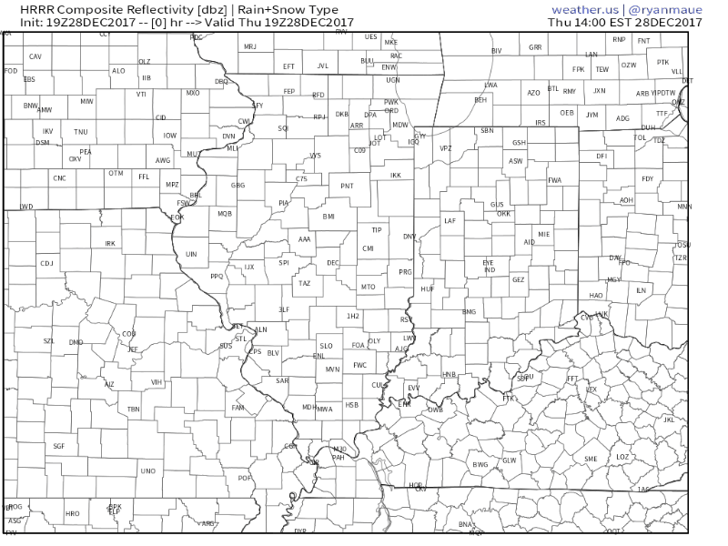
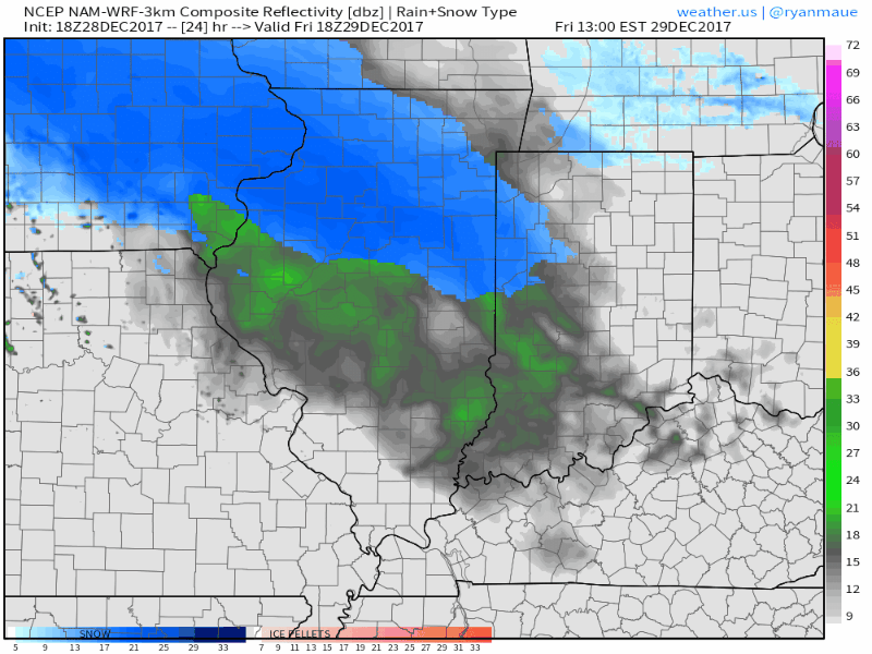
We have a disturbance today and tomorrow that will likely bring accumulating snowfall for the Laporte and Fort Wayne District. Right now we are tracking a swath of snow that is working its way across Illinois and will arrive in Indiana later this afternoon and evening.
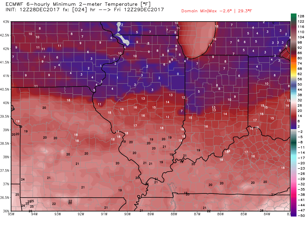
Temperatures will drop into single digits for northern districts again tonight.
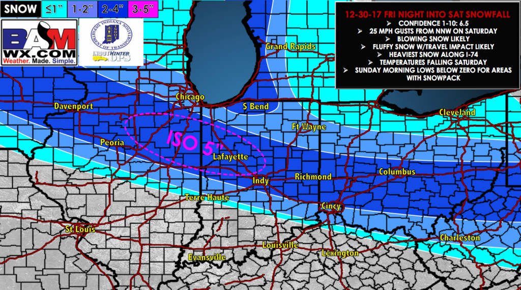
The next wave of energy looks to big a decent snow producer for the region. As of now, timing looks to be from tomorrow afternoon and into overnight tomorrow. Residual snow showers are possible on Saturday morning. Also note as winds pick up behind the system from the northwest, the lake effect snow machine will crank up and likely produce additional snowfall accumulations for parts of Northern Indiana.
Temperatures will also fall quickly throughout the day on Saturday which could produce additional problems with refreezing on pavements with melted snow. Overall, for the wave tomorrow into Saturday, here is our latest official forecast. *Note this does not include the snowfall from tonight or for lake effect snow Saturday and Sunday.