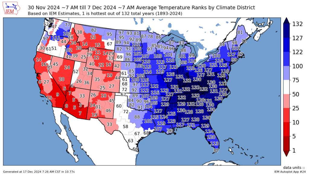
The first week of December 2024 was the coldest on record for lower Ohio and Tennessee Valley, but the month will likely be remembered for its significant ups and downs rather than its bouts of cold. While another cold shot arrives late this week, a much milder than normal pattern will close out 2024.

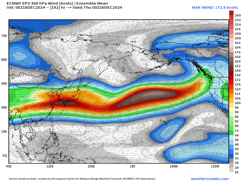
The variability of the North Pacific Jet, related to the absence of persistent El Niño or La Niña influences at the onset of the 2024-25 winter, has been one of the biggest culprits for December 2024’s wild swings. A substantial extension of the Pacific Jet, bringing mild Pacific air to the West Coast of the US, will drive the warm conclusion to the year.

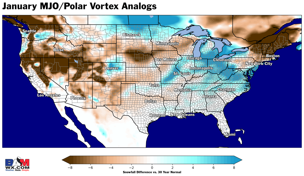
However, another shift is on the horizon; a weakening jet stream and favorable atmospheric patterns suggest the return of cold air in early 2025. Years similar to 2024/25, combined with model data, suggest that from January 5th through mid-January, the Eastern US will see colder and potentially snowier conditions, while warmth continues to dominate across the Western US.

Top pattern matches indicate a snowier than normal pattern for the Ohio Valley, Great Lakes and Mid-Atlantic with continued lack of snow across the Central Plains.

Bottom line, the winter whiplash will continue ahead, but it isn’t the worst thing for wintry weather prospects as we flip the page into the new year.


