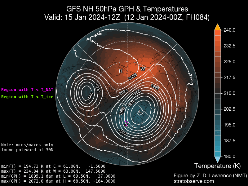
The Polar vortex is a commonly misunderstood, yet popular term in the meteorology world.
By Hope Kleitsch
Note, this is NOT a new term, it just happens to be a term that is flowing freely on the internet. It refers to the area of low pressure that is parked atop both of the Earth’s poles. Unlike the jet stream, the polar vortex is located in the stratosphere. It weakens in the summer and strengthens in the winter. When the polar vortex is stable, the jet stream is able to flow in a relatively normal pattern. Many times during the winter, the polar vortex will become unstable and will expand. When this happens, the cold air associated with the vortex can catch a ride on the jet stream, bringing the cold arctic air to the lower 48.

Recent History of the Polar Vortex:

—January 2024 Arctic Blast
After a rather mild December, much of the U.S. was forced into a record breaking cold middle of January. From Montana to Texas, daily record breaking lows were broken. Many in the northern plains felt wind chill values plummet to nearly 60 or 70 degrees below zero! States in the south (as far south as San Antonio, Texas) saw temperatures near or below the zero degree mark. On top of the cold temperatures, blizzard conditions blanketed Des Moines, Iowa to Chicago, Illinois. Many other states also got in on the wintry precipitation.


–The Great Texas Freeze (February 11-20, 2021)
In addition to a strongly negative Arctic Oscillation, the polar vortex was able to sink down into the mid-latitudes. The cold blast started to shift to Texas on February 10. Nine consecutive days freezing temperatures broke records for the longest freezing streak in the state’s history. This was a historic event for the state. On top of the cold temperatures, freezing precipitation made for havoc travel. A pile-up of over 100 vehicles on I-35 in Fort Worth occurred, shutting down the highway for hours. Power outages were also another hazard. Nearly 10 million people were in the dark. This would go to be a billion dollar disaster.

So where is the vortex going coming up? It’ expected to be relatively strong and slightly displaced towards Asia. In these situations, it makes it harder for the United States to tap into Arctic air meaning warmer risks for late January into early February for the United States.

