Freezing Drizzle is one of the trickiest, yet most impactful meteorological hazards to forecast. The most common error from a forecast standpoint regarding freezing drizzle is utilizing simulated radar / ice accumulation forecasts to effectively predict impacts. In reality, it is never that simple with this challenging type of winter weather.
It’s important to note that there are several key differences between freezing rain and freezing drizzle:
1. Freezing Drizzle will not usually show up on radar with any frequency, compared to freezing rain which is usually easier to see on radar. Freezing drizzle droplets are smaller, and therefore can evade the radar scan compared to freezing rain droplets which are much larger.
2. Freezing Drizzle is usually not related to a frontal system, and can happen with low hanging clouds/ moist environments that a typical forecast app won’t be able to pick up on.
3. Freezing drizzle is usually just enough to cause slick spots / a “glaze of ice”, where freezing rain can cause more widespread, significant impacts. The “catch” is, freezing drizzle events won’t always allow for pavement to be treated ahead of time, causing more localized impacts.
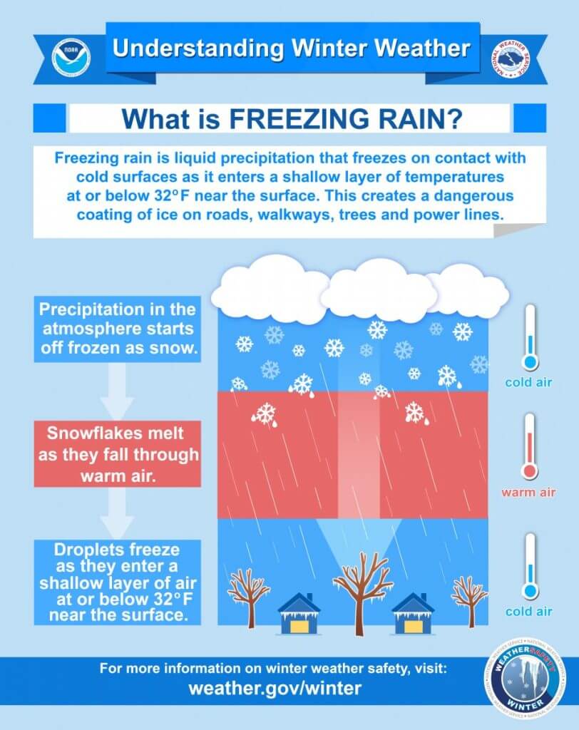
4. Freezing rain forms when melted snowflakes turn into water droplets, and freeze on contact with pavement that is at freezing. Freezing drizzle develops because of supercooled droplets that freeze once they reach the colder pavement. It can happen due to a shallow layer of saturation near the surface.
Forecasting for freezing drizzle requires experience in using what we call atmospheric soundings, which allow us to see the different layers of the atmosphere and where moisture is present. This helps us to determine if sufficient clouds / moisture towards the surface exists to allow for these supercooled droplets to form.
There are some model types that can aid in helping us see where better low level moisture exists in some areas vs others, but generally you need that advanced step… which is where we come in!
There are several ways Clarity users can avoid being caught off guard by this type of event. Whether you are in the pavement treatment / snow removal business, emergency operations, or just an AM commuter, our custom commentary (called nowcasts and insights) allow you to see the risks, even when a conventional radar or hourly forecast might show nothing / 0% chances. These are important visuals that are intentionally kept simple, and easy to understand.
Additionally, to ensure preparedness even in the most minor winter weather events, users can:
- Utilize a 24/7 chat with meteorologists to ensure they make effective decisions.
- View detailed video analyses breaking down critical forecast risks and impacts.
- Monitor PaveCast/Treatment Recommendations – By taking into account the pavement temperature and snowfall rates, users can adequately manage complex treatment plans and staffing.
These are the important features that can enhance the efficiency and success of operations during the impactful winter weather.


