Key Points – Tuesday, July 11, 2017:
Synopsis: Good Tuesday morning! We discuss the additional heavy rainfall and potential strong storms once again today, some parts of north central IN saw up to 5-6″ of rain just yesterday with more on the way today. In the video we analyze storm chances getting into Wednesday and overnight into Thursday morning…still multiple rounds of storms on the table here before the cold front swings through late week and drops the temps/humidity down as well. If you have any questions please let us know, have a blessed day!
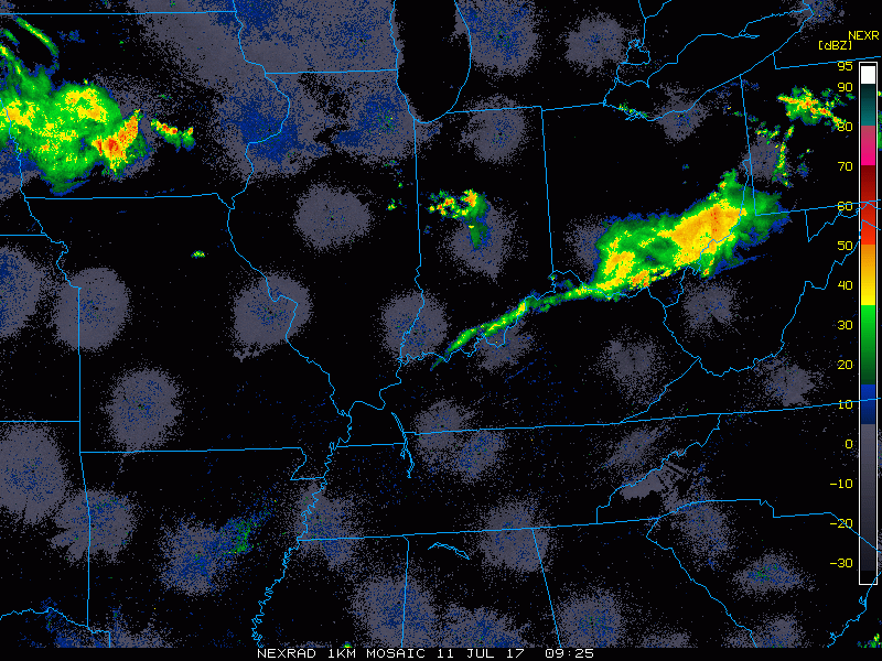
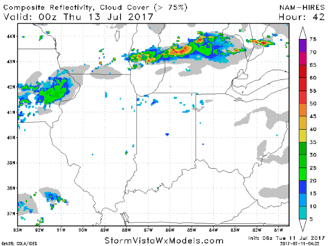
Current Radar:
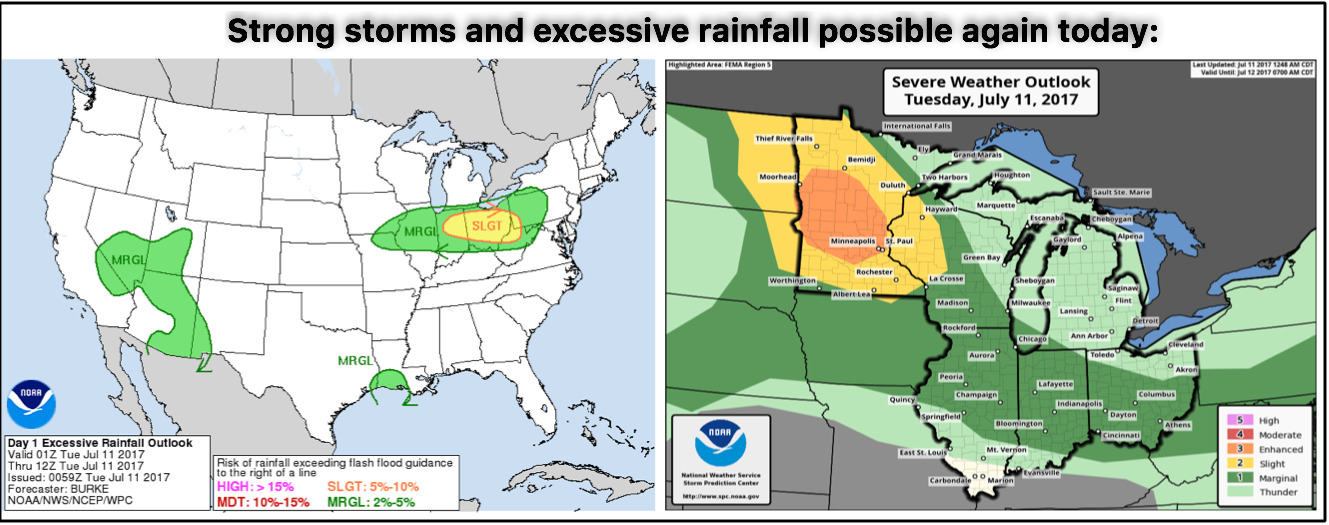
Current strong storm risk and excessive rainfall threats today…pending on sunshine and instability, upgrade to a slight risk could be introduced across parts of IN/OH.
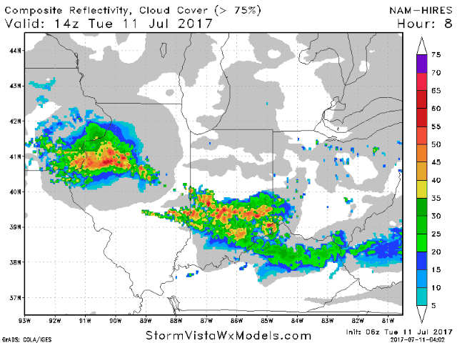
Simulated radar guidance today from the latest 3km NAM…this model is handling storms very well this morning and shows them continuing into IN/OH pushing south and east throughout the day:
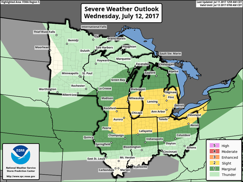
Strong storms on the table once again on Wednesday, overall we agree with the area highlighted below, could see the slight risk tugged slightly further south as well.
Simulated radar guidance later on Wednesday into the overnight shows the risk across mainly the northern half of the forecast area…with that being said, the solution does indicate a possible southerly trend in the storms overnight, something are monitoring closely and will update in the short-term for consistency.
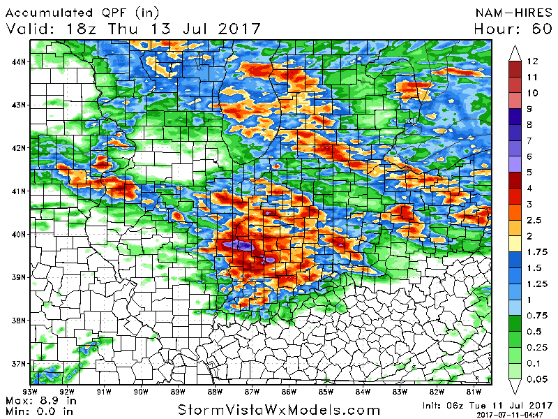
Looking at rain the next 60 hours…across central IN and parts of OH just relentless rains…use this as guidance, it won’t be exact but it shows the threats for heavy rainfall certainly on the table over the next 3 days. Localized 3-4″ on the table once again.
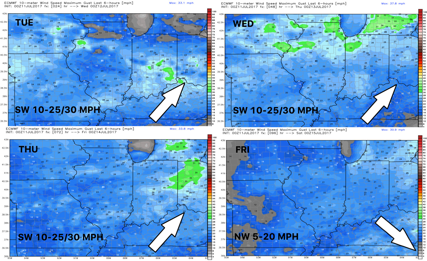
Wind forecast into late week:
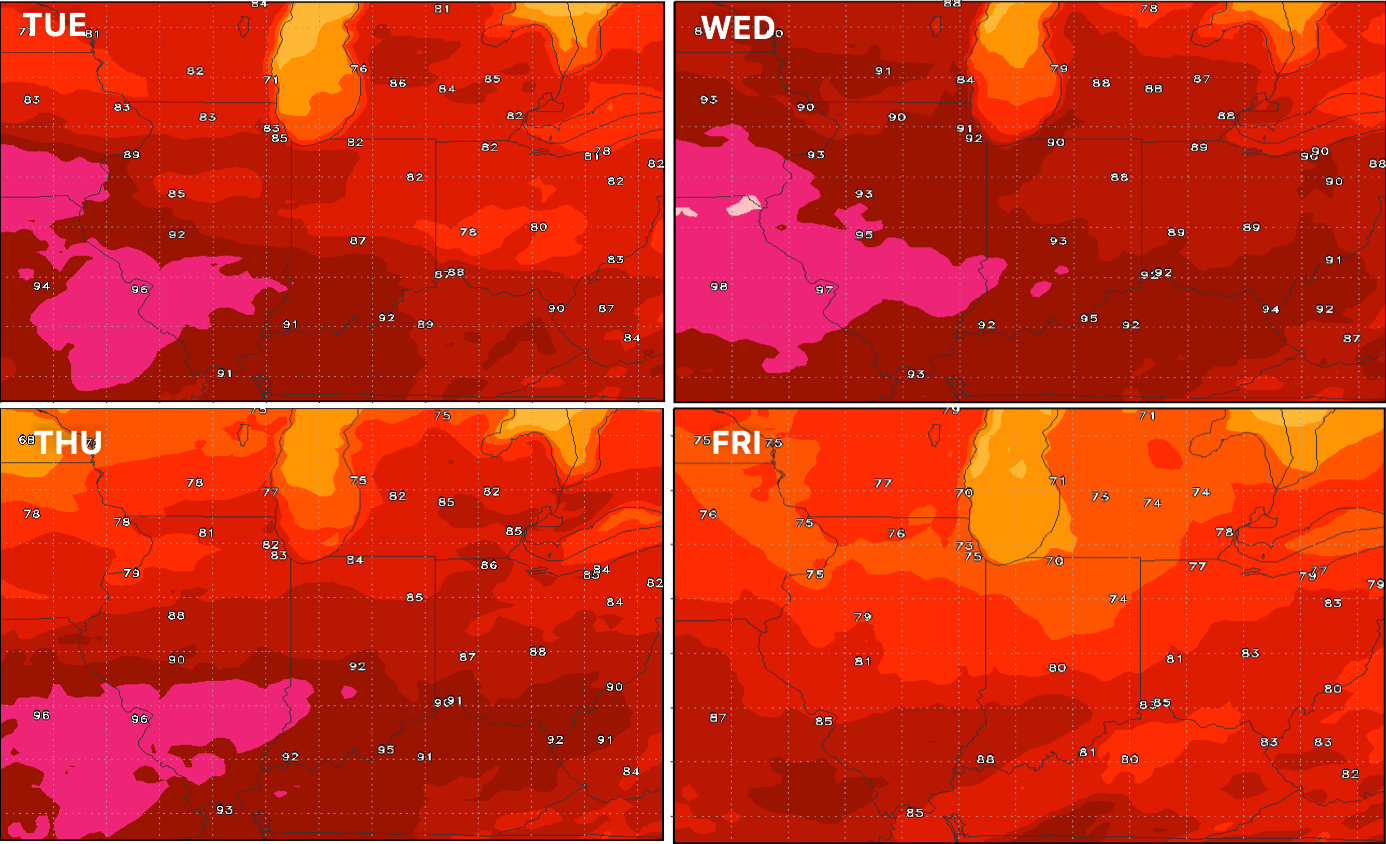
Temperatures will be quite warm until the front knocks them down on Friday:
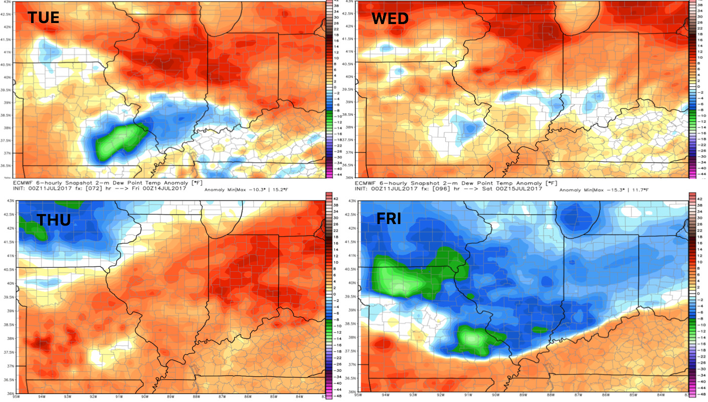
Dew points from normal…quite oppressive humidity through late week:
Confidence:
- Average to above average confidence showers and storms continue across parts of IN/OH today…some may be strong with heavy rains once again.
- Average confidence additional heavy storms getting later Wednesday into the overnight…some of these may be strong to severe as well.
- Above average confidence much more comfortable temperatures will settle in once the cold front passes later on Friday into Saturday.
Video (7 min):