#NEwx #KSwx #MOwx #IAwx #MNwx #WIwx #NDwx #SDwx Update on storm chances over the next 48 hours. N.
Good afternoon!
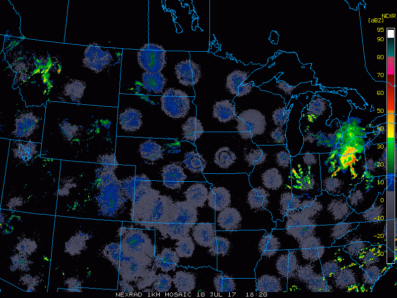
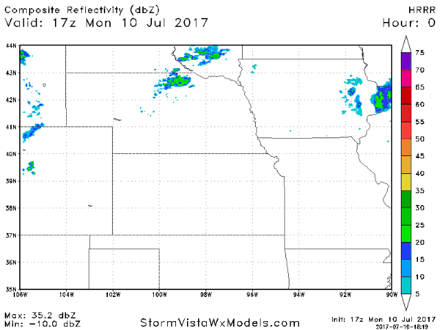
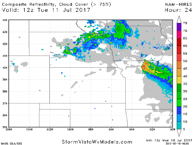
Current radar remains quiet, with just a few showers showing up over northern Nebraska.
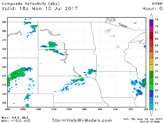
The radar will become more active as we head into this evening and overnight. Below is an animation of the HRRR model from 1pm today to 7am Tuesday which shows scattered storms tracking from west to east overnight.
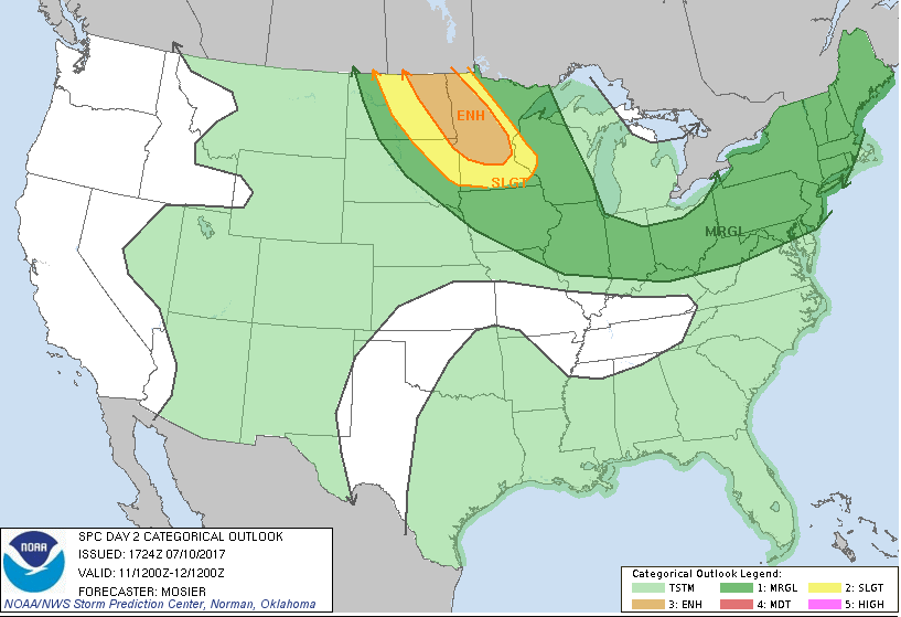
The severe risk remains low today, but there is a MARGINAL risk over the northern half of Nebraska into far western Iowa and the western Dakotas. Wind/hail would be the threats.
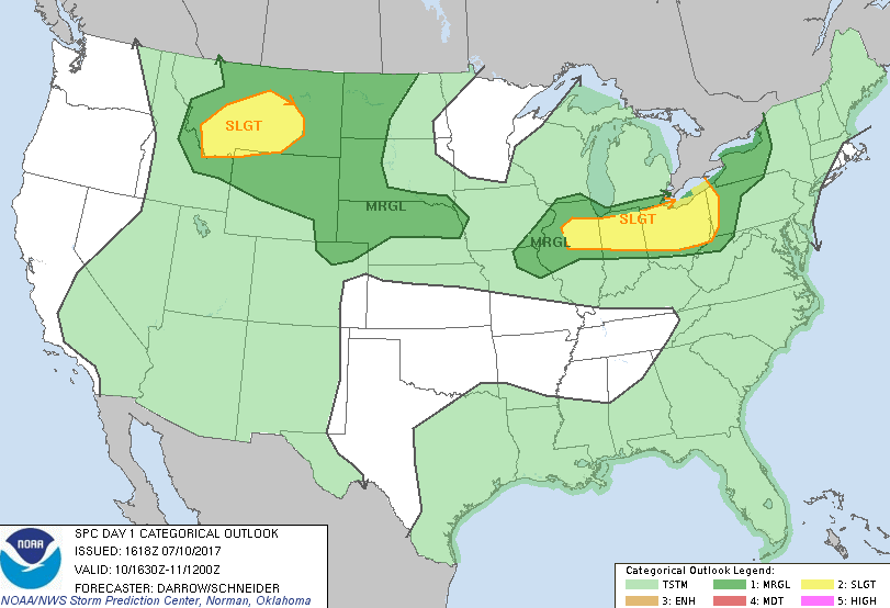
We will have to watch for more thunderstorm risks on Tuesday as storms will track on the northern periphery of an upper ridge. A ENHANCED severe risk has been placed from eastern North Dakota into Minnesota, with a SLIGHT risk surrounding that. A marginal severe risk covers most of Iowa into northeast Missouri. We will need to monitor for adjustments.
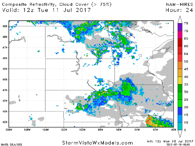
Below is an animation of the hi-res NAM model from 7am CT Tuesday to 7am CT Wednesday, showing thunderstorm activity moving out in the morning then additional storms moving in later in the day and overnight into Wednesday morning.
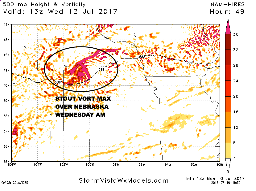
The hi-res NAM model shows a stout vort max over Nebraska Wednesday morning tracking eastward through the day. This will aid in additional thunderstorms.
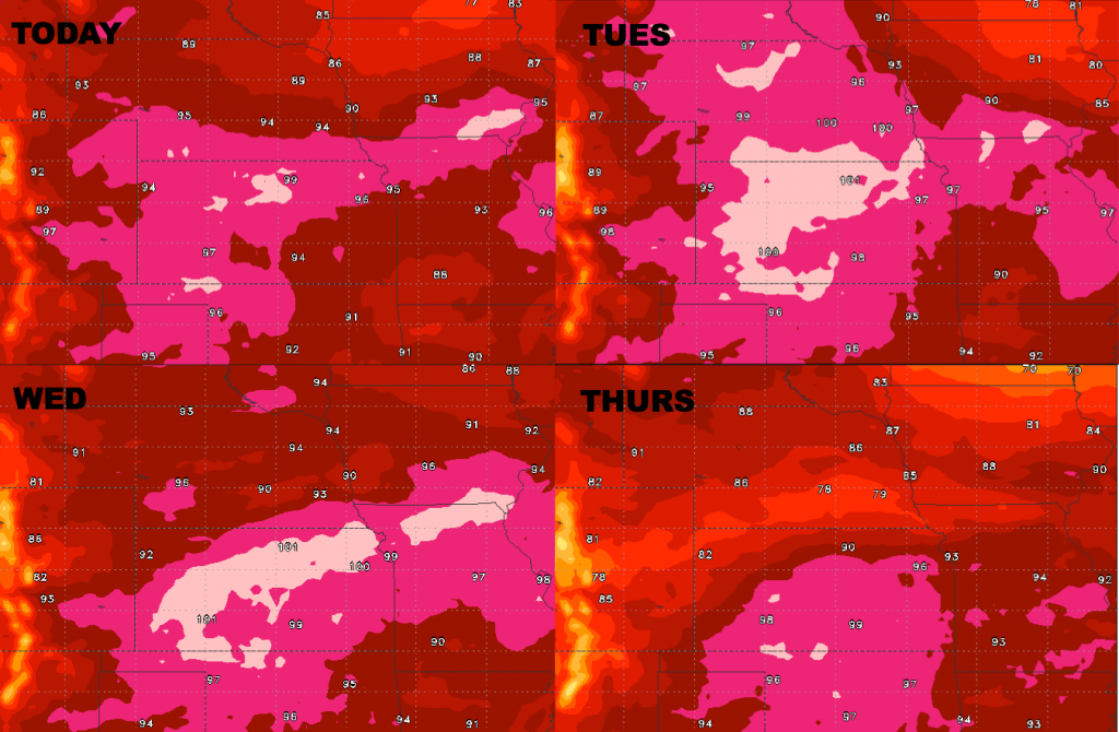
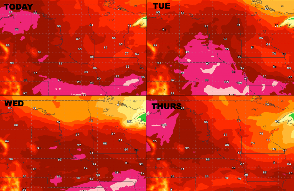
Heat will another big story this week. High temperatures over the next 4 days are shown below. Combined with high humidity, this will yield dangerous heat indices. Be sure to stay hydrated!
Short-term Video Update (4:39):