Synopsis: Good Wednesday afternoon! A frontal boundary continues to remain in the region with scattered showers and storms most numerous in central and eastern Kansas so far today. Areas further north are actually enjoying sunshine and dry/cool conditions. This front will remain in the area over the next few days, and will be the focus for locally very heavy rain bands to set up late Thursday through Friday night. The video goes into the details regarding the overall idea of where the heaviest rains set-up, as well as an update on severe storm potential on Friday. Have a great afternoon, and let us know if you have any questions!
Video (7 min):
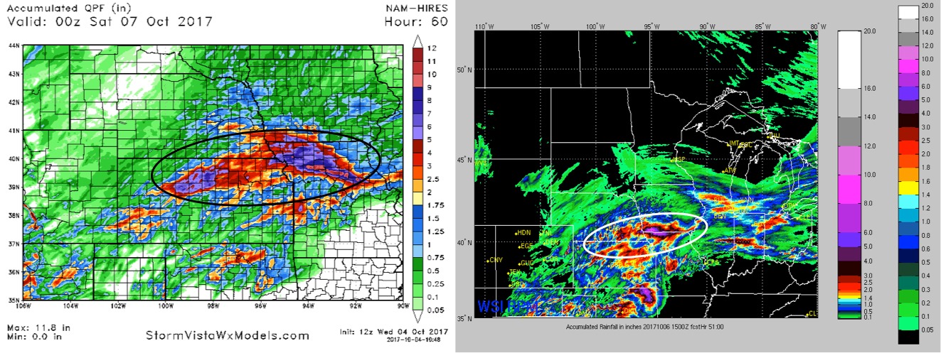
Latest rainfall guidance over the next 60 hours is shown below. Watching areas across Kansas, southeast Nebraska, southern Iowa, and northern Missouri where heavy rain will be possible. Notice both of the hi-res models have a band of rains in excess of 5″ somewhere around the Iowa/Missouri border. Much of this falling from late tomorrow and lasting through Friday night.
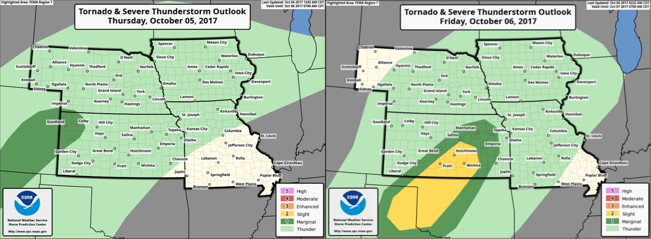
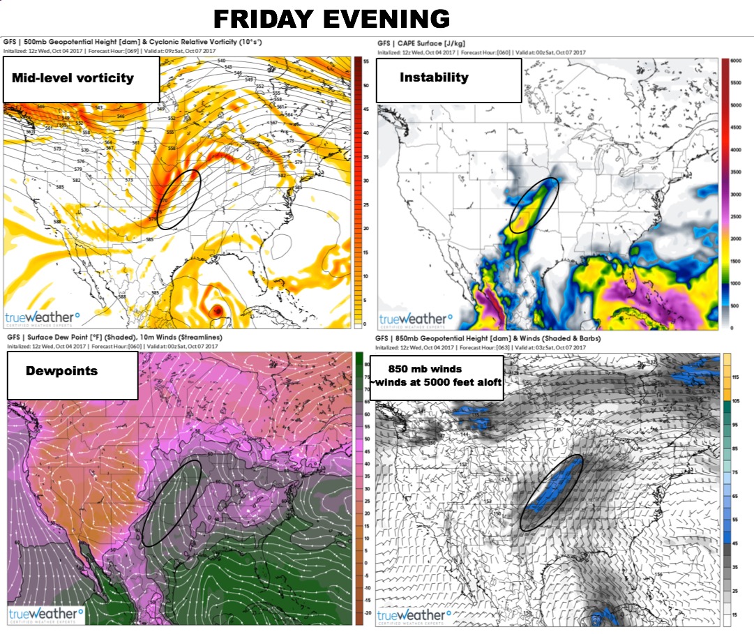
New data continues to show dynamics favorable for some severe storm potential late Friday mainly across portions of Kansas:
Here are the NOAA Storm Prediction Center severe storm outlooks Thursday and Friday: