Zone 3/4 #ILwx #KYwx: Active Next Few Days, Cooler This Weekend. E.
Key Points: July 11, 2017
Synopsis: Good Tuesday morning! We are tracking some thunderstorms moving through central Illinois this morning bringing heavy rain and some wind and hail as well. These will persist through today with periodic storms across the region. Significant threats of storms will continue Wednesday and Thursday before cooler and drier conditions return for the weekend into early next week. Have a blessed day!
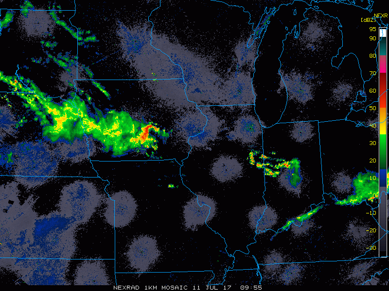
Current radar is quite active!
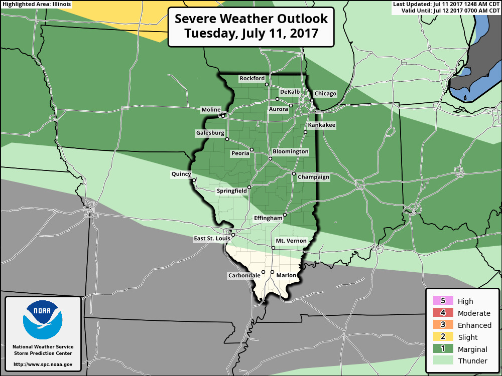
Strong storms will occur through the day and into the evening across the region and because of this, the SPC has outlined the region in a marginal risk for severe weather.
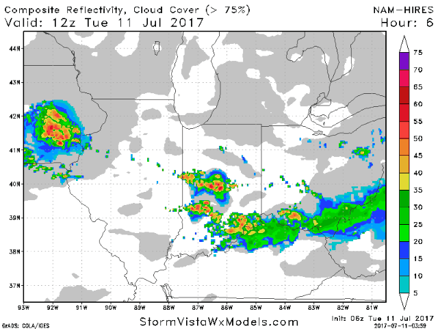
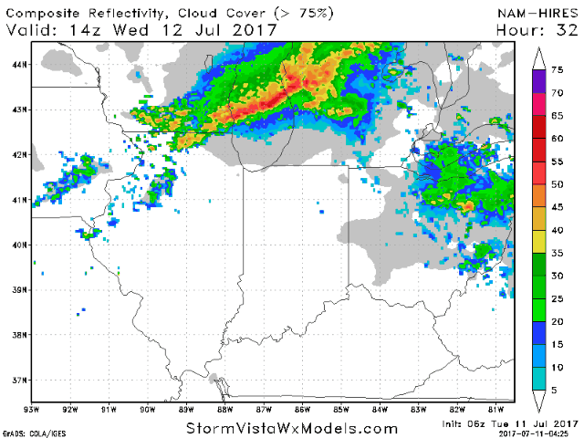
Here’s the projected radar through tonight.
Additional storms are expected tomorrow especially north and the SPC agrees.
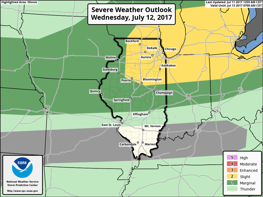
Latest projected radar for tomorrow into tomorrow night.
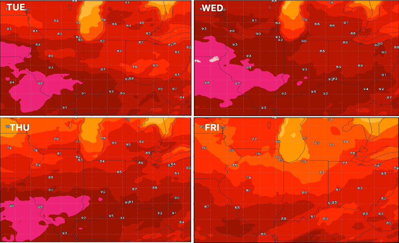
Temperatures stay warm through Thursday, then cool off some.
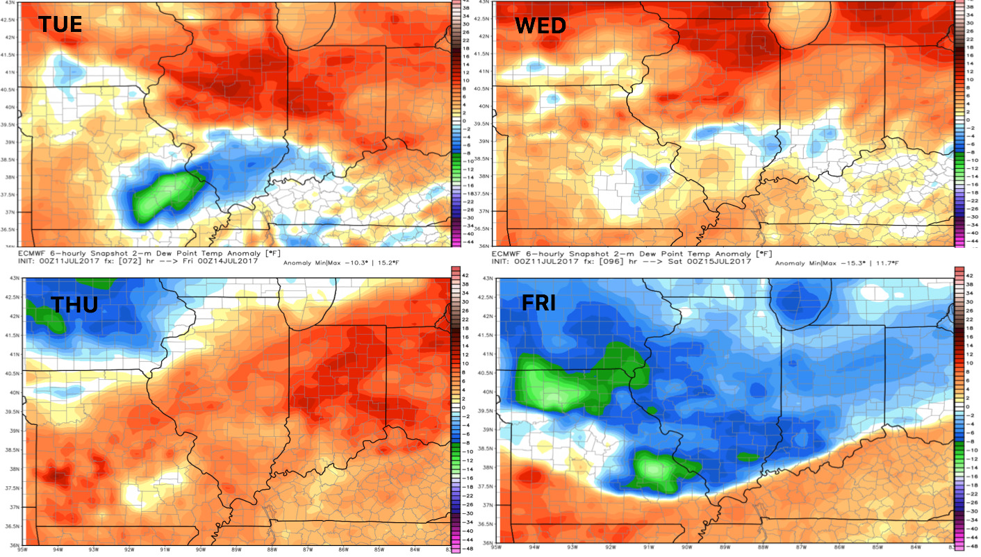
Humidity follows a similar pattern into the weekend.
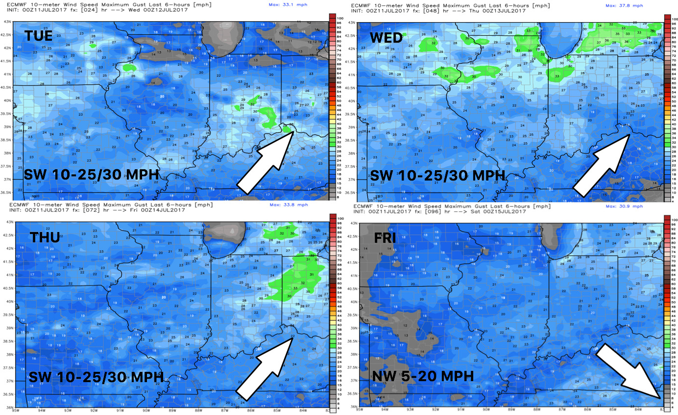
Winds next 4 days are shown below.
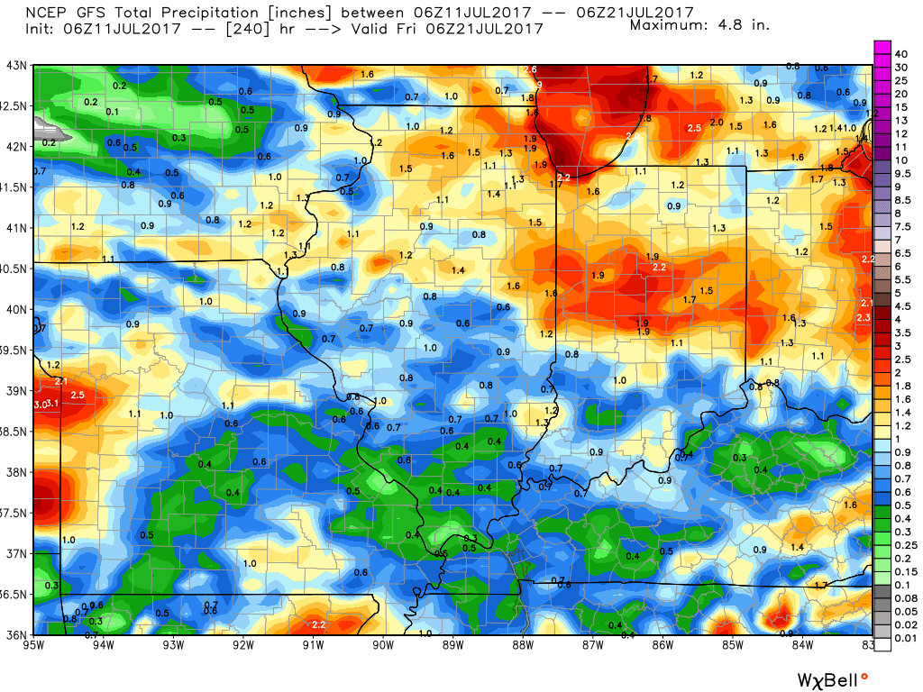
Total rainfall over the next 10 days is shown below and will be very dependent on storm location and intensity.
Confidence and Risk:
- Above average confidence in increased storm chances the next 3 days.
- Above average confidence in warm, humid conditions giving way to a pleasant weekend.
- Increasing confidence on seasonable conditions in week 2 with variable rainfall chances.
Today’s Video (7 minutes):