#INwx #MIwx #OHwx #ILwx Active This Morning, Much Cooler Into Next Week! E.
Key Points: June 23, 2017
Synopsis: Good Friday morning! We are tracking a cold front moving through the region this morning with showers and some gusty thunderstorms. This front will move to the south and east and combine with the remnants of tropical storm Cindy to bring heavy rains mainly south of our area. Much cooler air will arrive this weekend into early next week as an upper trough of low pressure settles over the region. This will promote cooler, but mainly dry conditions into next week with only a very low probability of spotty afternoon showers. Warmer air along with a renewed threat for rainfall will return by the middle and end of next week. This active pattern will continue into the beginning of July along with seasonable to slightly below normal temperatures. Have a blessed day and an even better weekend!
Current radar shows the activity across the region.
As we move through the day, we will dry out from northwest to southeast, as drier air moves into the region.
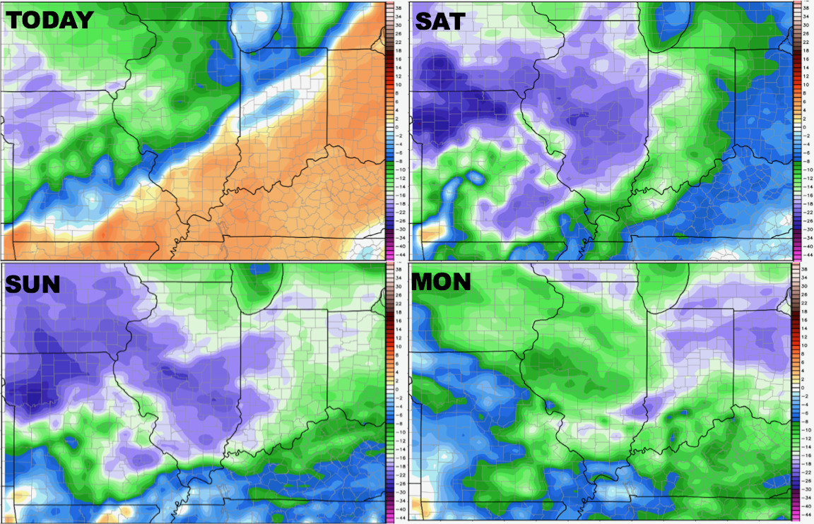
This dry air is shown beautifully via our dew pint anomaly forecasts into the weekend.
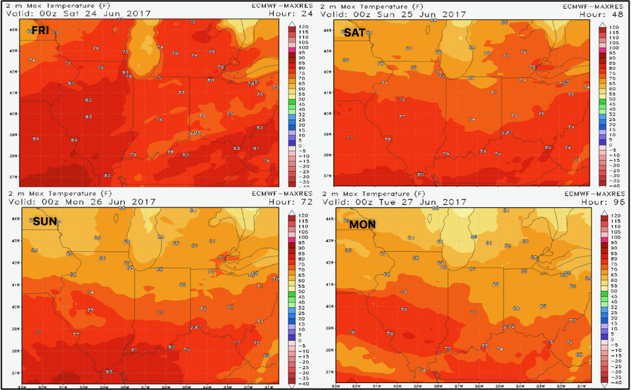
Along with drier air, cooler temperatures are expected, mainly in the 70s into next week.
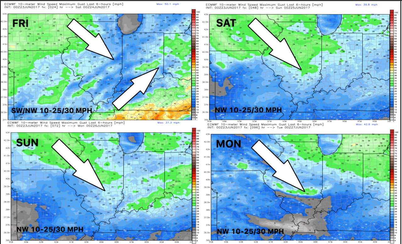
Winds over the next 4 days are shown below.
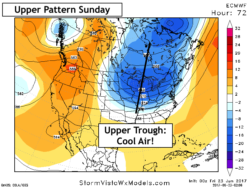
An upper trough of low pressure will promote cooler and mainly dry conditions through early next week.
Our week 1 temperature forecast is quite chilly, averaging 8-12 degrees below normal!

Some brief heat is expected later next week ahead of another cooler shot of air next weekend. This likely comes with more widespread rains. Here’s a look at the upper pattern.
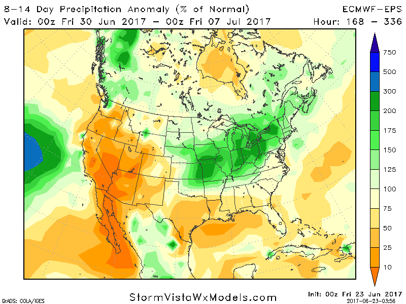
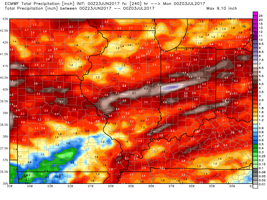
Rainfall in week 2 from all models is impressive and above normal. Latest forecast from the European ensemble is below.
10 day rainfall from the European model shows a widespread 1-3″.
Confidence and Risks:
- Above average confidence on cooler air along with dry conditions moving in for the weekend.
- Increasing confidence in brief heat to end next week ahead of another shot of cooler air.
- Increasing confidence in an active pattern later next week through the beginning of July with above normal rainfall.
Today’s Video (7 minutes):