Key Points – Thursday, June 22, 2017:
Synopsis: Good Thursday morning! Today we discuss the excessive rainfall and strong storm risks over the next 2 days as a cold front meets tropical storm Cindy remnants in the Midwest. Much cooler weather moves in Saturday into next week, the pattern continues to be active as we start getting in on a northwest flow. Have a blessed day!
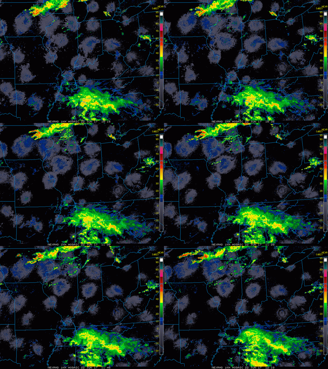
Current Radar:
Watching for activity to pick up south around lunch time today and then activity to really start to ramp up ~5pmEDT tonight. Expecting the cold front to interact with tropical storm Cindy Friday morning…will be very wet conditions across southern IL/IN and western OH on the day on Friday. Watching for things to pull out of here ~7-8pmEDT to the east Friday night.
We do have a risk for excessive rainfall and flash flooding especially south and east over the next 2 days:
In the video we also discuss the risk for stronger storms over the next 2 days…we think the slight risk needs to be pulled further north and west on the day on Friday.
Rainfall totals through Saturday…data continues to be consistent with 1-3″ with isolated higher amounts possible especially across the southern tier of the Ohio Valley. Won’t be shocked for some isolated spots to see 5″+ in heavier bands.
Current wind forecast for the next 4 days:
Here’s a look at temperatures into the weekend…much cooler weather filters in behind the cold front.
Dew point anomalies through the weekend…easy to see how cooler it gets as the cold front pushes through on Friday!
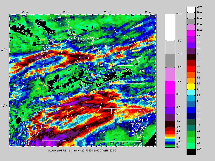
Rainfall look into next week…we get into a northwest flow starting Saturday into next week…it’s hit or miss with the rainfall…some will get 5″ some locations get 0.5″. If you have any questions with the forecast please feel free to reach out!
Confidence:
- Above average confidence showers and storms start moving in south to north today around lunch time…increasing in coverage tonight into Friday.
- Above average confidence additional storms development Friday as the cold front collides with tropical moisture bringing additional heavy rains and strong storms possible.
- Above average confidence cooler than normal temps settle in this weekend behind the cold front into next week.
- Increasing confidence our pattern stays active into next week with multiple days of rain chances.
Video (7 min):


