Key Points – Tuesday, June 27, 2017:
Synopsis: Good Tuesday morning! Waking up to another beautiful morning with cooler temperatures in the 40s and 50s today which is 10-20º below normal! Clear skies expected across the Midwest today under high pressure conditions. Getting into mid-to-late week temperatures and humidity are on the incline, along with our storm chances, some being stronger in nature…the risks discussed in today’s video. If you have any questions please let us know, have a blessed Tuesday!
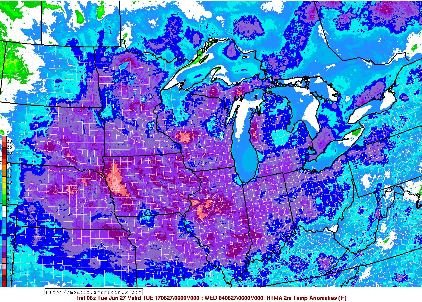
Temperatures from normal this morning…some spots 10-20º below normal!
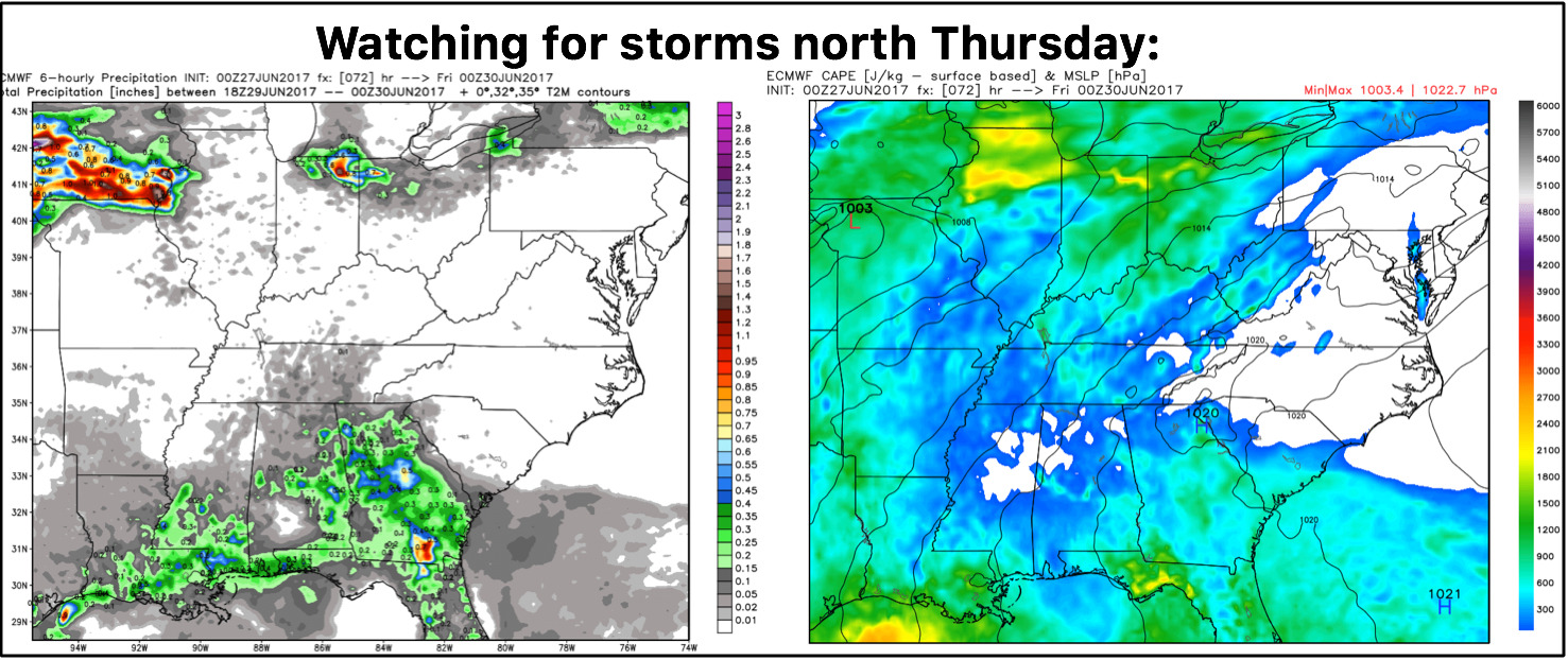
In the video we target our next chances for showers and storms going forward…the majority of storms stay to the west across Iowa and northern Illinois on Wednesday, not expecting these to migrate eastward much into Indiana and Ohio for the most part. It’s Thursday evening we see some weak energy sliding through the area with elevated CAPE (energy) in the vicinity where we need to watch for storms to the north.
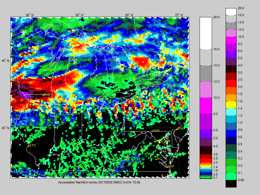
Rainfall total guidance the next 72 hours from the RPM…as you can see, the majority of rains stay north and west here…locations south of I-70 will be lucky to see any rainfall into late week.
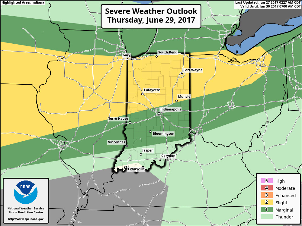
Here’s the latest strong to severe outlook for Thursday…yesterday we mentioned the risk needed to migrate further east and it did:
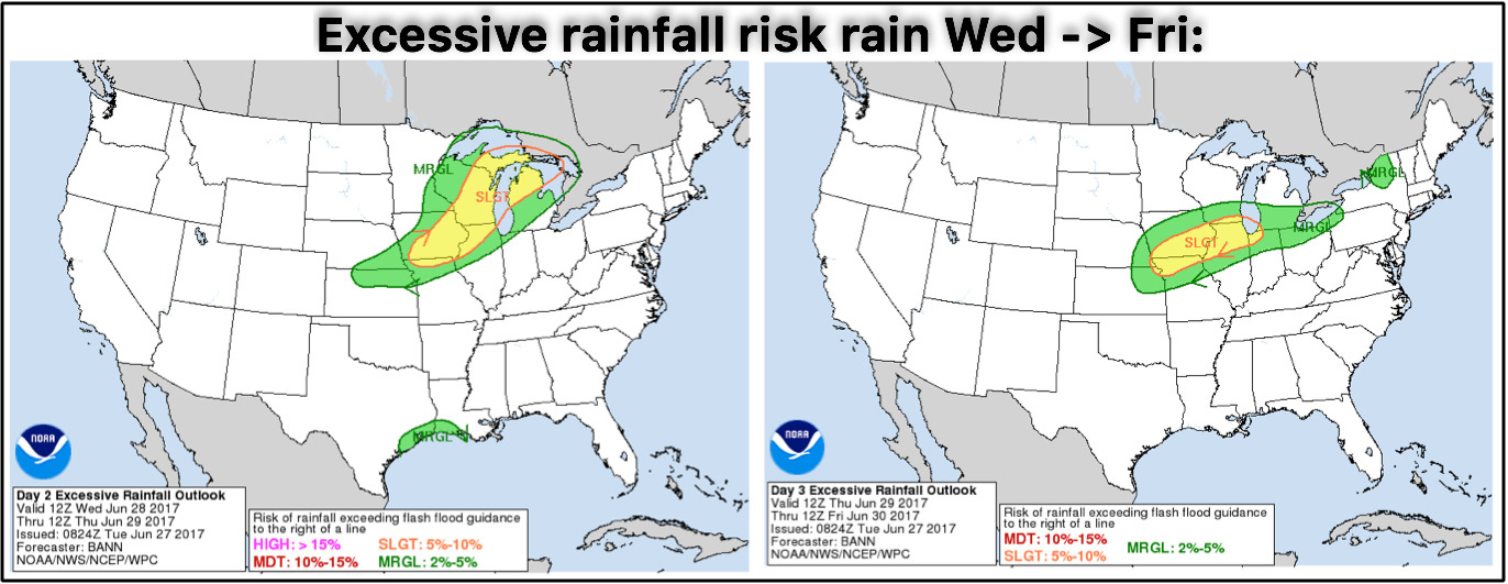
Excessive rainfall risks where issued across parts of the Midwest Wednesday through Friday for the potential for localized flash flooding:
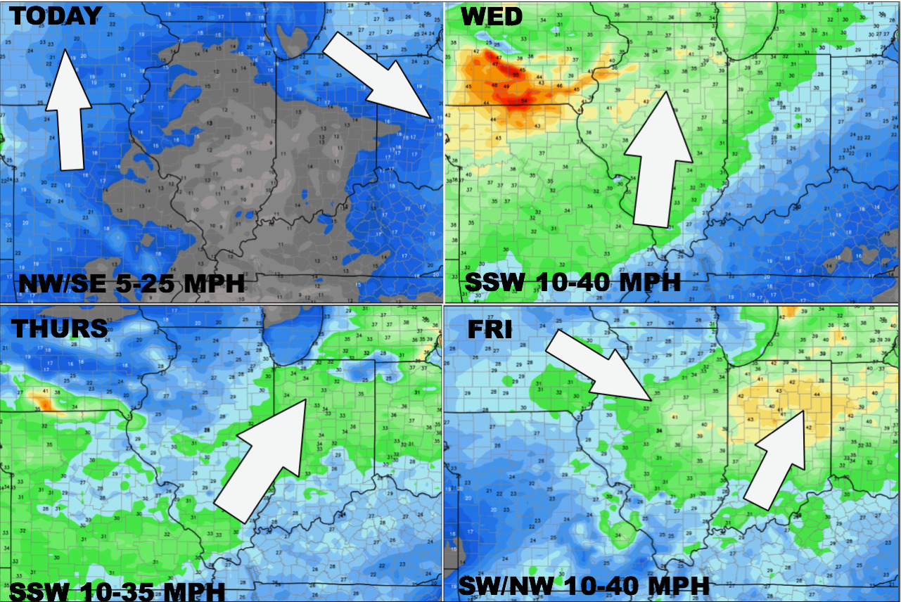
Here’s a glance at the wind forecast over the next 4 days across the Midwest:
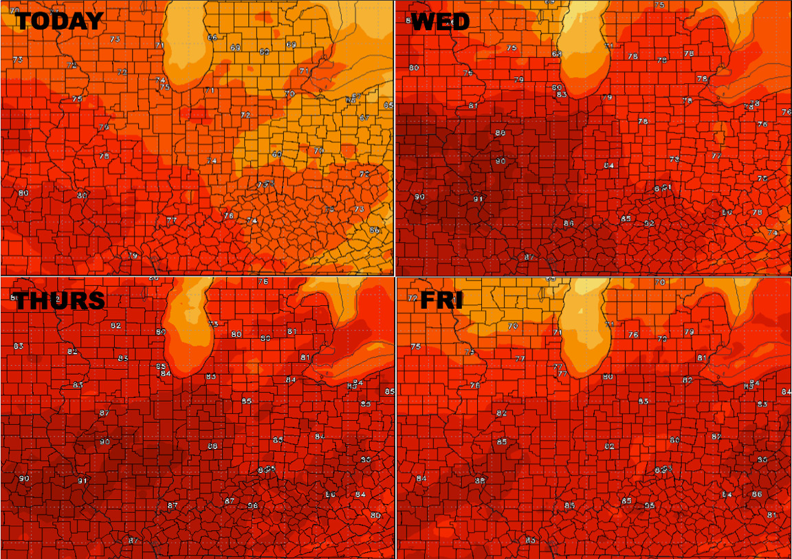
Temperatures warm mid-week…see a slight warming trend here:
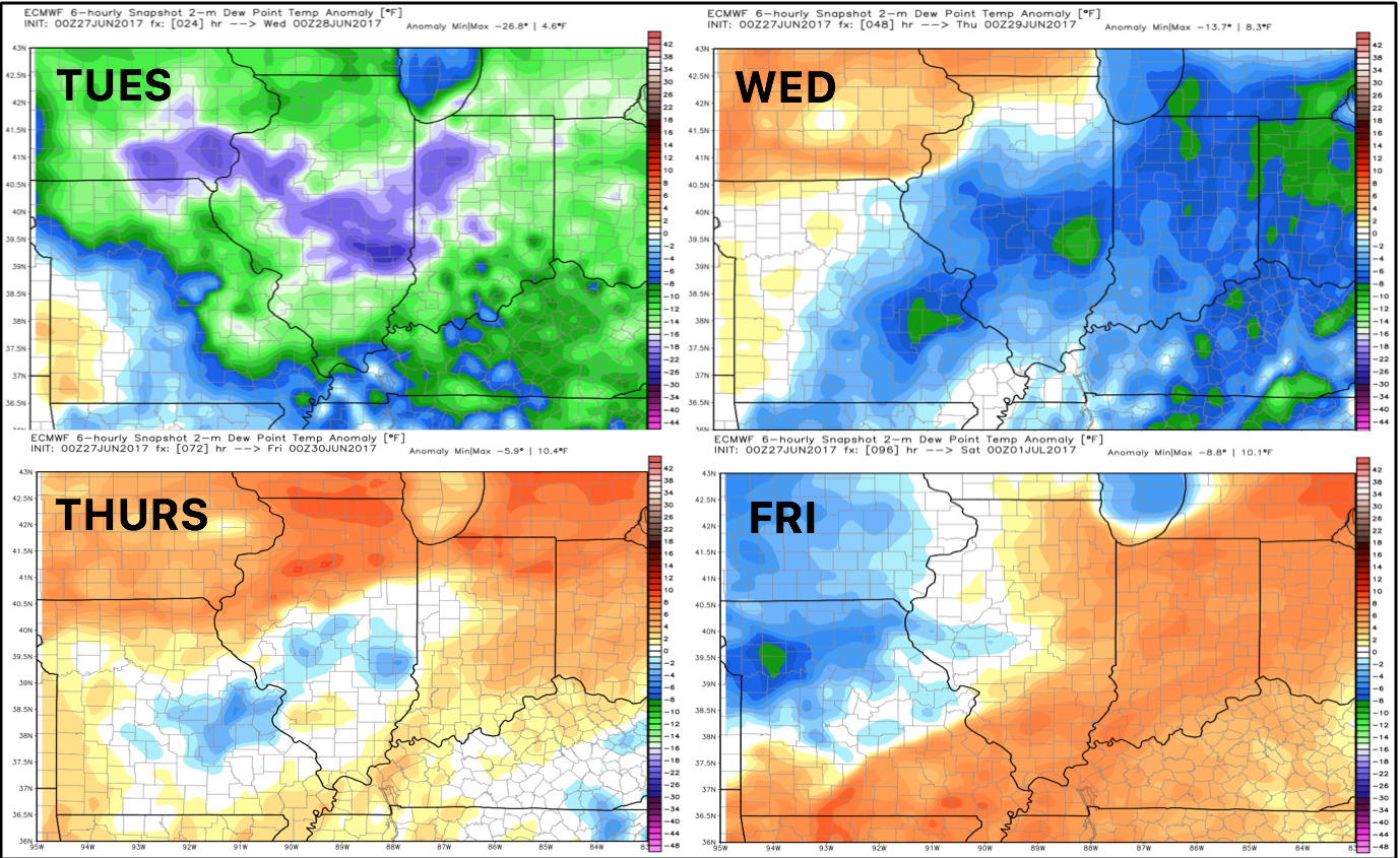
Dew point anomalies over the next 4 days, increased humidity is on the way:
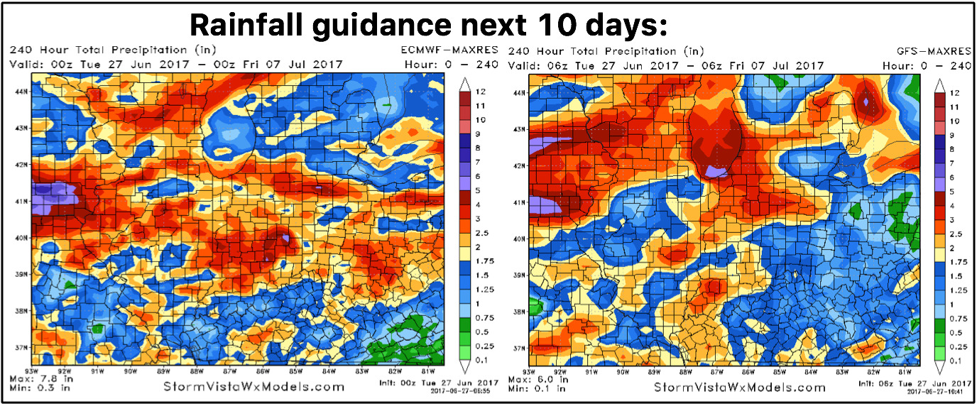
Total rainfall through the next 10 days…as mentioned in the video we are watching for continued active rains getting further east into next week seeing more northwest flow…into the weekend, however, the focus will be to the north and west.
Confidence:
- Above average confidence it’ll be another nice day across the Midwest under high pressure!
- Average confidence the majority of storms on Wednesday stay to the west in Illinois…drier conditions more likely across IN/OH.
- Average confidence we see an increase in storm coverage getting into Thursday as we discussed yesterday the risk area needed to move further east to cover the risks.
- Increasing confidence the pattern stays active into next week as we start to get under more northwest flow.
Video (7 min):