Key Points – Monday, June 26, 2017:
Synopsis: Good Monday morning, hope you all had a great weekend! Today we discuss the scattered storms getting into later today, despite starting the day mostly sunny. Overall calm weather sets in Tuesday into Wednesday, it’s Thursday and beyond into the weekend we need to start watching for the risk of storm clusters to move east through the Midwest, can’t rule out some of these being stronger as well. Temperatures slowly rise mid-week and beyond as we starting issuing in a more southerly flow. Have a blessed day!
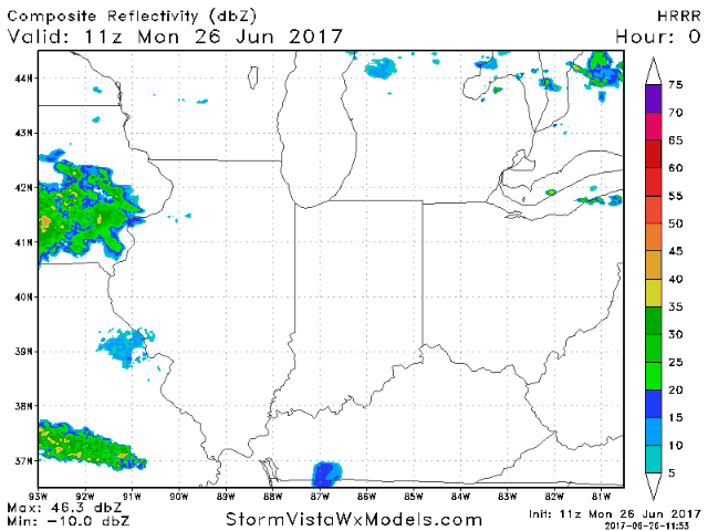
Current Radar:
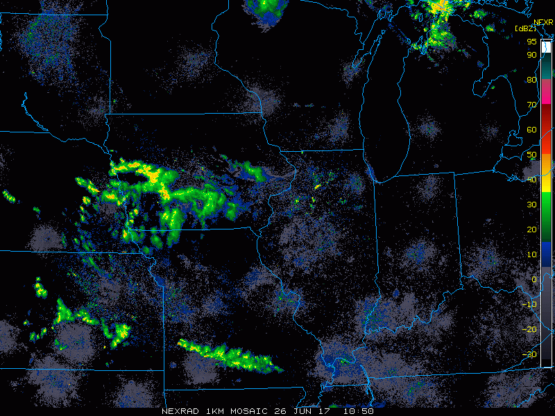
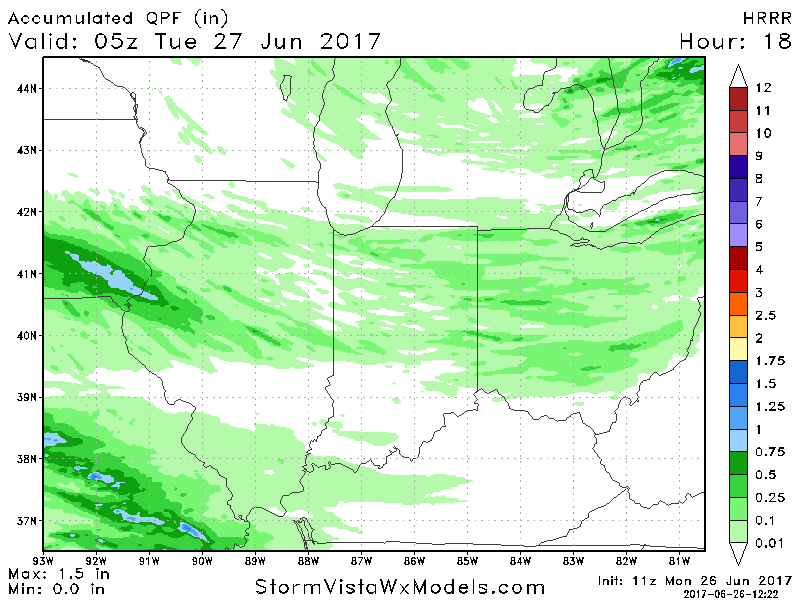
Simulated radar today…expecting scattered showers ~50% to start working in across Indiana/Ohio to start popping after noon. By about 7pm tonight the broken line of storms continues south and east, expecting these to wind down by sunset.
Locally higher amounts possible, but without a lot of energy and moisture in the atmosphere it will be tough to get more than the 0.5-0.75″ out of these storms.
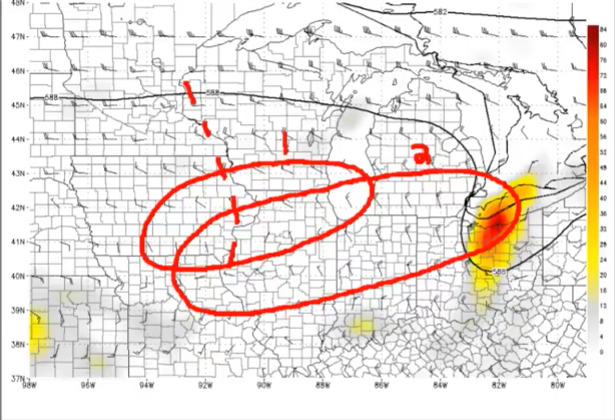
Tuesday into Wednesday the weather remains relatively calm and quiet, watching Thursday into late week for our next chance for clusters of storms as discussed in the video…it’s really this timeframe where the rainfall activity starts to ramp up. We really need to start watching that famous “588” line with the northwest flow to find the stronger storm chances.
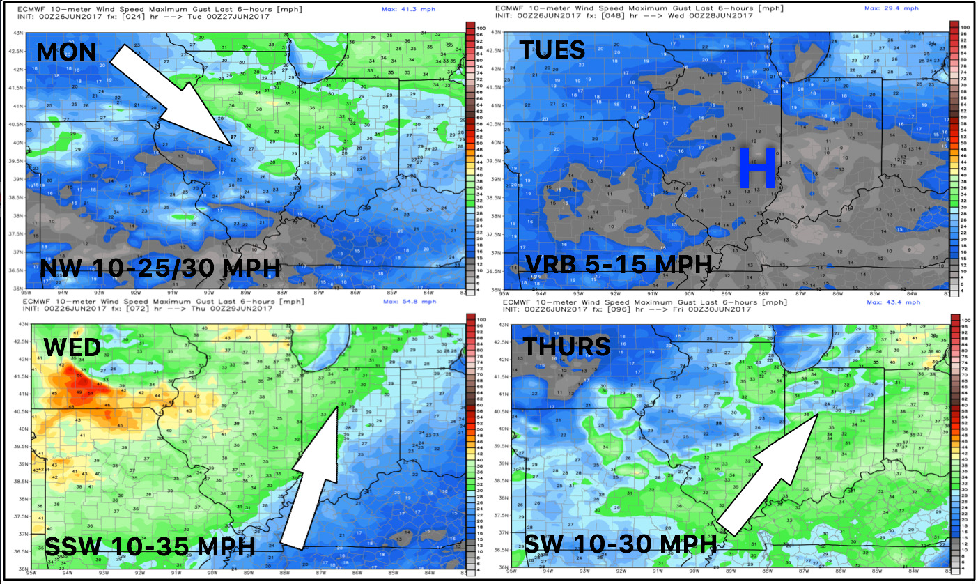
Latest wind forecast over the next 4 days…pretty windy getting Wednesday and beyond as we get in on a more southerly flow.
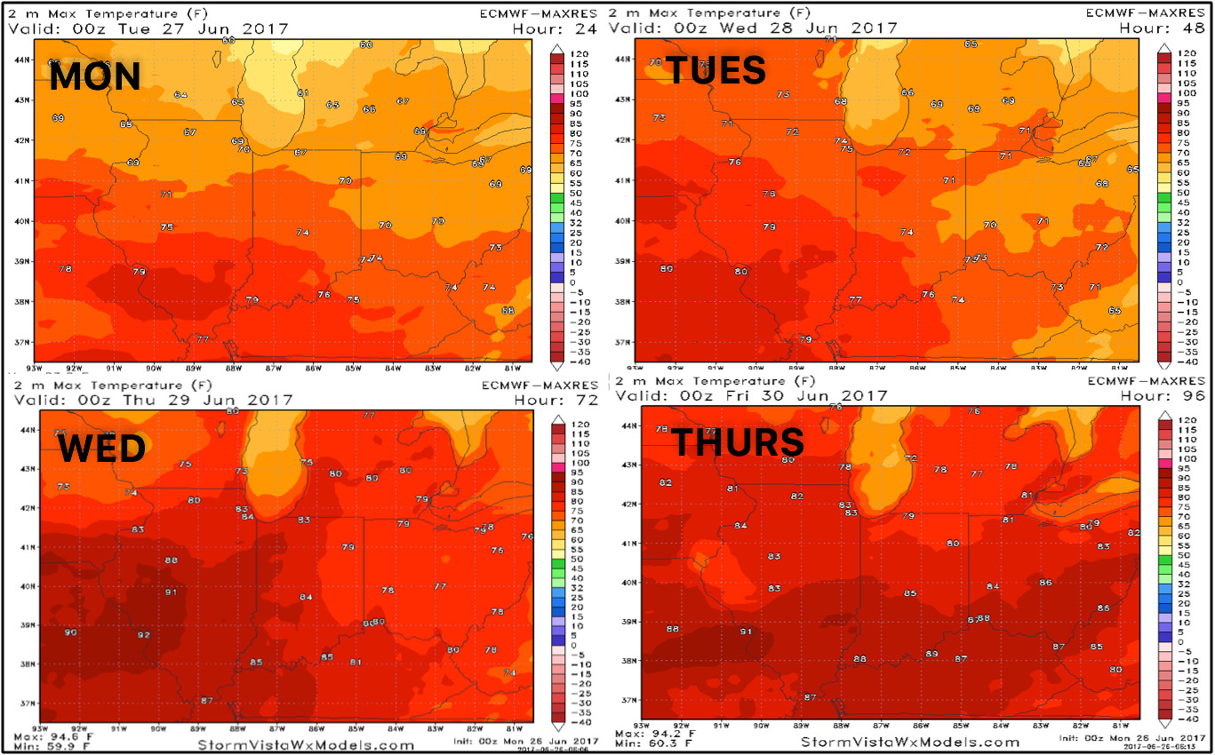
Here’s a glance at temperatures into mid to late week as well…overall, pretty cool with a slight warming trend:
Looking at dew points from normal here as well you can see how very comfortable the next 2-3 days will be, but getting into late week the humidity starts climbing back:

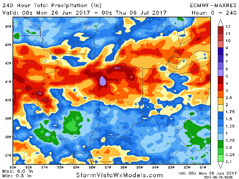
Looking at rainfall totals over the next 10 days is very impressive…all depends on where the 588 line sets up to where the storm clusters track. Not everyone gets on the heavy rains of 3″+, but some do cash in on localized higher amounts.
Confidence:
- Above average confidence of scattered showers and storms later this afternoon…should diminish near sunset.
- Average but increasing confidence of multiple storm cluster threats getting into late week into the weekend.
- Above average confidence temps start to warm mid to late week as well getting in on a more southerly flow.
Video (7 min):