Key Points – Friday, August 4, 2017:
Synopsis: Good Friday morning! The cold front continues to move off to the south and east ushering in humidity-relief and much more comfortable temperatures into the weekend! Regarding our next rain chance Sunday, the question becomes exactly how far north the precipitation comes and to what intensity…risks discussed in today’s video analysis. If you have any questions let us know, have a blessed weekend!
Today’s video (7 min):
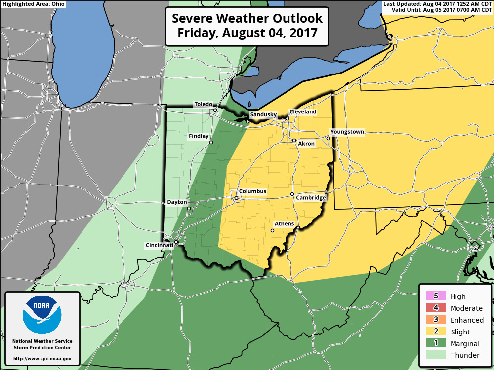
Strong storms across central to eastern Ohio today…locations further west will be behind the cold front remaining cooler with sunshine:
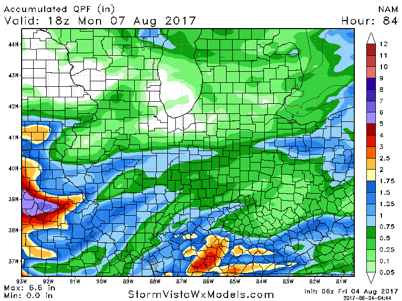
We think the rainfall will largely be I-70 south into Sunday…there is potential that these storms could move further north, we will update on this in today’s short-term forecast:
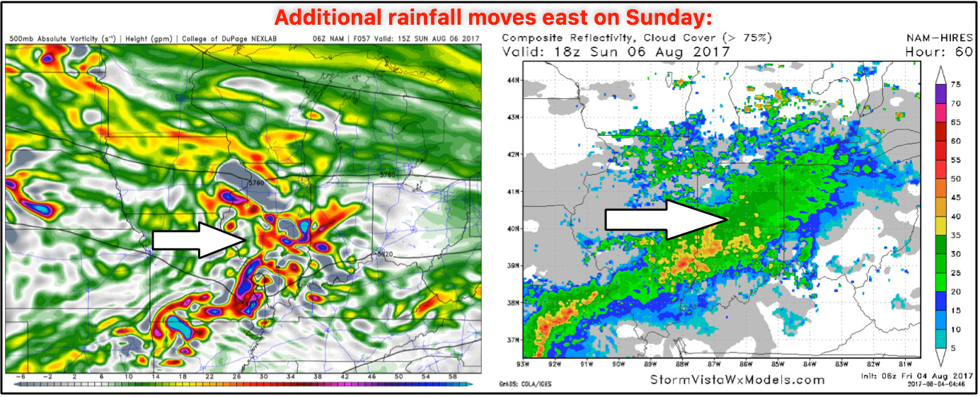
Additional rains of 0.5-1.0″ likely as these showers and storms work east into Sunday…a few isolated higher amounts will be possible:
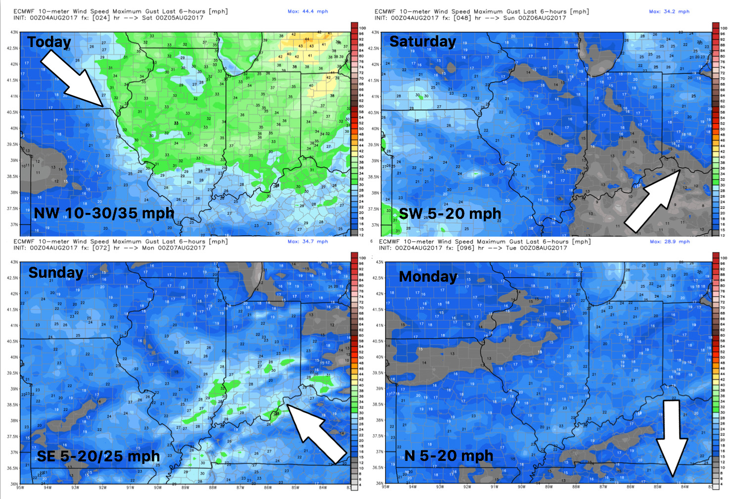
Wind forecast into early next week:
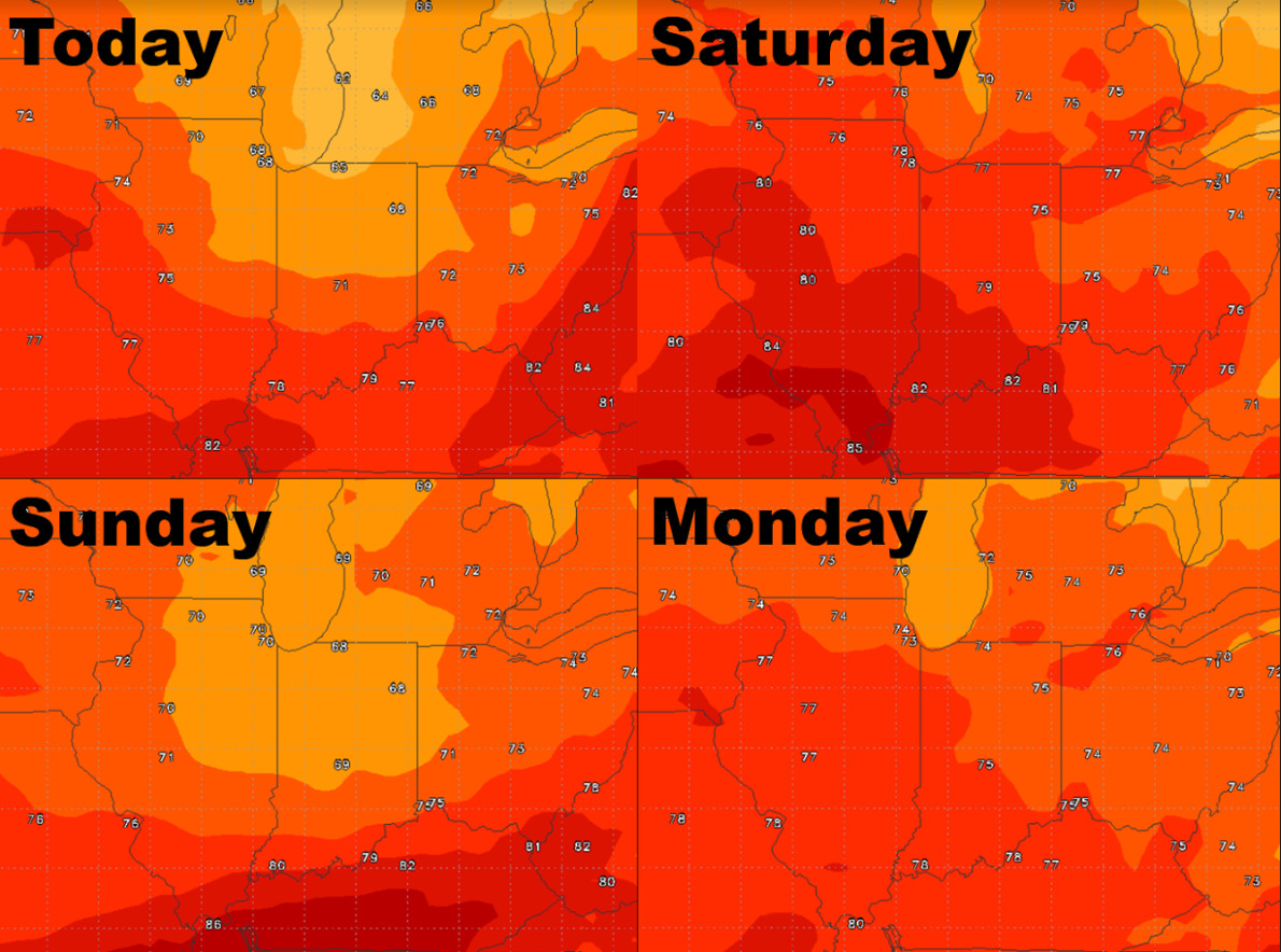
High temperature guidance:
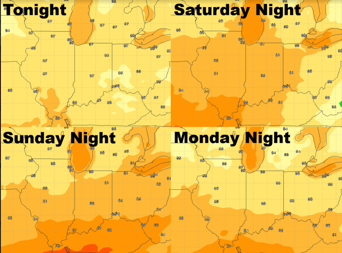
Overnight low temperature guidance:
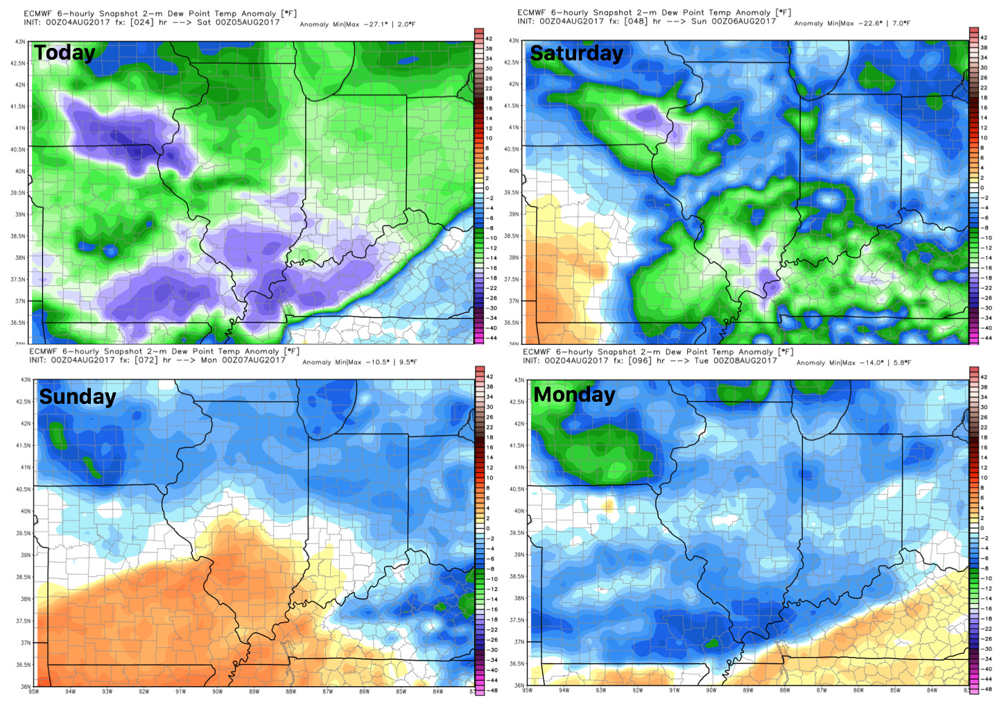
Dew points from normal show a humidity relief settling in the next 2 days!