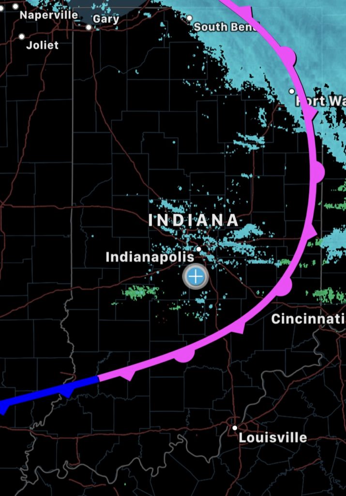
Trends this evening support saturated lower levels through 1/3am leading to scattered precip returns on radar with the front continuing to pass temps will fall quick near 12am.
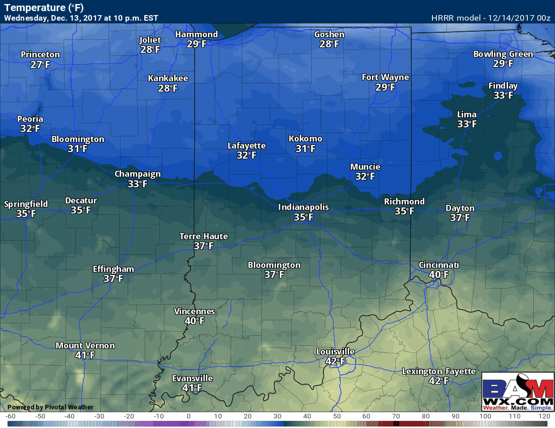
Forcast temps overnight from 10p-5a across the state.
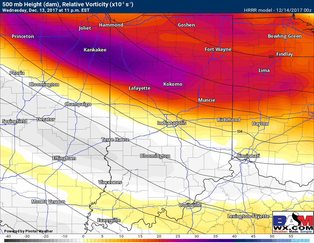
You can see the energy max hangs around promoting just enough lift around for a possible drizzle leading to black ice on untreated surfaces. This loop is from 11p-2a. Probability of this happening across central IN is ~60% currently.
Ive circled the area where these slick surfaces are possible tonight. If you have any questions please feel free to reach out. I would suggest at least patrolling roads/lots from 3-5am checking things out for slick surfaces. M.
![]()