Synopsis: Good Thursday morning! Expecting a warmer and more humid day today, along with the risk for some very isolated pop-up thunderstorms. It will also be rather breezy with peak gusts over 30 mph. Friday will feature a better chance for some scattered storms, especially as we head towards game-time, with coverage around 40%. A cold front will push through the area on Saturday, with the best storm chances through the morning, then decreasing during the afternoon with some sun possible by game-time leading to a very nice Sunday forecast.
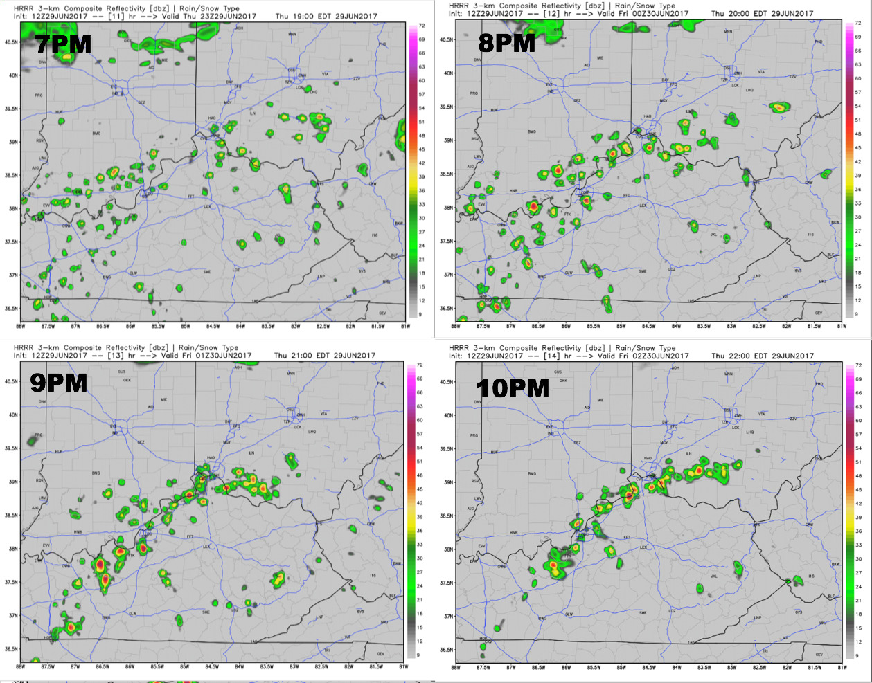
Expecting isolated t’storms to bubble up this afternoon and into the evening hours. Coverage should be roughly 30%. Any thunderstorm can produce brief heavy rainfall. Here is a look at the forecast radar from the HRRR model during the game.
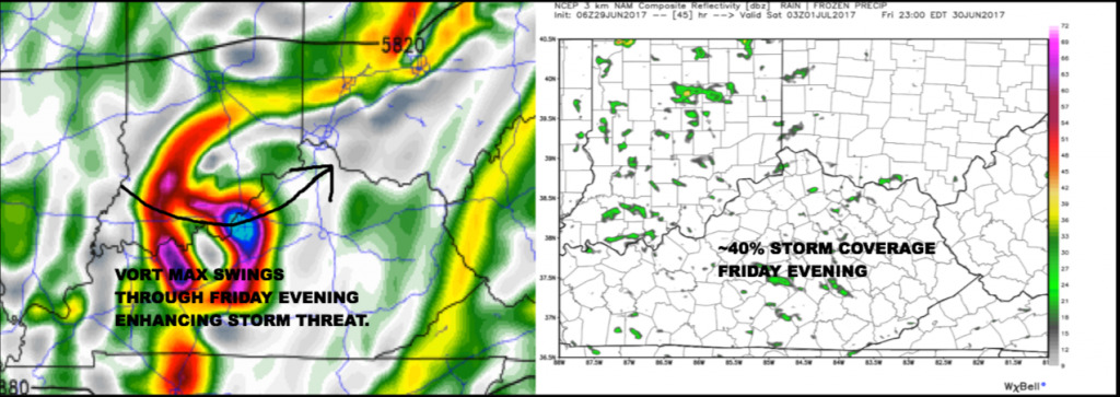
Friday will feature widely scattered thunderstorms during the afternoon and evening hours, with ~40% coverage expected. We will have to watch a vort max swinging into the area during game-time which may enhance storm development.
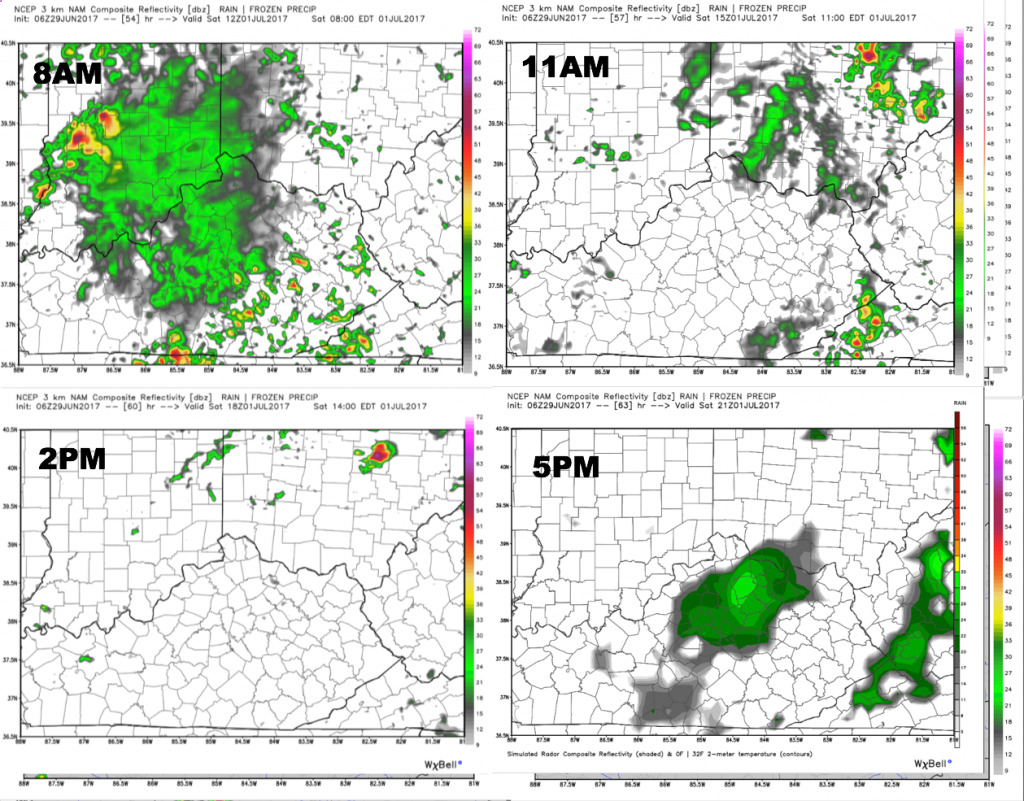
Storm coverage looks to increase Friday night and through the first half of Saturday, as a cold front approaches the area. Storm coverage should be lower during the afternoon, with some sun breaks possible during the game. We cannot rule out isolated activity during the game, but coverage should be hit or miss.
Please let us know if you have any questions with the forecast ahead!
-Nathan