Northern Plains Update: Tracking Severe Risks Into Early Next Week. E.
Key Points: August 18, 2017
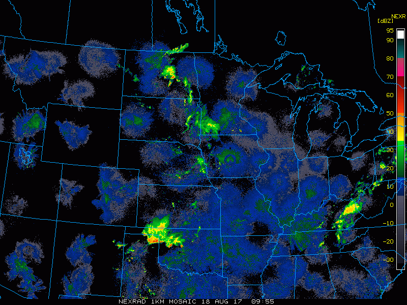
Synopsis: Good Friday morning! Current radar shows some showers across Minnesota and North Dakota this morning while the remainder of the region is largely dry. This afternoon, a severe risk exists for portions of southwestern MN and far eastern SD with the main threat being hail and damaging winds. However, a localized tornado is not out of the question either. Calmer weather returns for Saturday and the first part of Sunday before another cluster of potentially severe storms impacts southern portions of the zone Sunday night into Monday. Have a blessed Friday and weekend!
Today’s Video (5:30):
Current Radar:
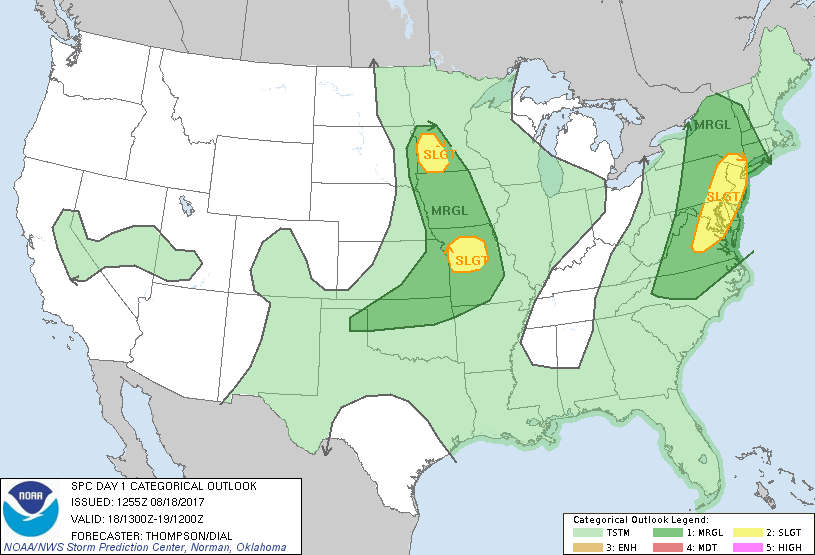
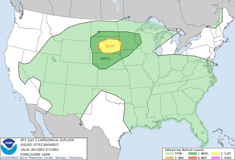
The SPC has issued a slight risk for severe weather in SW MN this afternoon and evening.
Projected radar through tonight.

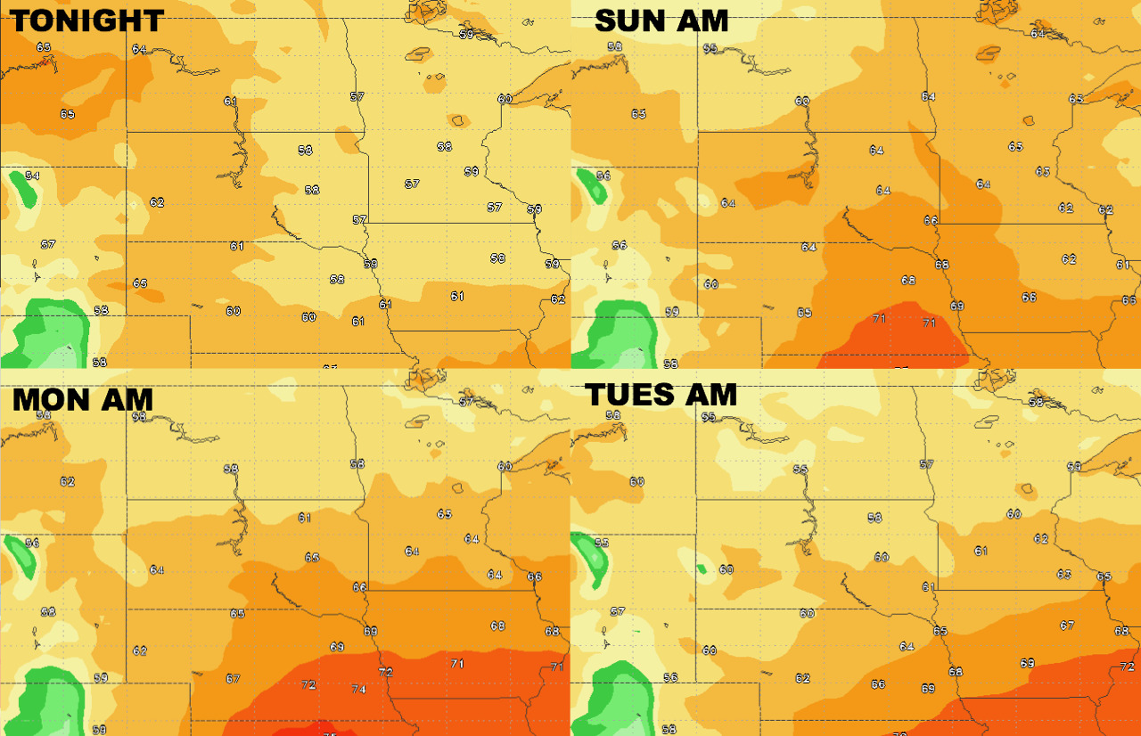
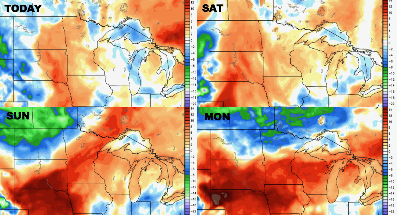
High temperatures over the next 4 days.

Low temperatures over the next 4 days.
Humidity remains high through early next week.
Another severe risk exists Sunday night into Monday.
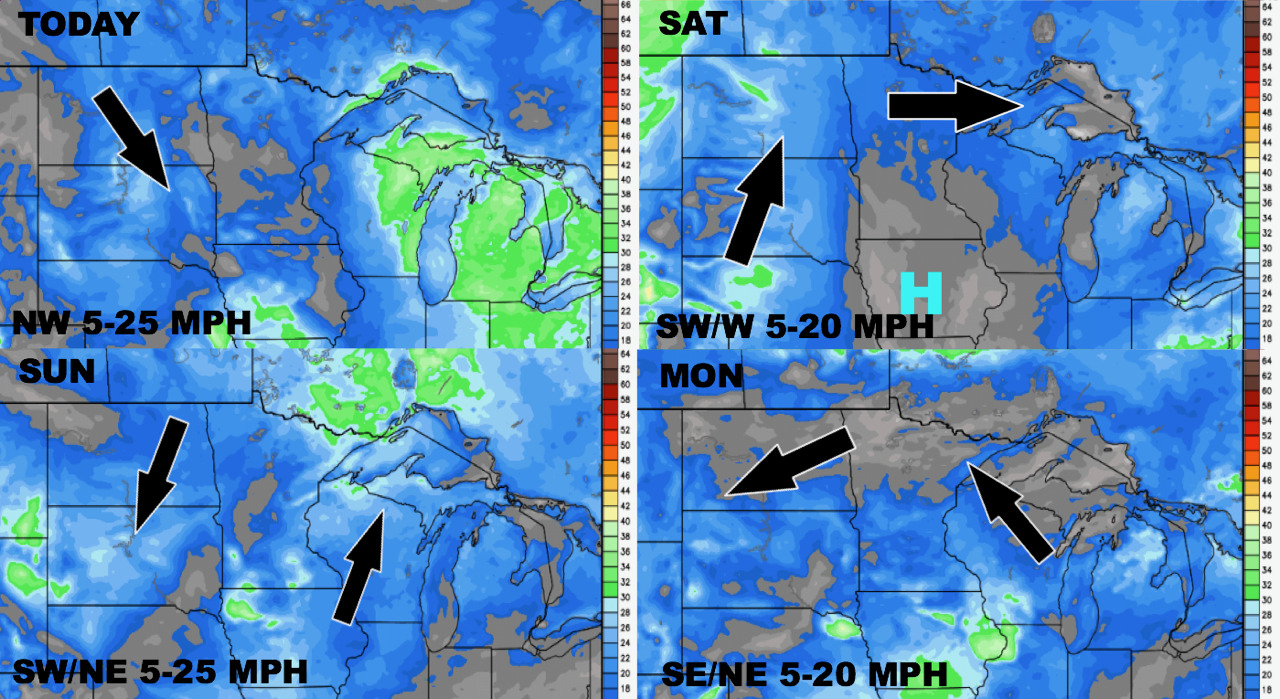
Wind forecast next 4 days.
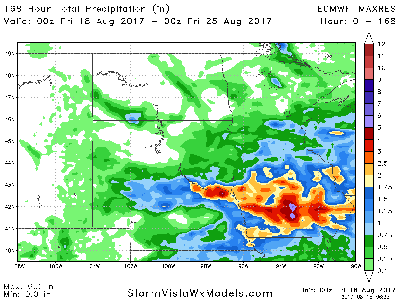
Total rainfall through day 7.