#SDwx #NDwx #MNwx #WIwx Significant Rains Coming For Many Sunday-Monday! Details Here! E.
Synopsis: Good morning! Frosty conditions this morning across eastern areas with temperatures in the 20s and low 30s. Elsewhere we are warming nicely as a warmer airmass moves in. Our next threat of significant rain, mainly across the southern half of the forecast area, comes Saturday night through Monday as an area of low pressure moves through the region. Frost and freeze concerns return for Tuesday behind this system especially north ahead of another weak disturbance Tuesday night into Wednesday. It appears another surge of warmth will return to end next week into next weekend along with another threat for rain.
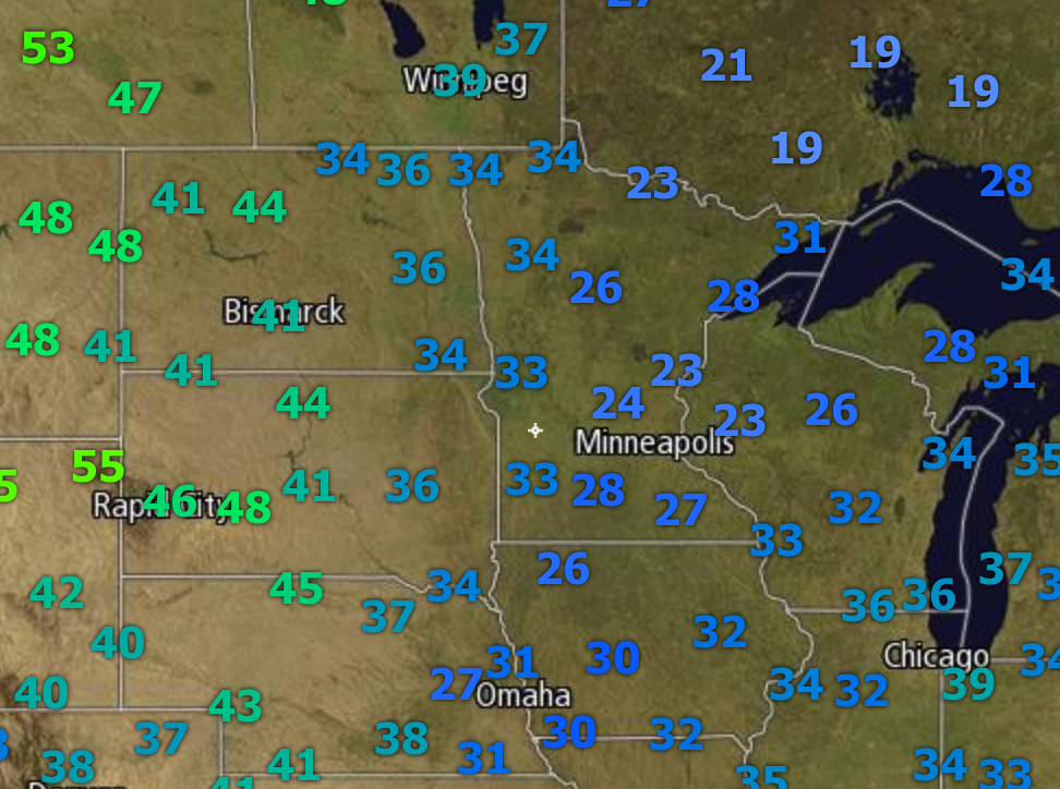
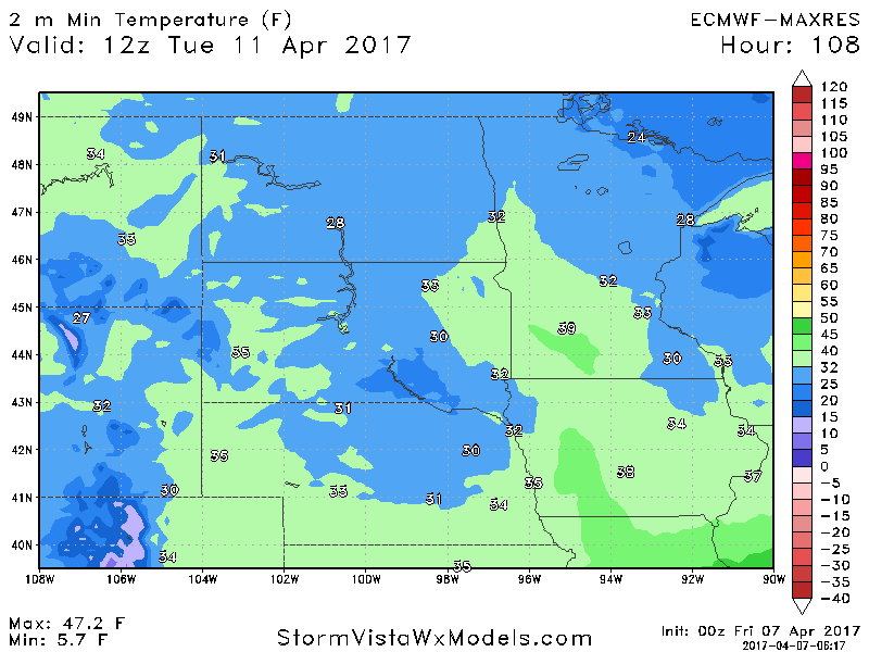
Looking at temperatures out there this morning, they are certainly chilly in the east!
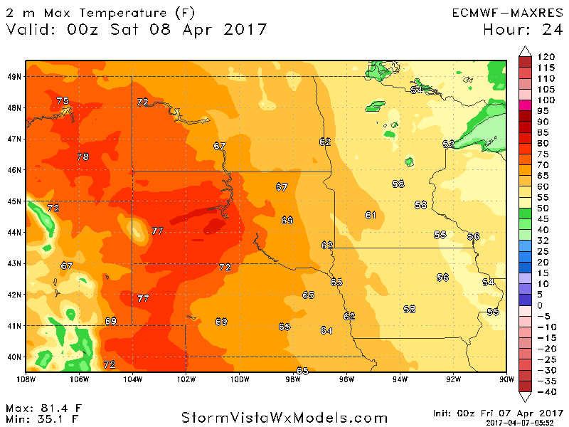
Temperatures today warm into the 50s and 60s in eastern areas, while western areas warm into the 70s!
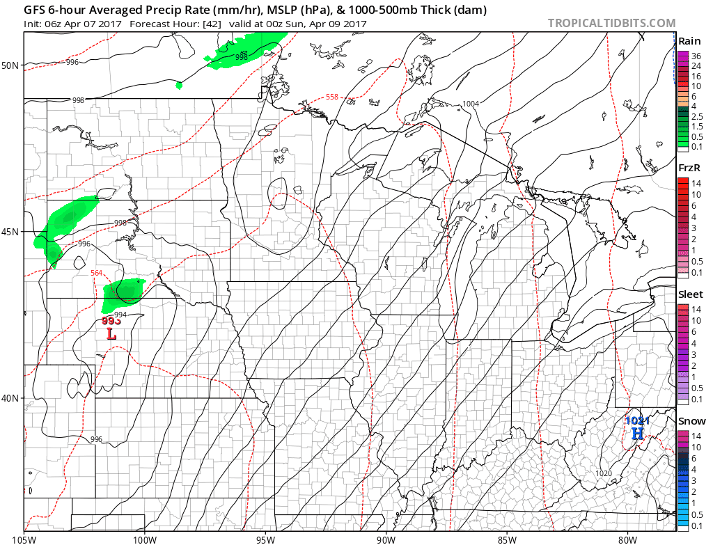
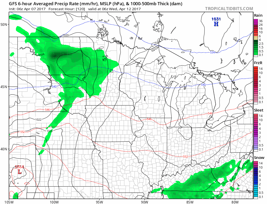
Our next system arrives Saturday afternoon west and spreads east through Sunday. Unfortunately, it looks to mainly impact the southern two-thirds of the forecast area, leaving northern areas dry once again.
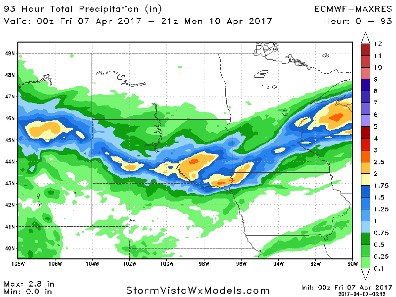
Total rainfall looks impressive south, but again, look how tight the cutoff in rain looks to be!
Behind this system, high pressure moves in, bringing another frost and freeze threat for Tuesday morning.
Some additional rains are expected Wednesday as warmer air pushes into the region.
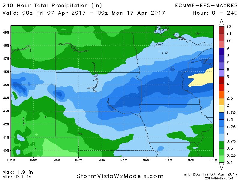
Another rain maker is in the cards for next weekend as well. Total rainfall over the next 10 days is shown below.
Confidence and Risks:
- Above average confidence for 1-3″ of rainfall through early next week in much of the southern half to two-thirds of the forecast area while the far north stays mainly dry.
- Above average confidence in another frost/freeze threat Tuesday morning.
- Average confidence in additional showers Wednesday and then again next weekend across much of the region.
Today’s video (5 minutes):