#SDwx #NDwx #MNwx #WIwx #IAwx #NEwx #MOwx #KSwx Frost/Freeze Threat This Week, Warmer This Weekend! Details Here. E.
Synopsis: Good morning! We are watching an area of low pressure spin its way through Missouri this morning, spreading rain across Iowa, Missouri, eastern Kansas, and southeastern Nebraska. This will move northeastward through the day with showers and a few embedded thunderstorms across Missouri. We are also watching a frost and freeze threat across the Dakotas and western Nebraska for tomorrow morning, then further east across Minnesota, Iowa, Kansas, and Missouri Friday morning. We will warm significantly into the weekend with 70s and 80s on the table for many. Our next system will develop Sunday into Monday spreading showers across the north and some thunderstorms in southern areas. Cooler conditions along with additional frost/freeze threats (especially north) look to return by midweek next week.
Current radar shows low pressure with ongoing showers across southern areas this morning with high pressure largely controlling the weather to the north. 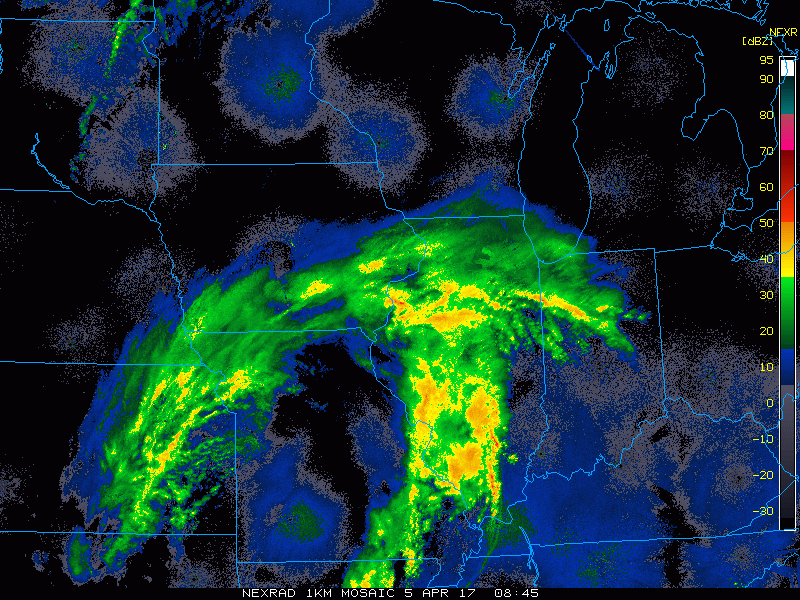
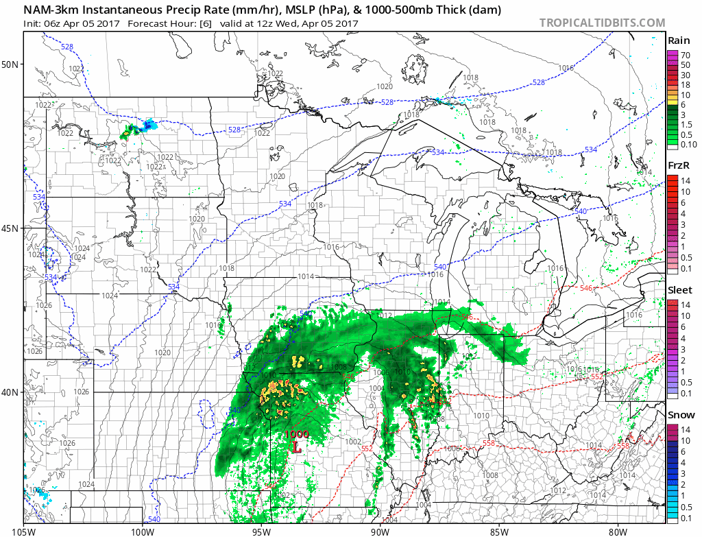
Projected radar today shows this feature moving to the east with additional rains across Iowa, Wisconsin, and Missouri through today. High pressure will move into the Dakotas and northern Minnesota this evening promoting dry conditions.
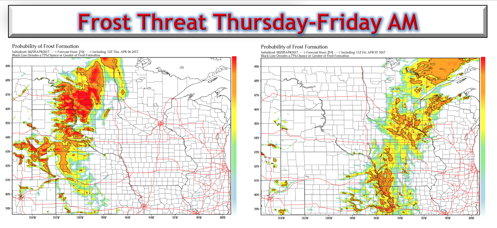
Behind this system, frost and freeze threats rise for Thursday morning and Friday morning as colder air works in from the north. Here’s our propriety frost product for both mornings.
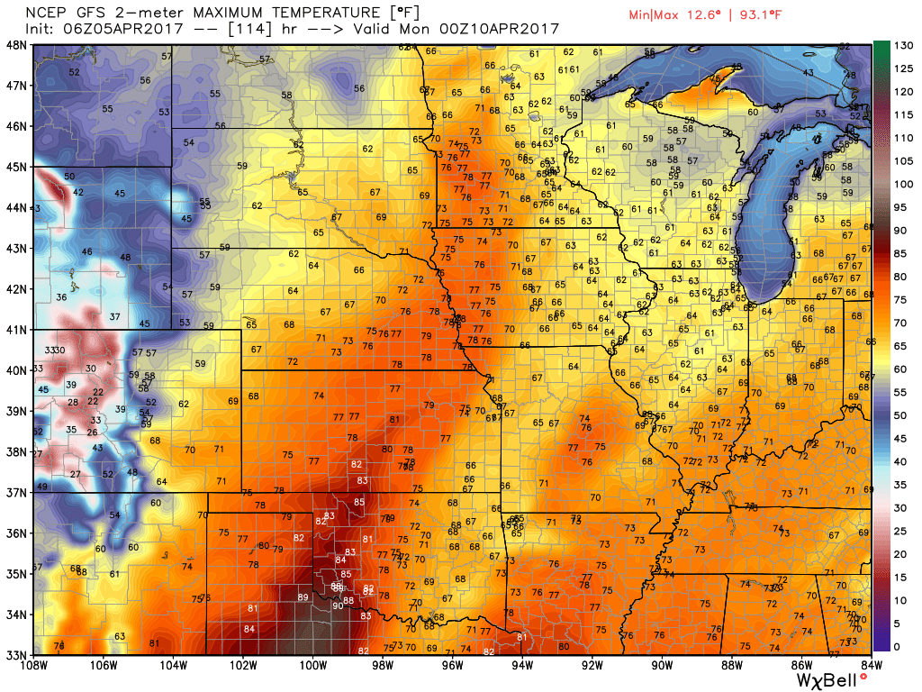
Temperatures over the weekend will warm nicely into the 60s and 70s for many. Here’s a look at temperatures Sunday.
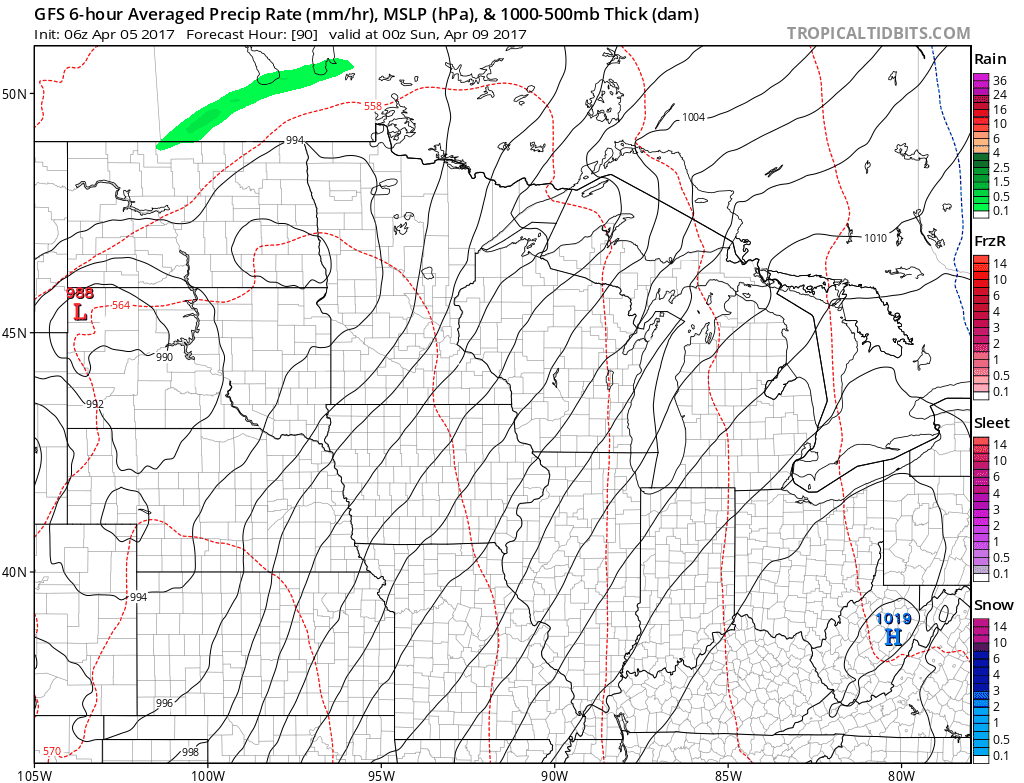
Our next system comes later Sunday into Monday with showers and a severe weather threat south. Here’s the latest GFS model forecast.
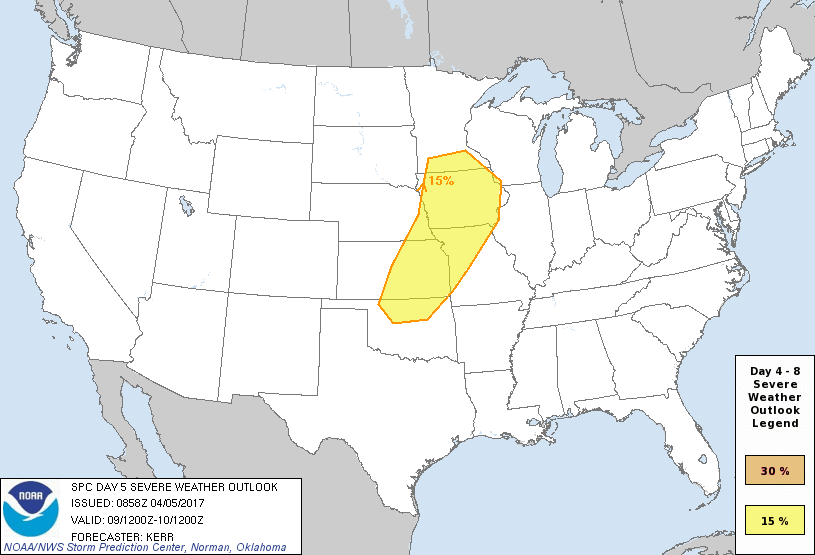
With this system, the SPC has issued a 15% chance for severe weather across portions of the region Sunday. We will continue to monitor this over the coming days!
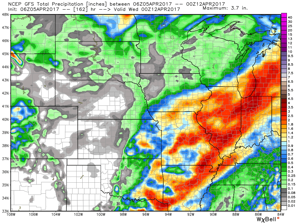
Total rainfall over the next week will be significant across southern areas, causing concern for some planting delays through much of next week.
Confidence and Risk:
- Overall above average confidence the northern Plains continues to feel the effects of high pressure and largely stays drier than normal with the exception of a few scattered showers through the weekend.
- Above average confidence of a potential frost and freeze threat on vegetation Thursday and Friday mornings as temps get into the 20s and 30s.
- Above average confidence we warm up in a big way this weekend with temps in the 70s and 80s expected overall.
- Increasing confidence on a severe weather threat early next week across southern areas. This combined with recent rains may cause planting delays.
Today’s video (7 minutes):