#SDwx #NDwx #MNwx #WIwx Drier Than Normal This Week, But Wetter Times Coming? Details Here! E.
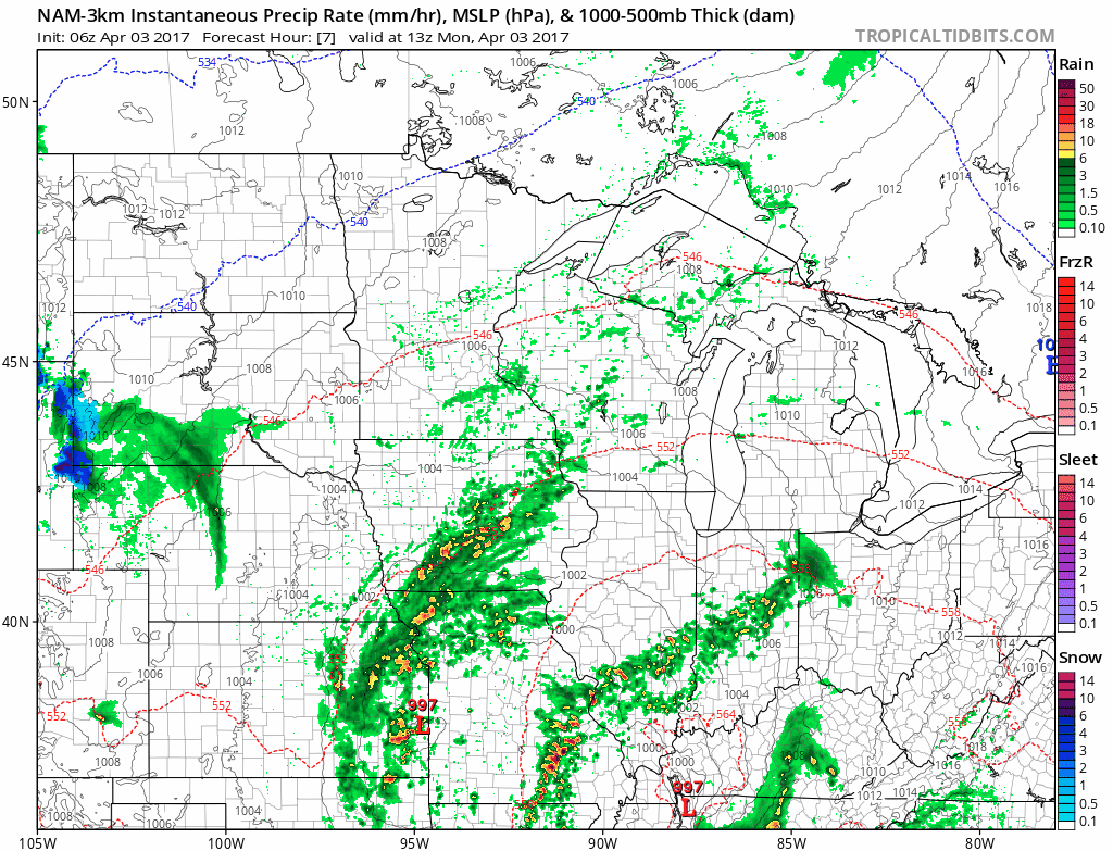
Synopsis: Good Monday morning! We are tracking an area of low pressure moving to the south of the forecast area this morning, bringing some showers to southern SD, MN, and WI. This system will slowly move eastward over the next 24 hours continuing shower chances through tonight. Today’s QuickCast is below.
Showers will continue in the Southeast through tonight. Here’s the latest projected radar.
A few showers will be around in the Dakotas tomorrow, but rainfall looks minimal (generally less than 0.25″). Eastern areas look to dry out for the day.
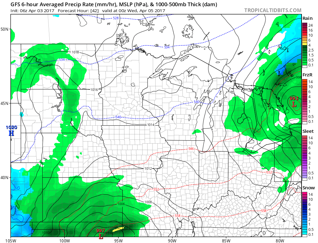
The next system approaches southern areas once again midweek. Notice the southerly trend with these systems continues as Canadian high pressure keeps things dry north.
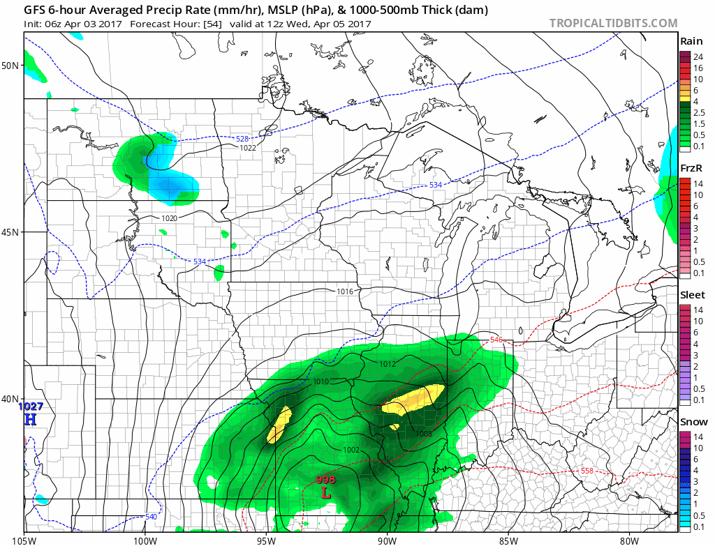
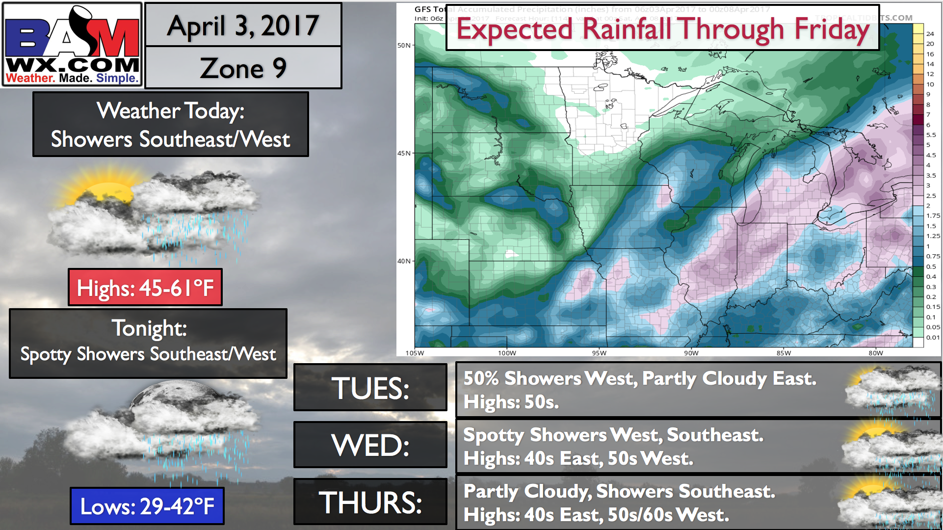
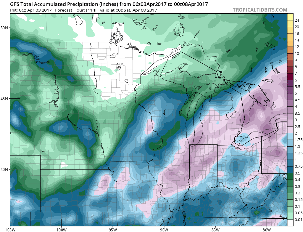
Rainfall through Friday looks minimal across the north, with more appreciable rains in the south and east.
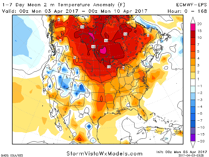
Temperatures this week look very warm compared to average, 5-10°F above normal!
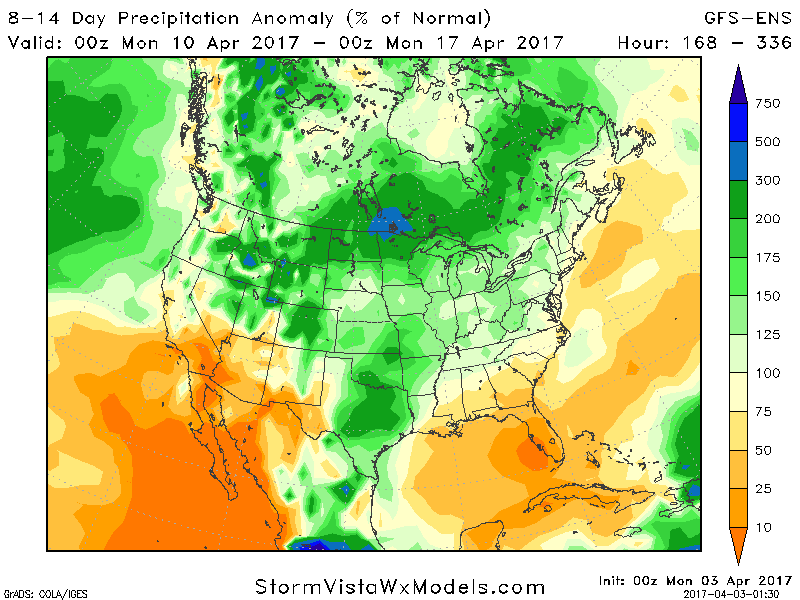
A more active pattern may emerge by this weekend into next week. Latest week 2 precipitation forecasts compared to normal are all above normal as we approach planting time in southern parts of the region.
Confidence and Risks:
- High confidence on drier than normal times across the north this week, with near to above normal precipitation in southern areas.
- High confidence on warmer than normal temperatures this week.
- Increasing confidence in wetter times developing this weekend into week 2.
Today’s video (7 minutes) explains it all! ~Ed