Good Morning,
Looking over things this morning and things are remaining rather consistent with respect to todays game forecast. Tomorrows forecast has featured a few NW clicks with potential storm placement like what we talked about in the video yesterday. In terms of today I would look for highs near 90 with humid and rather uncomfortable conditions. Winds will be SW 10-20 MPH. Other than this I see no weather related concerns for todays game. 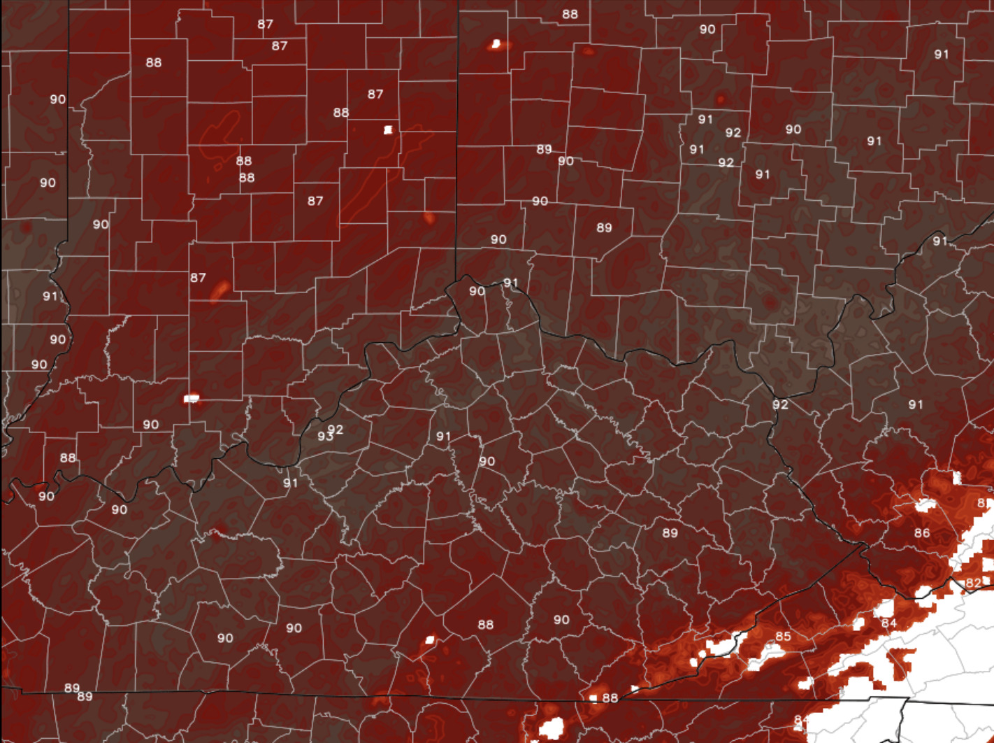
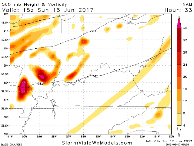
Sunday game update. As of right now the system looks to have taken a few NW clicks. The primary forcing arrives around 4pm-9pm. A scattered storm threat will develop as early as 12/1 as of right now. You can see below forecast radar and how it evolves.
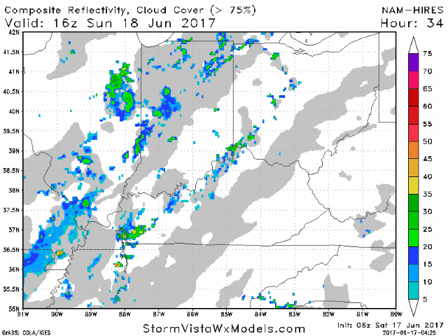
The dynamics of the system have clearly shifted NW also suggesting there could be coverage of ~50/60% Sunday afternoon in and around the area. Pending on exactly where the axis of rain sets up will bey the key to the forecast tomorrow. We will know a lot more tomorrow morning.
Total rain Sunday evening into Monday looks like this right now via the overnight data. 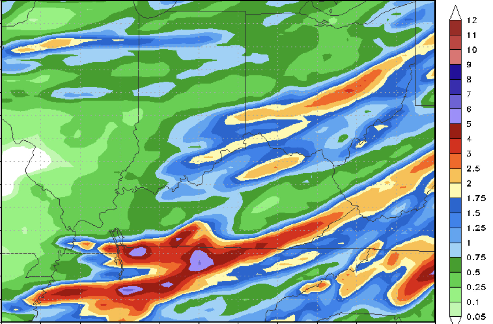
If you have any questions about this just let me know. Thank you.