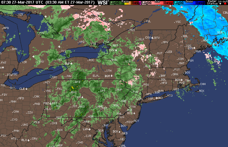
Good morning! A bit of freezing rain is occurring in the higher elevations of northern CT and western MA this morning leading to some slick spots. Elsewhere, a cold rain is greeting us this morning. Here’s the latest radar as of 6 AM.
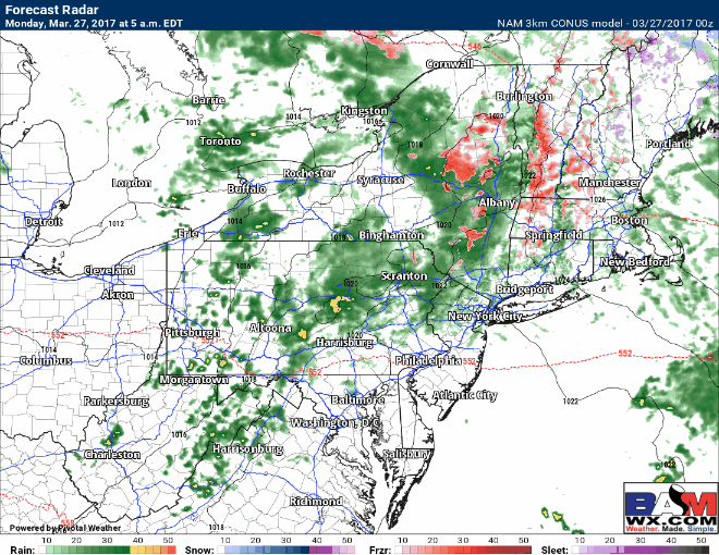
Temperatures rise this morning leading to all rain across eastern PA and New England. Across Ohio and western PA, it is likely a mainly dry day today in between systems. Projected radar today:
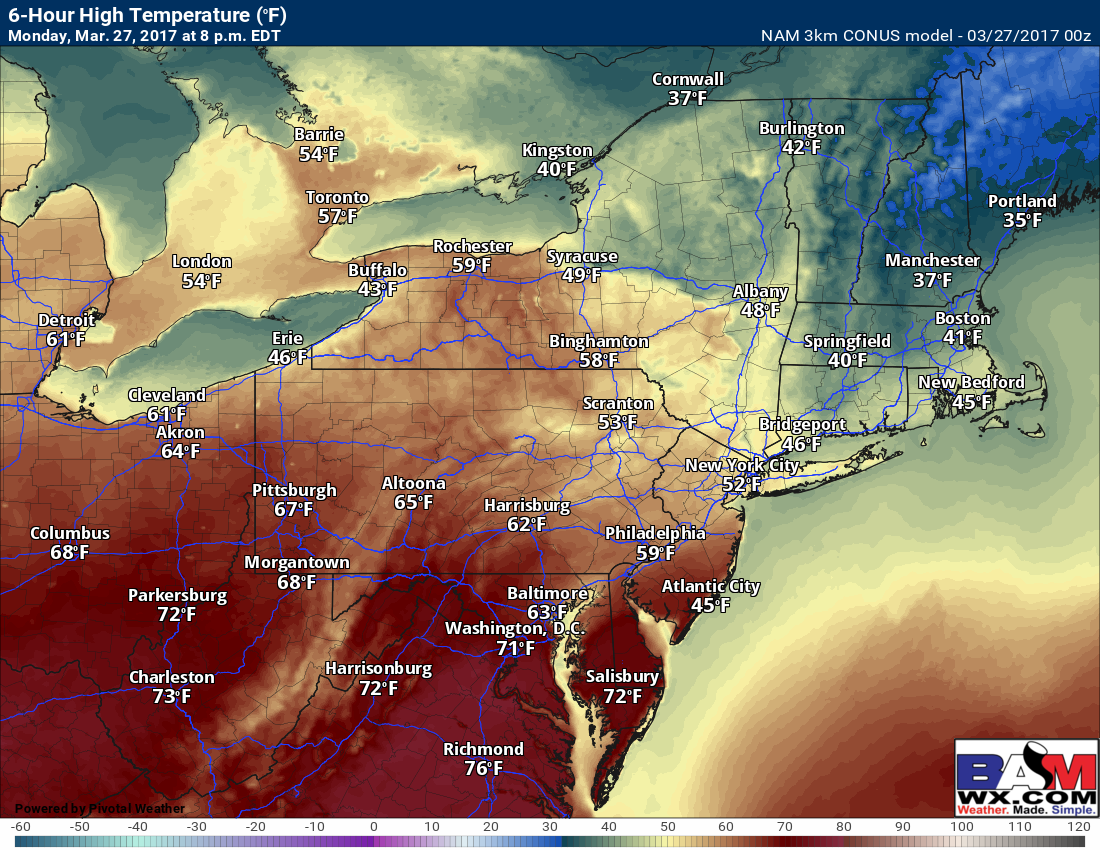
Another large temperature spread across the region. 60s to near 70 west with only 40s and 50s across New England.
More showers and unsettled conditions will occur Tuesday into Tuesday night.
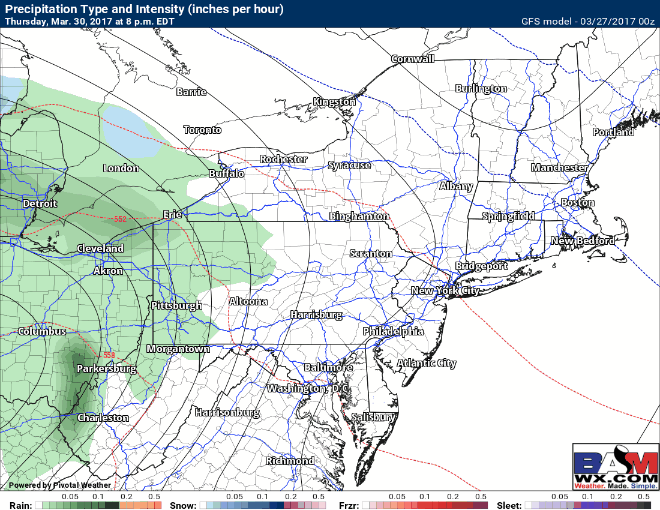
Wednesday looks like the “pick of the week” with temperatures in the 50s and 60s with some sun. More unsettled weather approaches the region late Thursday across Ohio and Pennsylvania, then pushes east through Saturday. Here’s an idea of the pattern from the GFS model. I have more on this in the video below!
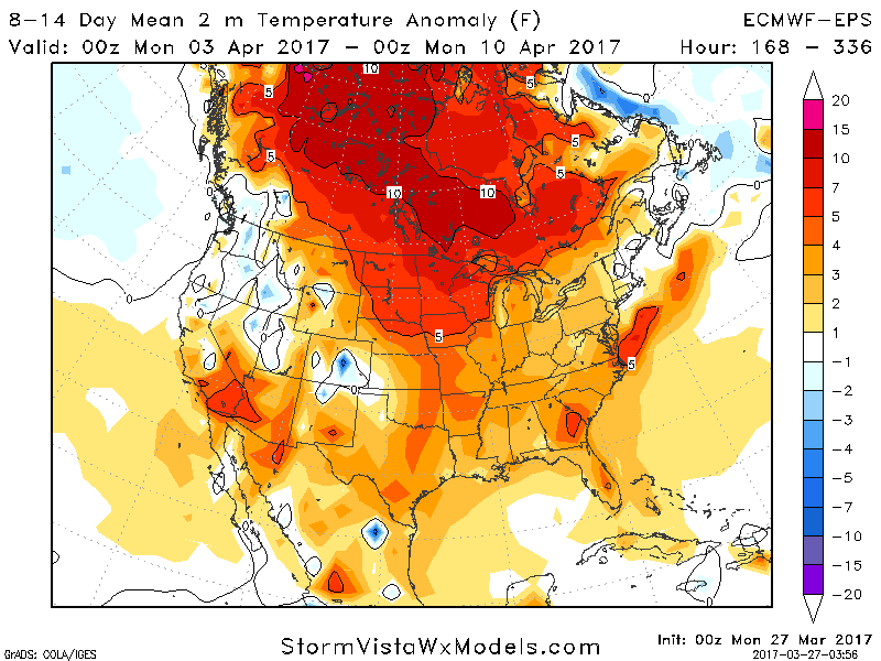
Looking into the long range, we continue to slowly crawl toward Spring across New England. In week 2, once again expect the warmest temperatures across Ohio and PA with somewhat cooler (seasonable) conditions across New England.
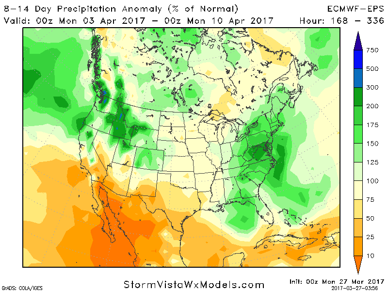
Along with the warmer conditions, it looks quite unsettled with well above normal rainfall in week 2!
Confidence and Risks:
- High confidence on a very unsettled week ahead with rain chances every few days.
- High confidence on warmest temperatures across PA and Ohio, with cooler conditions across New England through early April.
- High confidence on an unsettled, wetter than normal pattern into the first half of April.
The video below covers it all! ~Ed