Good afternoon! We have a lot to discuss this afternoon building off of this morning’s blog, so I’ll get right to it.
With respect to the storm tomorrow into Wednesday, model guidance continues to trend a bit warmer. Here’s the projected radar late this evening through the day Tuesday. Notice rain enters Ohio and western PA this evening and quickly spreads east overnight. This sets the stage for some brief icing potential during the morning commute across the Hudson Valley, interior CT, and western and northern MA. Rain will largely be the predominant precipitation type elsewhere, with some snow across far northern MA into northern New England before a change to ice and eventually rain.
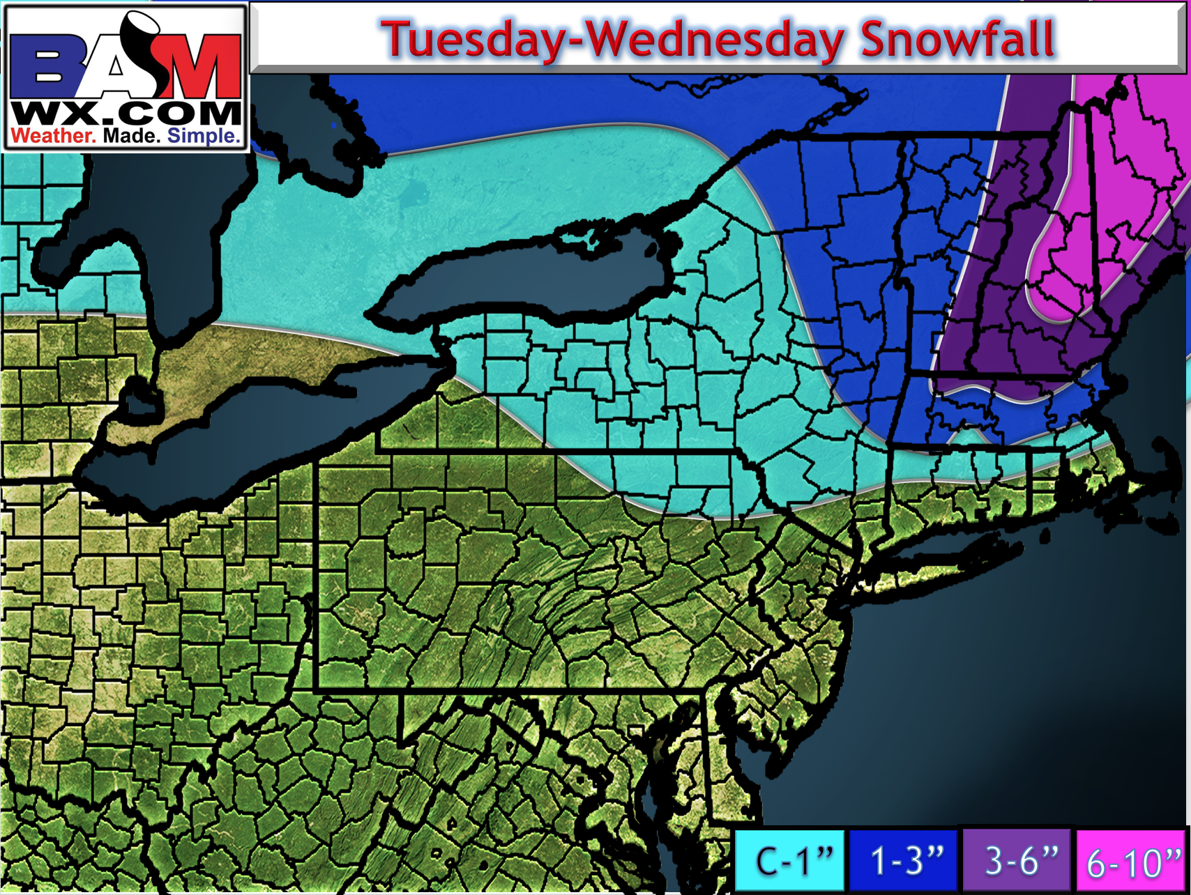
Here’s the updated snow map.
Precipitation will wind down Wednesday morning from west to east and temperatures will fall behind a cold front. Here’s Wednesday’s temperature outlook.
This cold front will set the stage for the next piece of energy moving through the region. With a disturbance this strong, we will see snow, but where exactly the disturbance tracks will determine how much snow falls where.
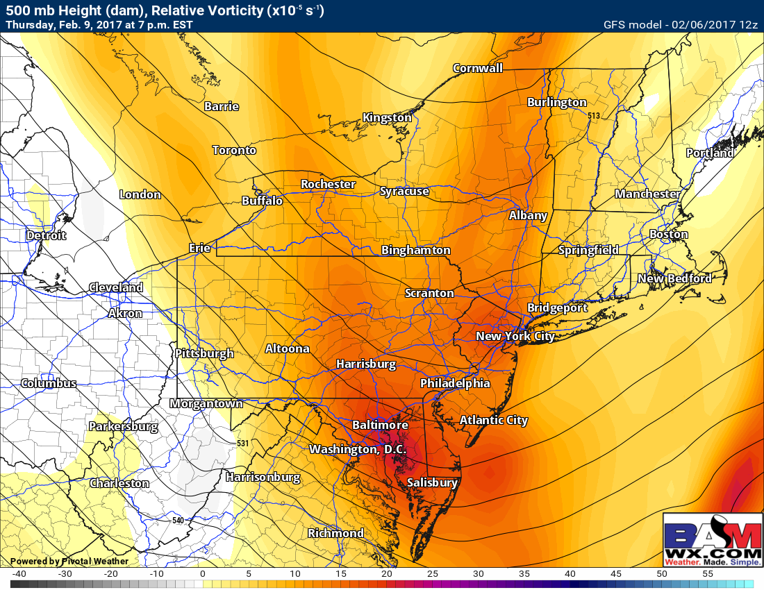
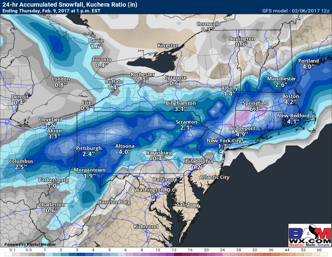
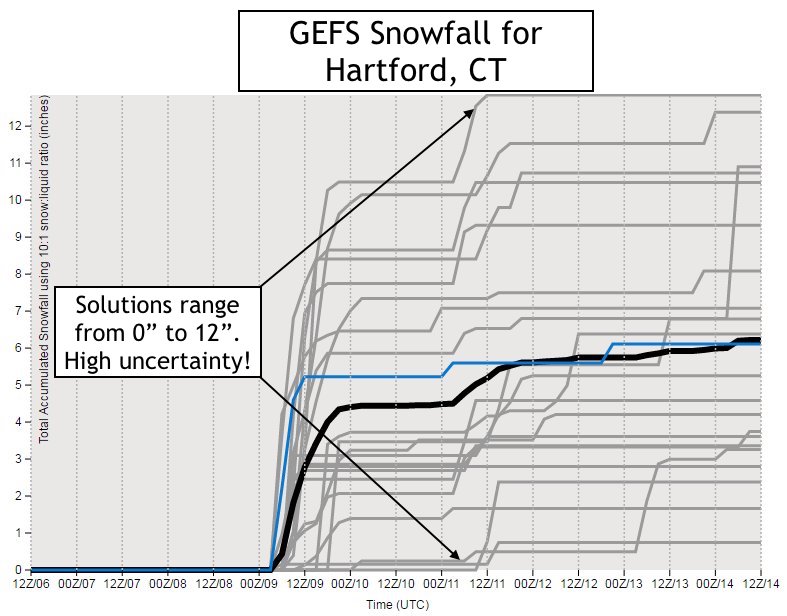
Right now, guidance remains uncertain with how much snow will fall. Here’s a great example: below is the GFS forecast, then below that is the GFS Ensemble snow line graph which contains 21 different members. Currently, the GFS is bullish on some significant snow, but in fact, its ensembles have solutions ranging from 0″ to 12″ in Hartford, CT!
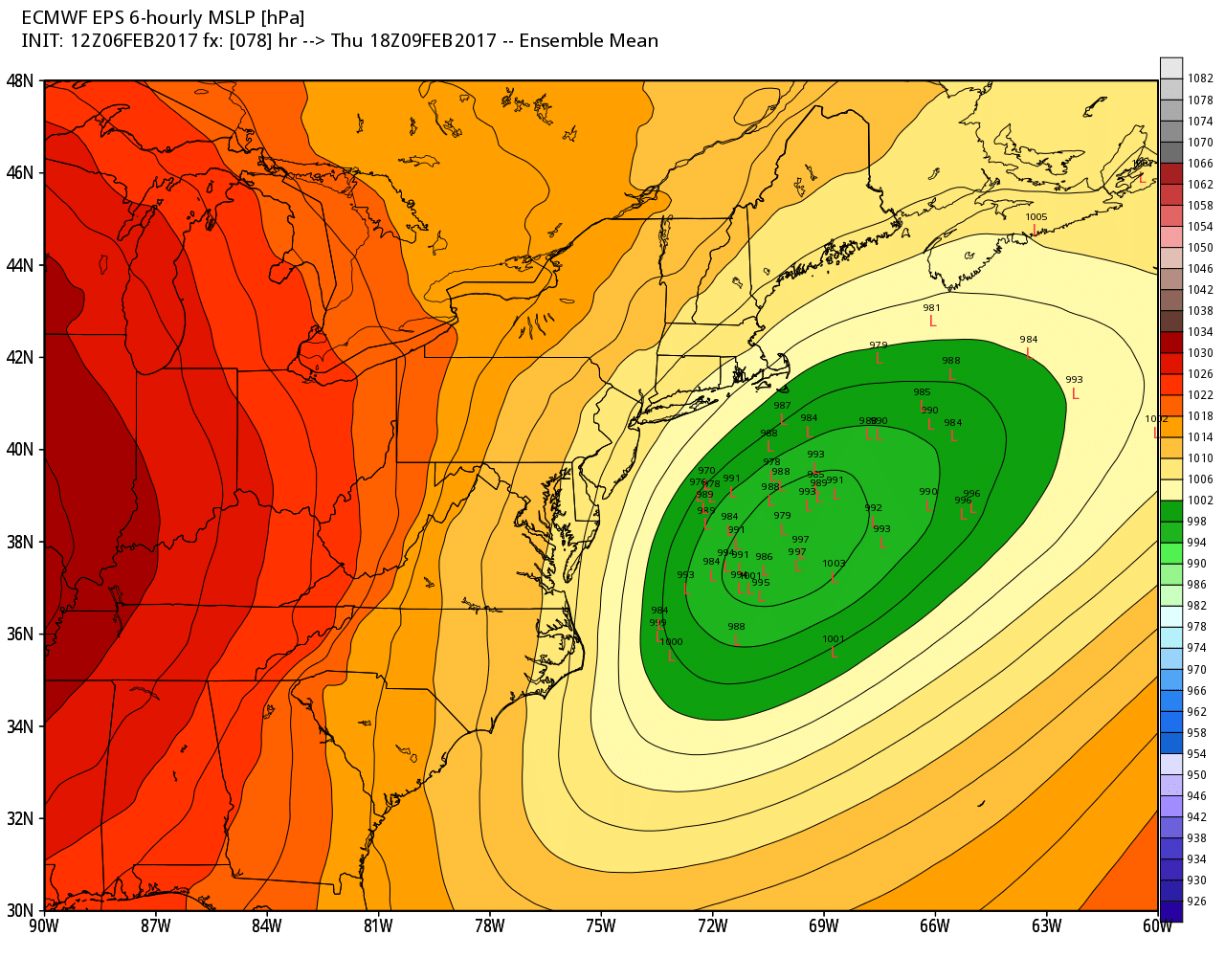
The latest European model also has some snow in coastal areas, but examining the ensembles (51 different members) shows that some member are farther northwest than the mean track. This may mean a northwest shift could occur in future runs – something to watch.
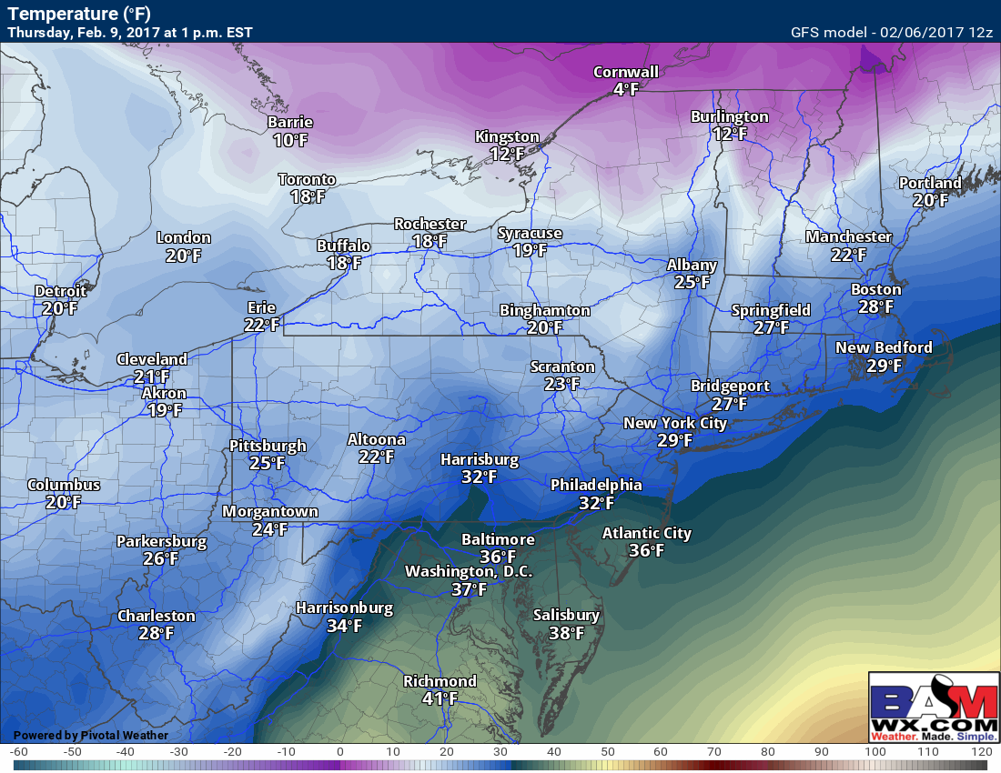
Further south across West Virginia, southeastern PA and southern NJ, temperatures will be borderline cold enough for snow to stick. Here’s a look at forecasted temperatures from the GFS (which is a further north solution as of now).
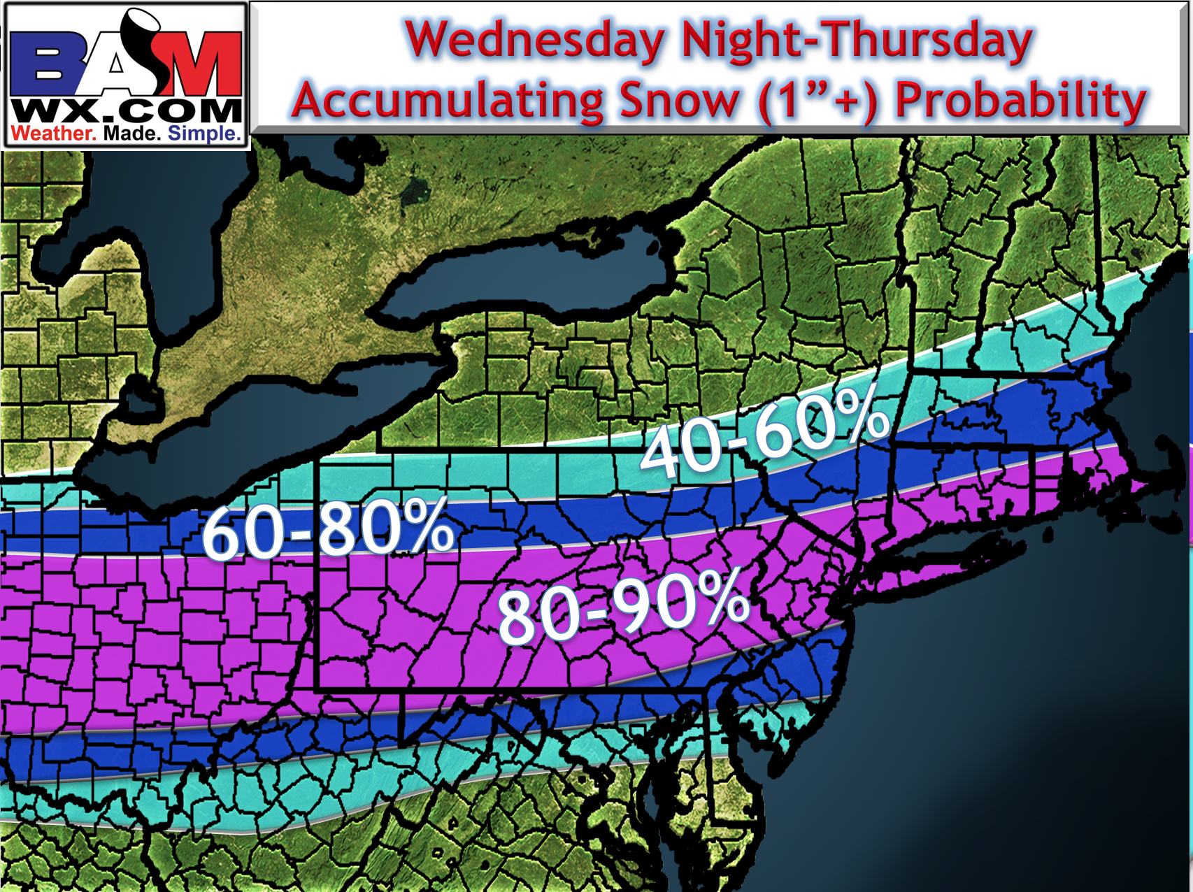
With all of this said, here’s the updated thinking as to where 1″ or more of snow may fall Thursday. Note there will be changes to this forecast as model guidance hones in where the low will track.
I’ll have a full update tomorrow morning with all the latest information.