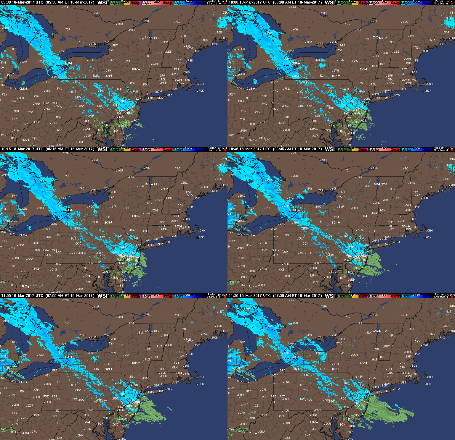
Good morning. Latest computer model data has trended southeast with the snowfall expected today into Sunday. As discussed yesterday afternoon, the location of the area of low pressure was going to dictate snowfall amounts. As of 8 AM, some light mixed precipitation is falling across the Mid-Atlantic, but likely will not amount to more than a coating to 2″ or so, mainly on colder surfaces.
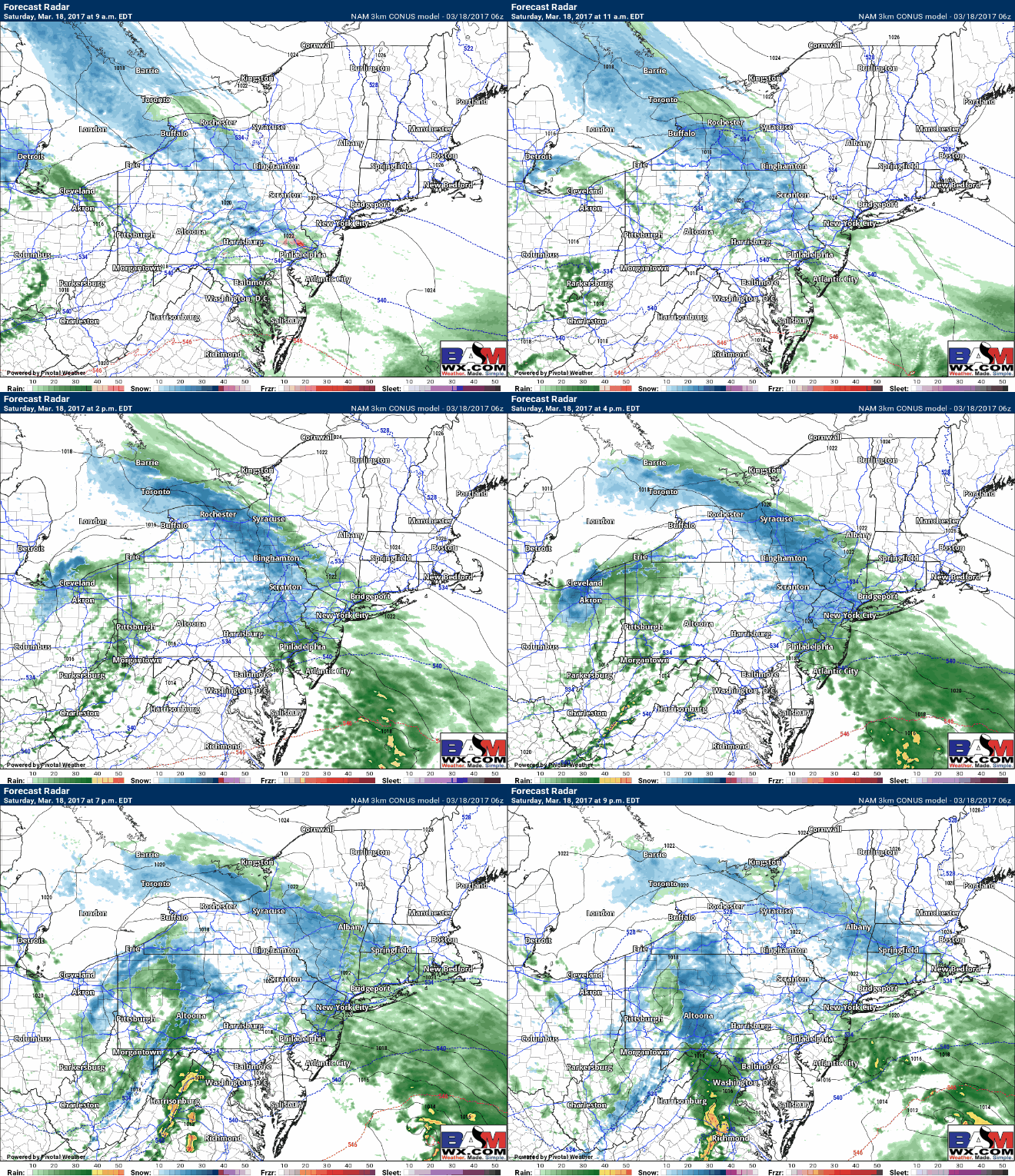
Rain and snow showers will continue to today across the region with minimal accumulations. Here’s the latest projected radar from the 3 KM NAM model.
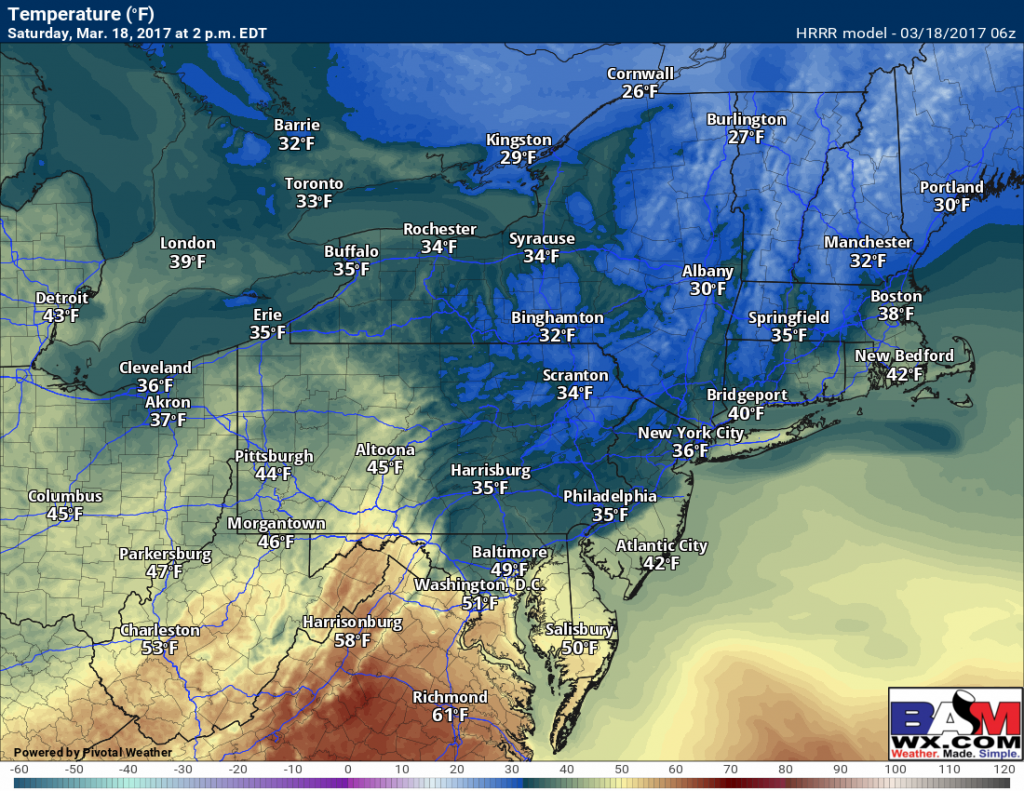
Temperatures will be warmer today, so this combined with the March sun angle will make accumulation on pavement a very minimal concern. Temps today by the later afternoon:
Some light snow is still a concern overnight across coastal NJ, Long Island, and southeastern New England, but I think it is very minimal – maybe a few inches on Cape Cod, but even this may be localized. Latest snow map:
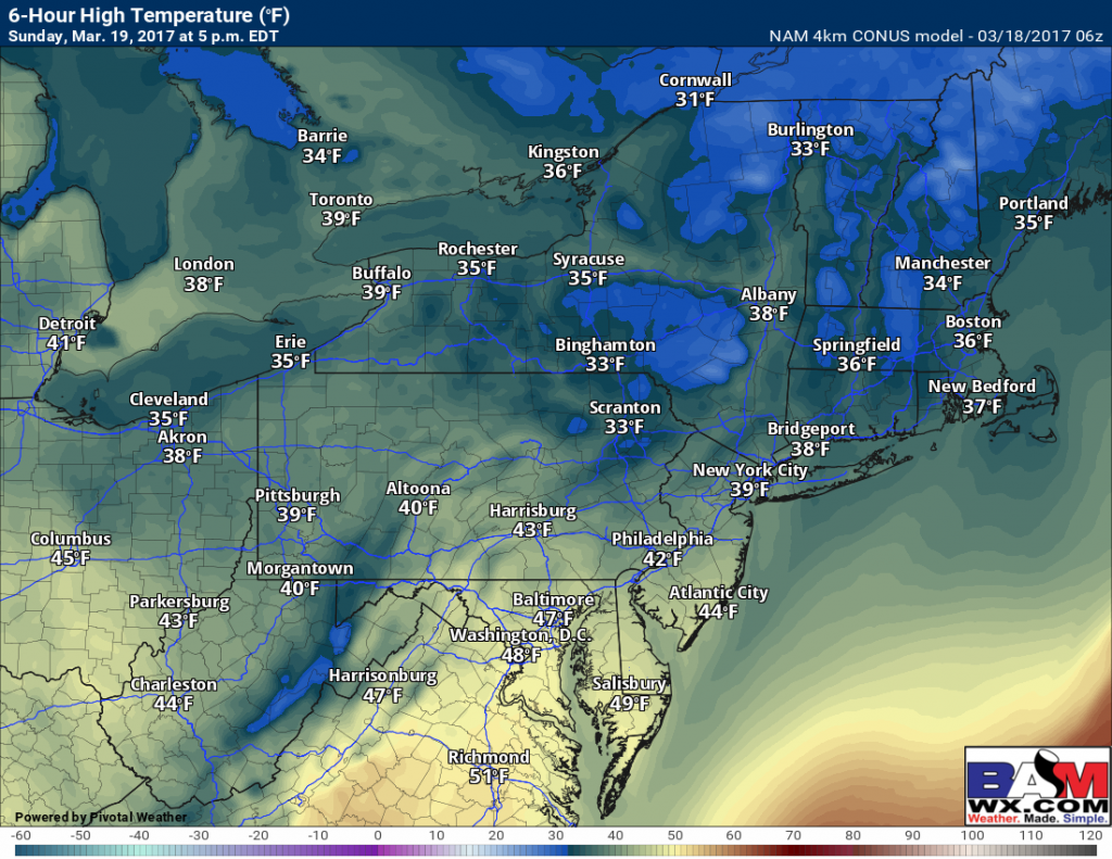
Sunday should feature some clearing and temperatures into the upper 30s and lower 40s. Some of these numbers may even be a bit low.
A look at our exclusive 7 day forecasts show a warming trend through early week, before another cool down late week in New England. You can access these graphs by going to the “zones” tab on the site, clicking “7 day forecasts”, then selecting the city code closest to you. Here’s Providence, RI.
Have a wonderful day. I’ll update if needed this afternoon as I observe radar trends. The video below should explain it all. ~Ed


