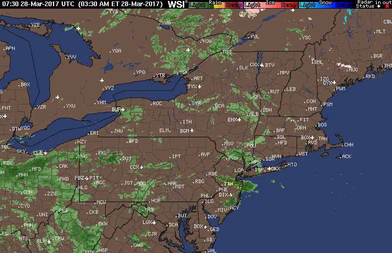
Good morning. We are tracking some patchy dense fog as well as some shower activity across the region this morning. Here’s the latest radar as of 5:50 AM.
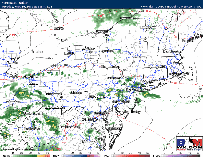
Through the day today, showers look to continue with plenty of clouds around. The best chance for any breaks in the clouds will be in western areas where rain ends around midday. Rain lasts through this evening across eastern areas. Here’s the projected radar.
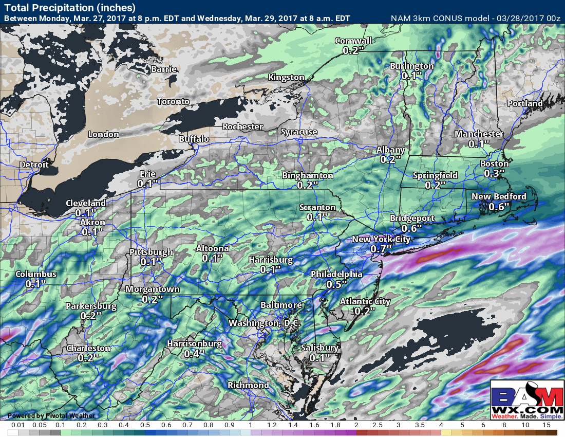
Rainfall through Wednesday morning looks generally between 0.25-0.50″ with locally higher amounts possible.
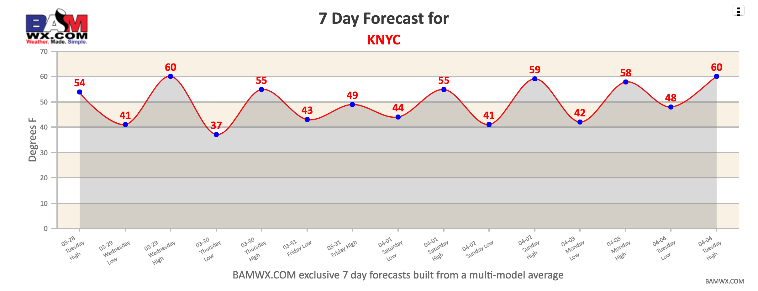
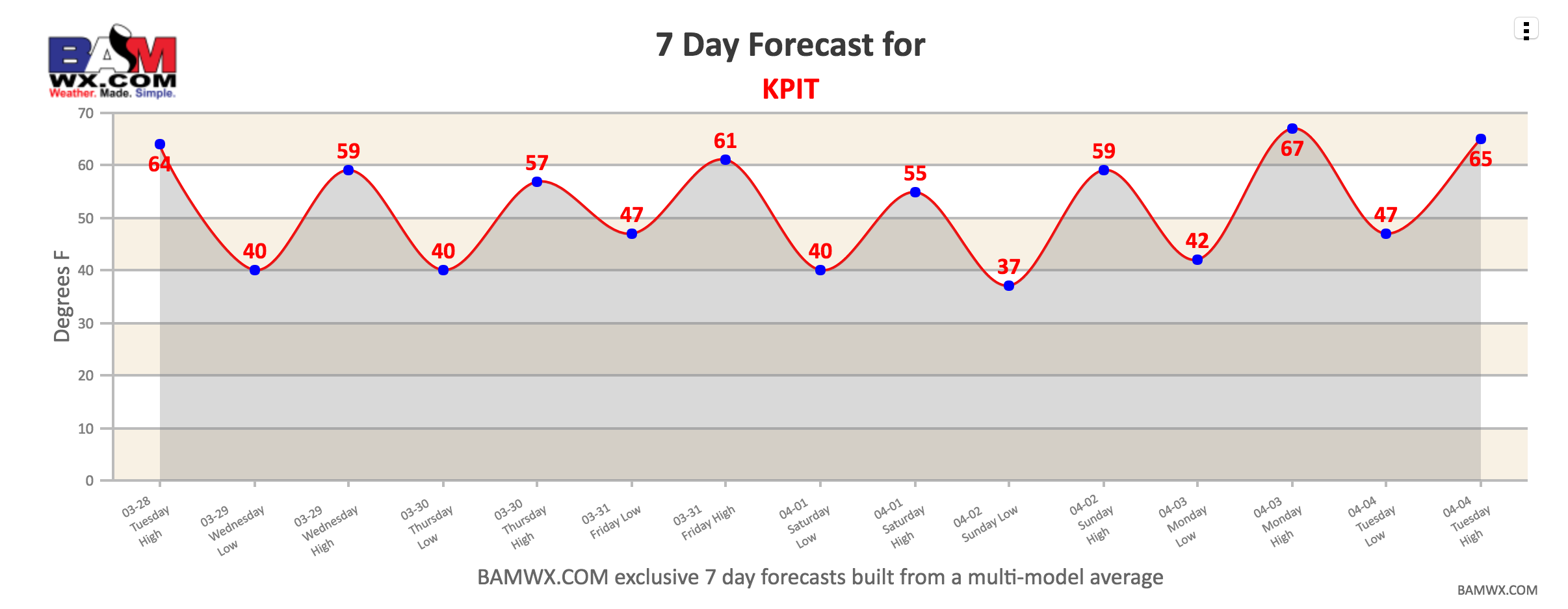
Wednesday and Thursday look seasonable in the 50s and 60s with some sunshine. Here’s a look at our exclusive 7 day forecast graphs going forward for both Pittsburgh and NYC. To find data for the city near you, go to “7 day forecasts” under the zone tab.
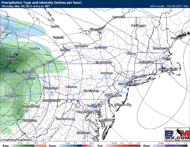
 Our next system in this active pattern approaches Thursday evening into Friday and last through Saturday morning in the east. This system likely brings rain, but model guidance is interesting in New England. Here’s the latest GFS model. I’ll have full details in the video so make sure to watch!
Confidence and Risks:
- High confidence on wet conditions lasting through this week and likely into next week as well.
- High confidence in temperatures overall staying above normal across the region.
- High confidence on a system Thursday night through Saturday morning with rain across much of the region.
- Low to moderate confidence in some front end wintry precipitation across New England. The extent of this remains uncertain…stay tuned!
Today’s video is 5 minutes. Have a good day!