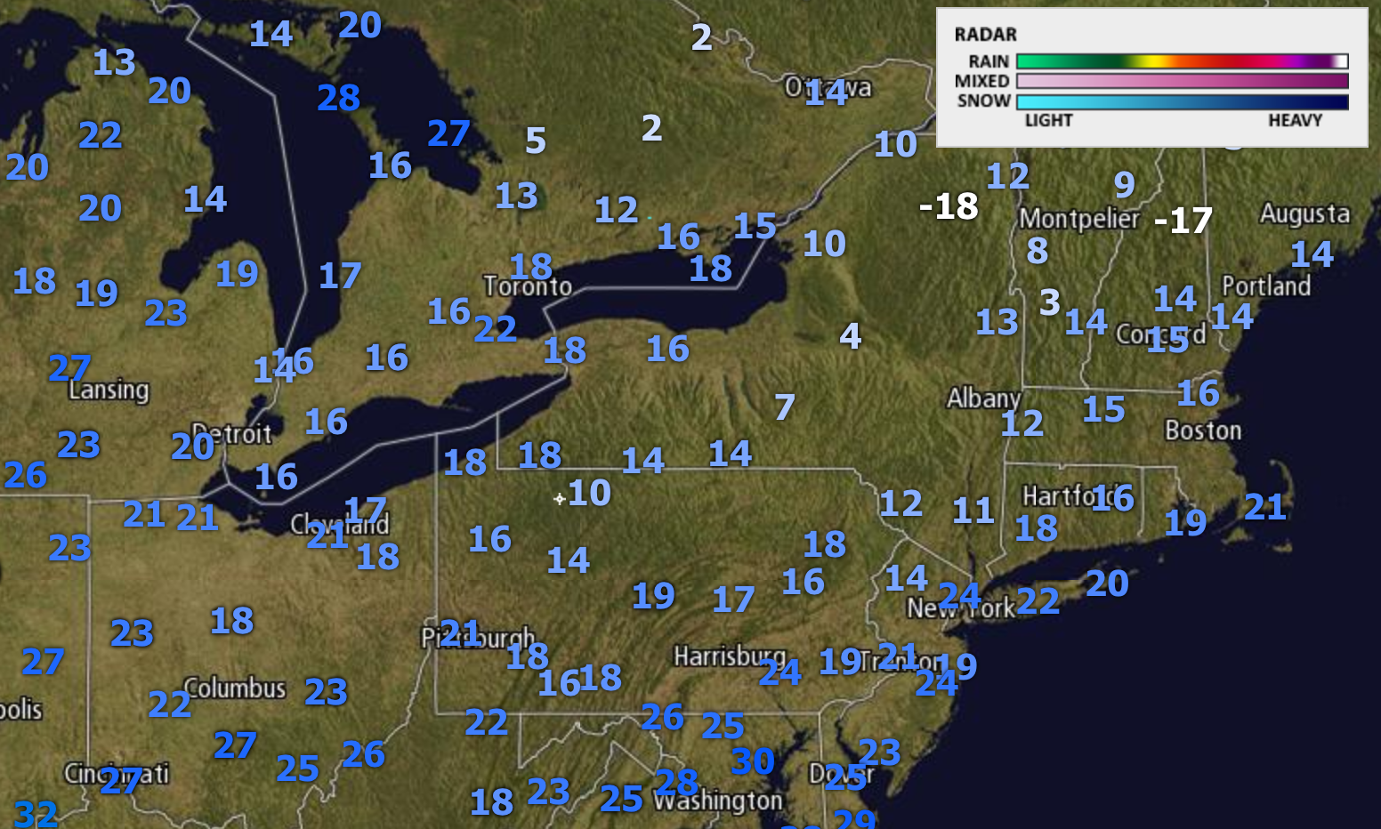
Good morning! The radar is clear this morning, but it is frigid out there for late March! Here are the latest temperatures as of 5:30 AM.
Today will be a dry day with slightly warmer temperatures compared to yesterday, particularly west.
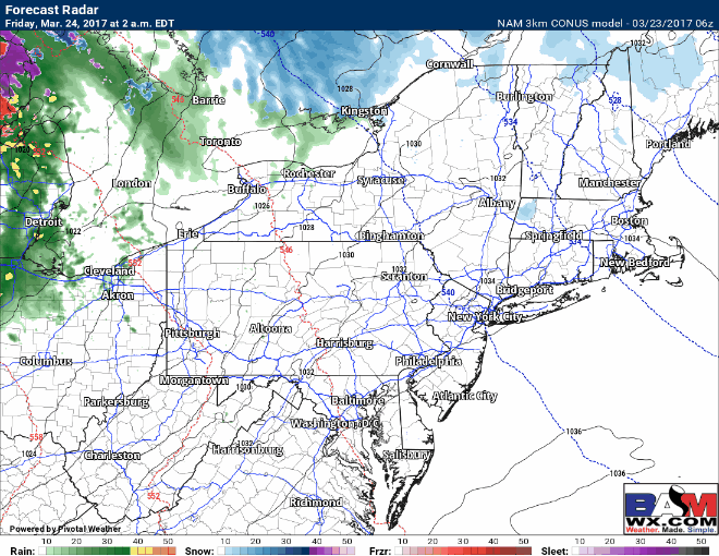
Our next system will approach in the form of a warm front for Friday morning with a wintry mix across central and northern PA, spreading eastward into the Catskills and Berkshires later on. It should be plain rain along the coastal plain. NAM projected radar for Friday:
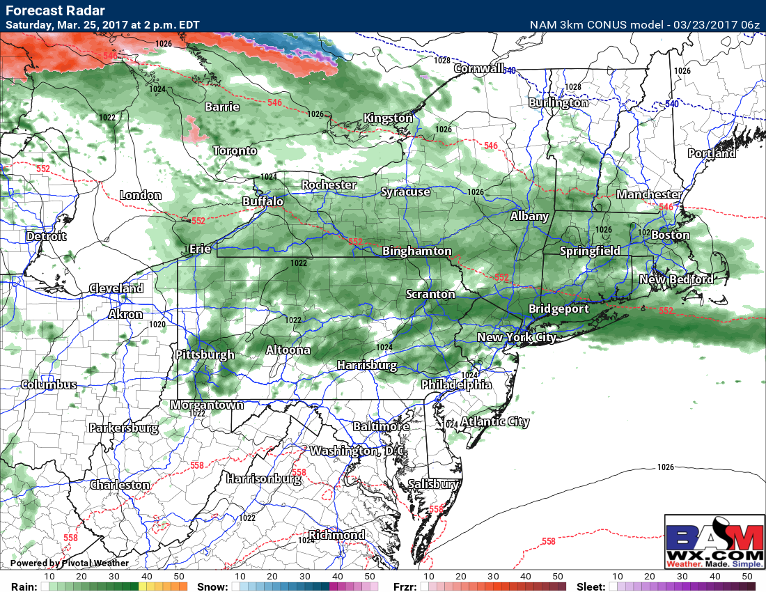
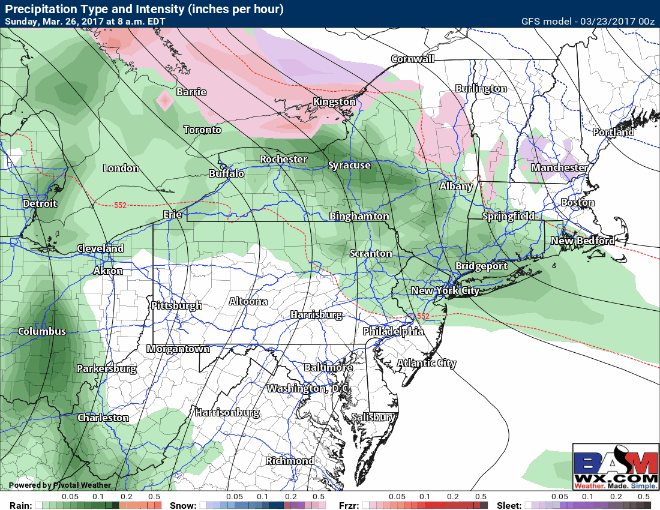
The front will likely get hung up across the I-80 corridor into southern New England Saturday with some showers along it. Here’s the projected radar for 2 PM Saturday.
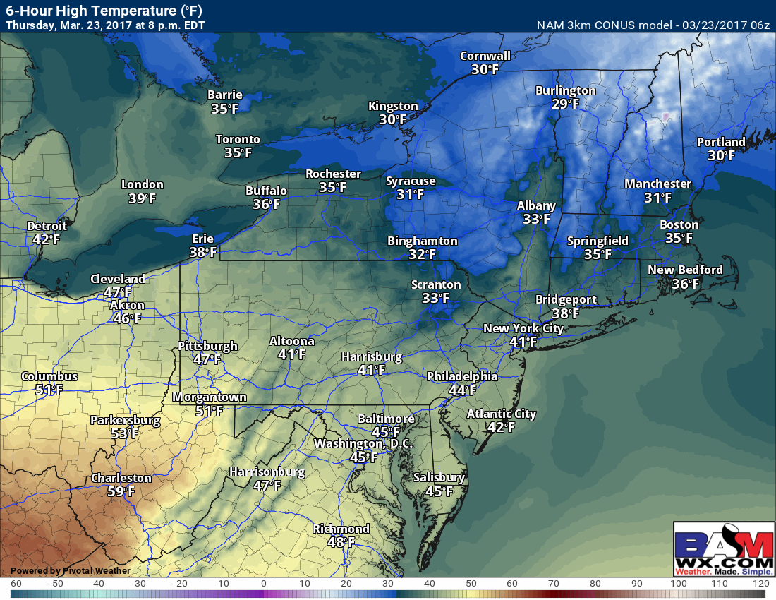
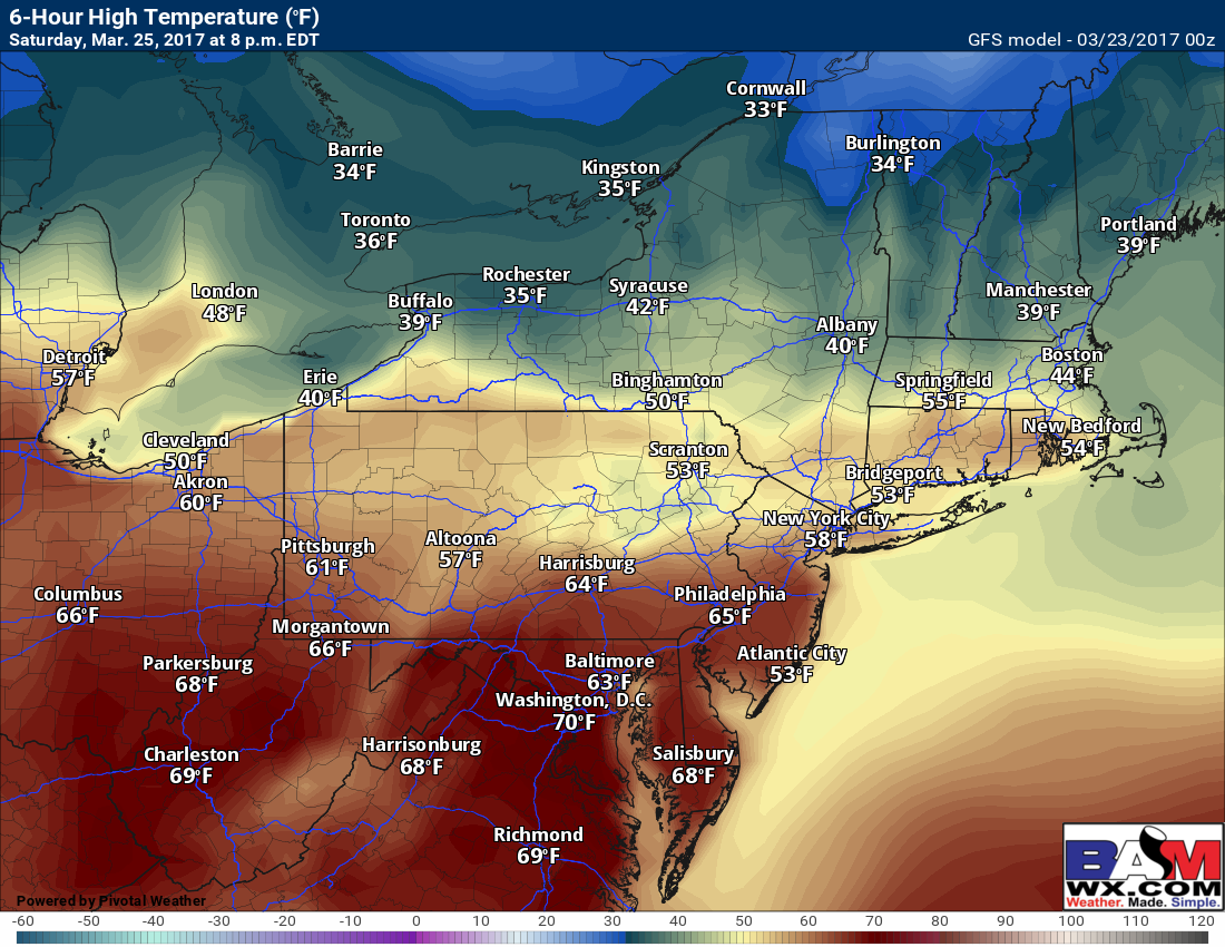
South of the front will get quite warm, but along and north of it with be cloudy and dreary. Here’s a look at high temperatures Saturday.
This is the beginning of what looks like an active pattern in the Northeast. Another system will approach Sunday into Monday with mainly rain. There may be some initial mixed precipitation in northern areas, but where it occurs will depend on the location of the warm front.
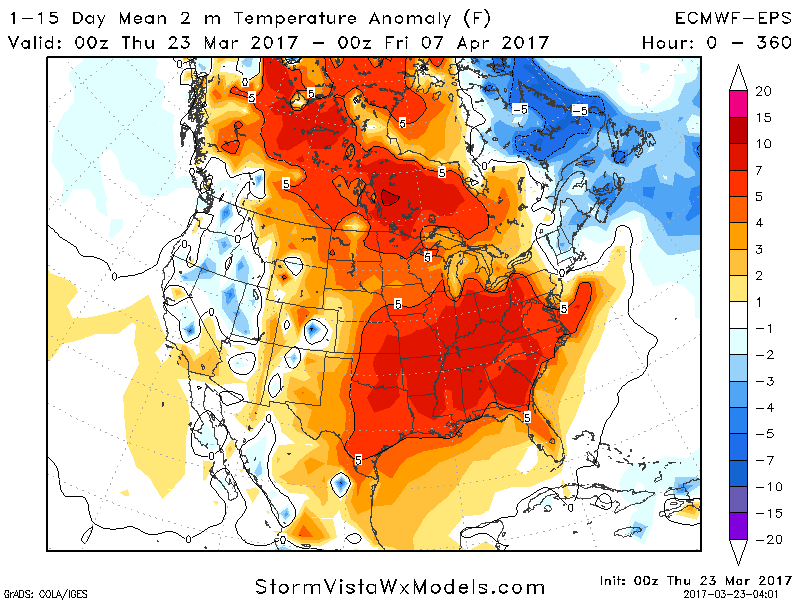
Overall the next 15 days will feature warmer weather across the country, but the Northeast will only be closer to normal due some easterly flow and storminess. ‘Tis the season!
Confidence and Risks:
- Moderate confidence in some freezing rain/mixed precipitation across PA, the Catskills, and western MA Friday morning before a change to rain. It will be plain rain closer to the coast and across Ohio.
- High confidence in a stormy and somewhat warmer pattern developing. The warmest weather will be across Ohio and PA with New England closer to normal.
- Low to moderate confidence on precipitation type across the interior Sunday-Monday depending on location of the warm front.
The video covers it all! ~Ed