Good day – we are tracking yet another winter storm for the Northeast expected late tonight through Sunday and even into Monday across eastern New England. This has been an incredible stretch of winter weather across the region and it looks to continue through this week. Precipitation types will be diverse across the region as warm flow off the Atlantic will dictate wintry precipitation versus rain depending on where one is located. Let’s break down the forecast hour by hour. This is a long, but informative post, so make sure to read it all! Let’s get started…
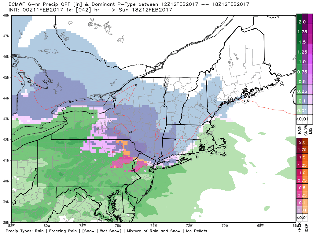
Initially, cold air will be in place across New England as precipitation moves in, leading to a burst of snow developing later Sunday morning. Here’s the European valid at 2 PM tomorrow. Notice it will likely be snowing in most areas outside of southeast Massachusetts.
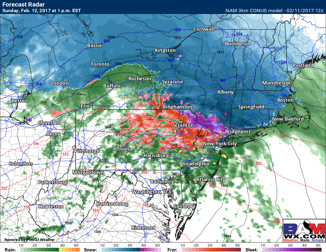
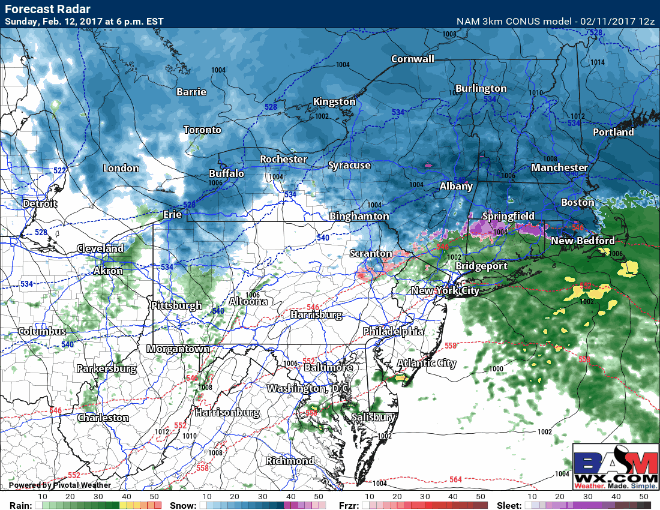
The 3km NAM valid at 1 PM mirrors this solution with snow, heavy at times for most areas. Notice how tight the rain snow line will be just north of New York City and along the CT shoreline. It could very well be raining at the beaches and still snowing only a few miles inland – very tough forecast! Some icing will also be ongoing in northeast PA and northern New Jersey where 0.05-0.15″ ice accretion is possible during the afternoon tomorrow.
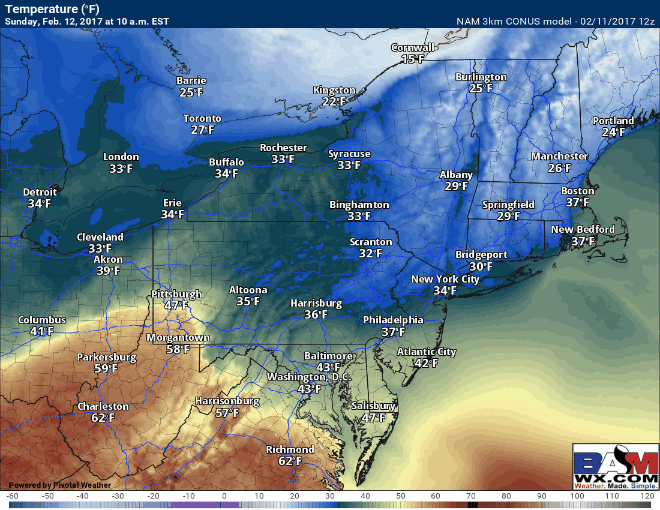
Through the afternoon, the area of low pressure will move just south of New England, pumping a warmer southeast flow in off the Atlantic. This should allow temperatures to rise in southeastern New England above freezing after a burst of snow. Here’s a look at the wind direction and surface temperatures at 4 PM.
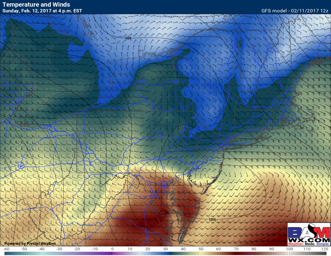
Here’s the corresponding precipitation type around that time. Notice how the rain/snow line will creep northward through the afternoon, now up to central CT, the Hudson Valley, and northern RI.
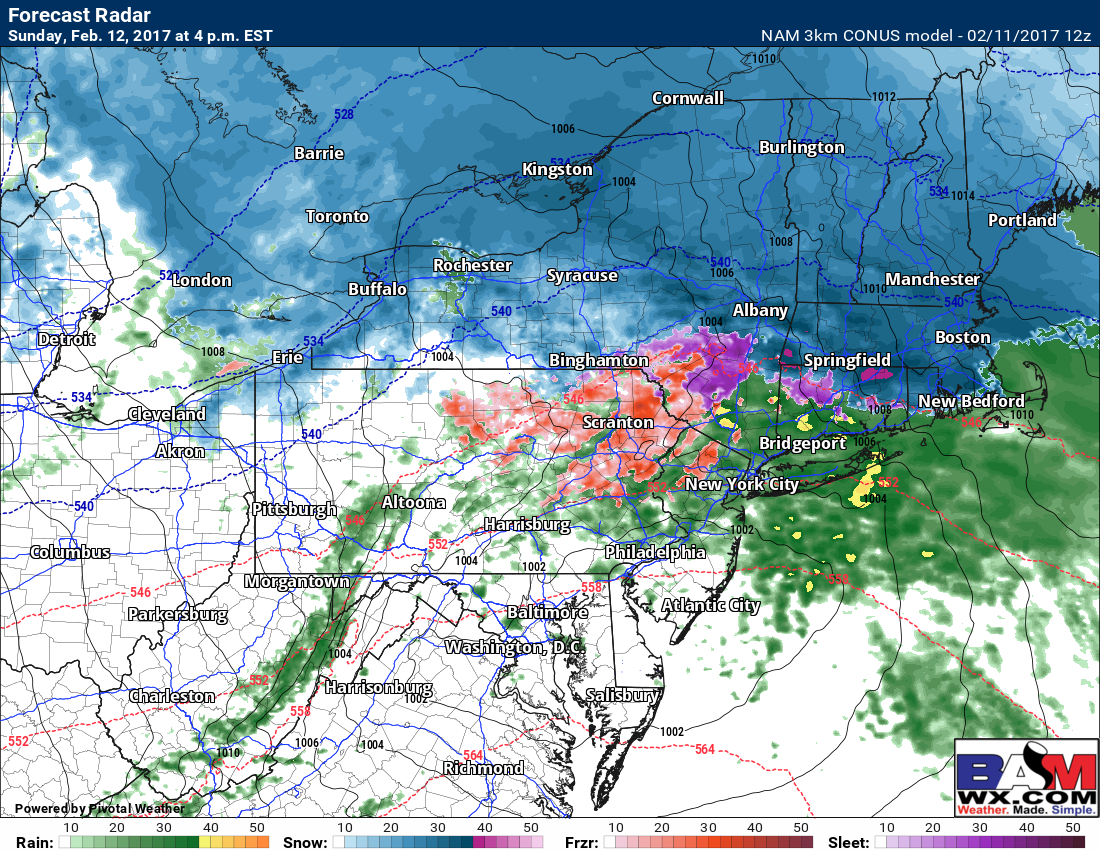
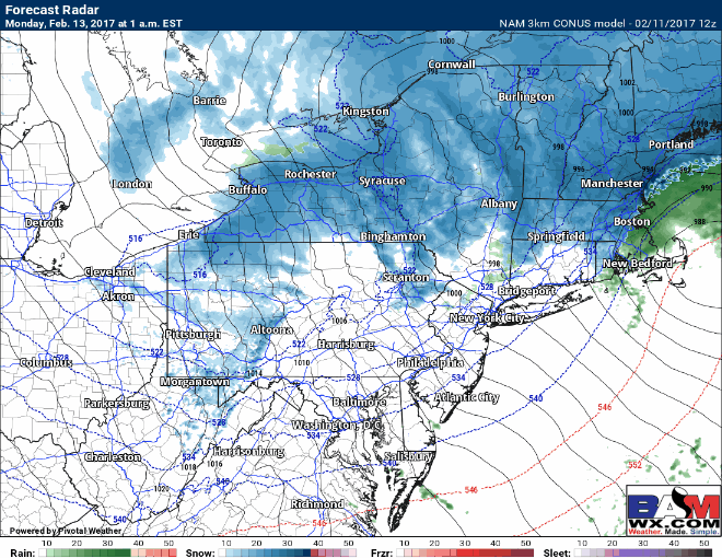
As the system moves south of New England, this will drive colder air back into the system. At first glance, I believe the rain/snow line gets up to about I-84 and I-90 late tomorrow afternoon and early tomorrow evening before sagging southward once again. The 3km NAM shows this idea well tomorrow evening. Western PA and eastern Ohio will also see snow showers overnight, totaling a few inches with locally more in lake effect belts.
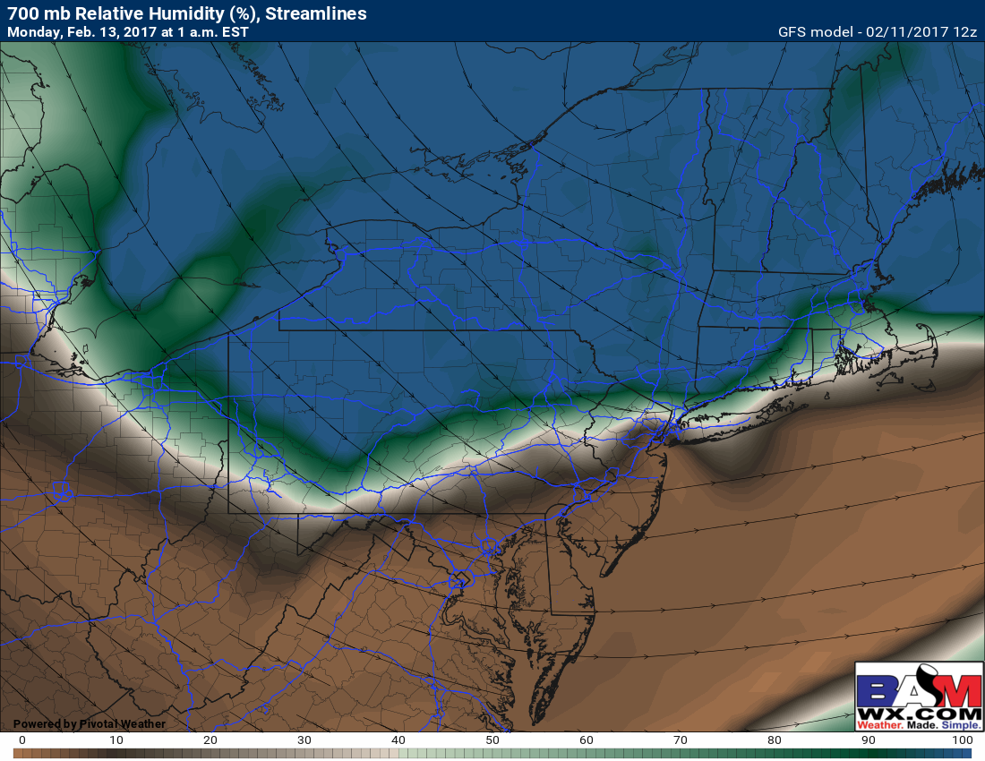
Due to the track of the system, dry air will likely be pulled into areas south of I-84 in southern New England, allowing precipitation to become scattered or just non-existent late tomorrow evening. This is shown well by 700mb relative humidity. Notice the dry (brown) colors in coastal New England. North of here, snow will continue overnight and this is where the heaviest amounts will be.
As the storm strengthens offshore and cold gets wrapped back into it, expected rain to change back to snow in eastern Massachusetts and perhaps Rhode Island as well. This will create snowy conditions for the morning commute Monday.
Temperatures will be crucial through the storm and this animation below covers the entire event. Notice temperatures rise during the afternoon and evening, then rapidly fall overnight as colder air is drawn into the storm, setting the stage for backside snow in eastern New England.
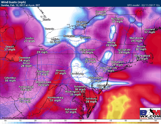
Winds will also crank late Sunday night into Monday. Here’s the latest wind forecast from the GFS, highlighting wind gusts past 50 mph along the coastline with winds past 40 mph even across all of PA. This will lead to scattered power outages and downed trees.
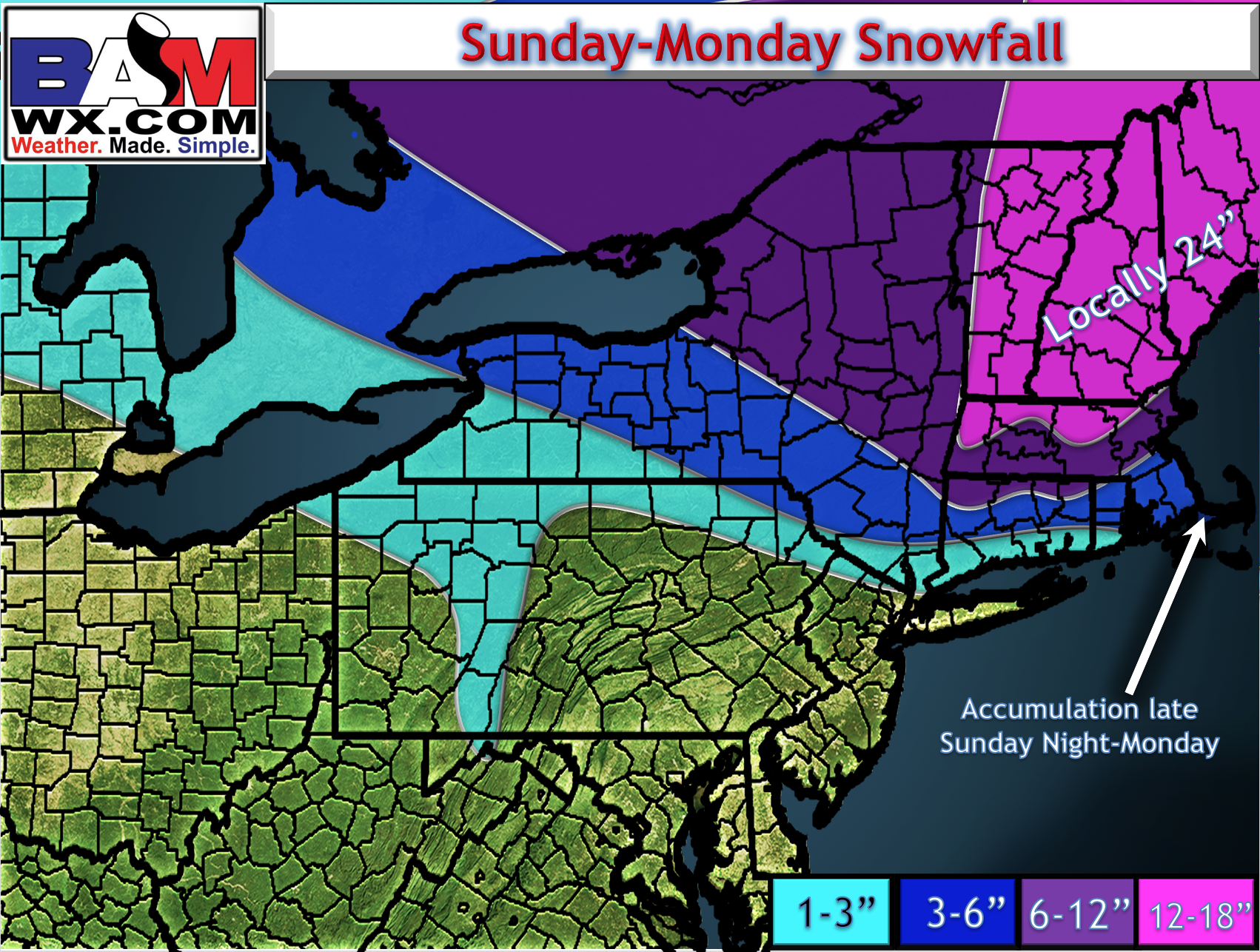
As far as total snowfall, it’s a tough forecast along the immediate coast where a change over will occur some time late Sunday morning or early Sunday afternoon. This makes the total snowfall forecast difficult because any delay in changeover will raise amounts. However, here’s my latest update with a general 1-3″ north of NYC into coastal CT/RI, then 3-6″ in central CT, northern RI, and southeast Massachusetts where that burst will occur early Monday morning. Highest amounts will fall from northern CT northward into northern New England. Some places will likely approach 2 feet! This will be a wet snow, too, as temperatures will be close to freezing throughout the event in places where it stays all snow.
That’s all I got for now. I’ll update if anything changes this afternoon, otherwise enjoy your Saturday and enjoy this rollercoaster of a weather pattern. ~Ed