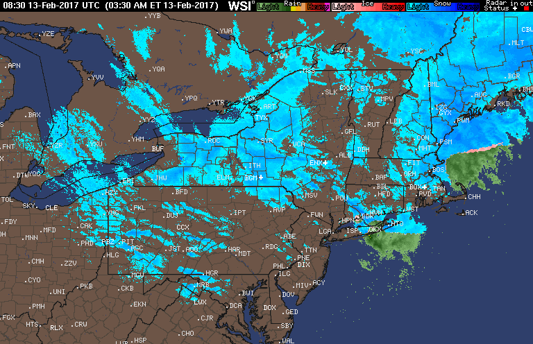
Good morning. Snow is winding down in eastern Massachusetts this morning as an area of low pressure moves away. Elsewhere, lake effect snow showers are causing some briefly slippery conditions from eastern Ohio all the way into western CT, dropping a few coatings of snow. Some places in northeastern Ohio and northwestern PA have seen a few inches of snow overnight. Here’s the radar as of 5:50 AM.
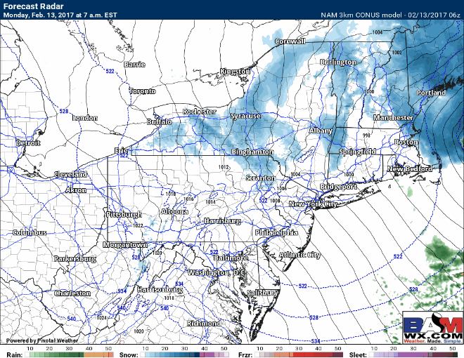
Low pressure will move away from New England through today taking the snow with it. Flow will also flip out of the southwest ending snow across Ohio and PA as well. Here’s the projected radar.
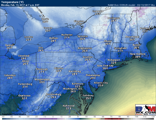
Temperatures will remain cold today behind the storm with most places only getting into the 20s and 30s. Here are temps throughout the day.
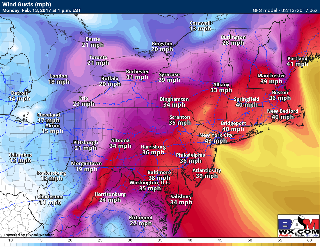
Winds will also be howling through the day, gusting past 40 mph for many! Here’s the GFS at 1 PM.
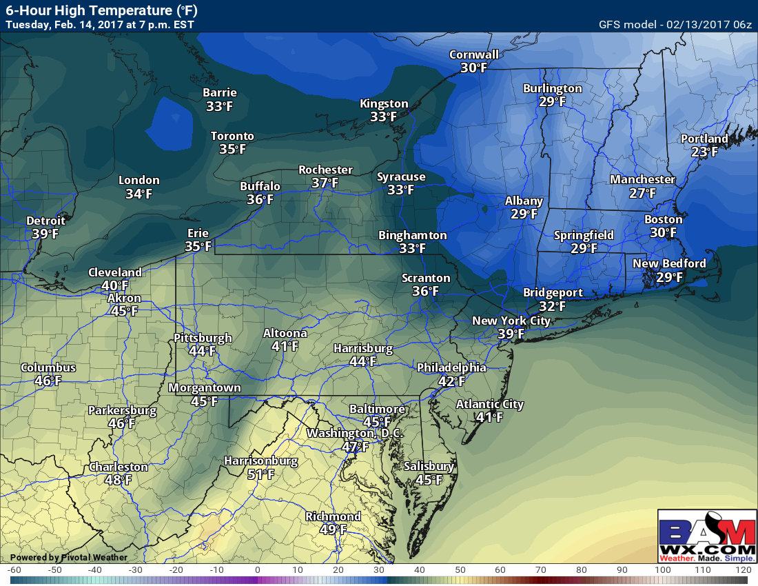
Tuesday looks like a warmer day with some sunshine for most. Temperatures look to warm significantly compared to today, getting into the 40s across Ohio, PA, and the Mid-Atlantic, and into the 30s for New England where there is significant snow pack. Here are the high temperatures from the GFS for Tuesday.
We continue to watch mid-week for a possible storm, but latest indications keep energy separate until it’s too late for a big storm in the Northeast. Here’s a look at the too pieces of energy valid Tuesday evening. Also notice the upper level ridging in the West is slanted eastward which is not a good orientation for a major winter storm.
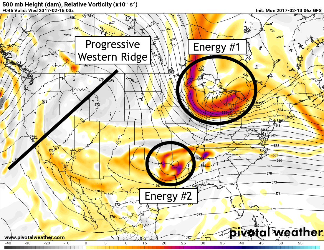
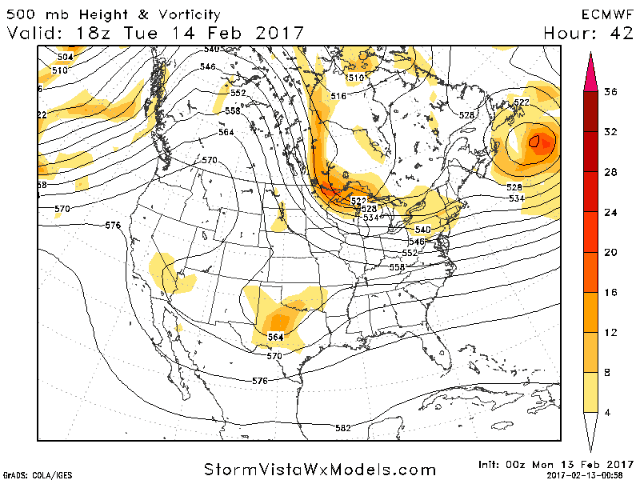
With that said, “energy #1” will still swing through the region Wednesday with some snow showers across northeastern Ohio, much of PA and northern New England. I wouldn’t close the book entirely on a storm Wednesday-Thursday quite yet, but the window of opportunity surely is shutting fast. The European is similar to the GFS, but notice how its a bit closer to a bigger storm as the energy “phases” faster. Something to watch through tomorrow.
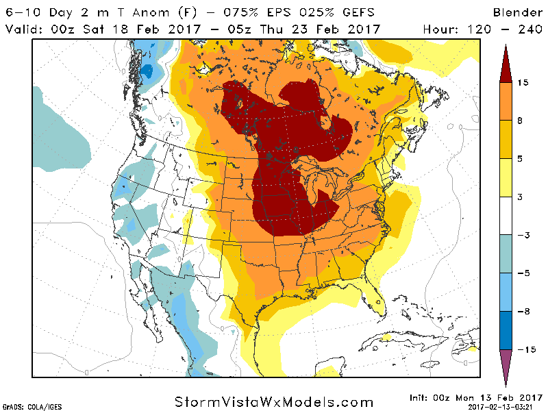
Beyond this, a warm up is expected late this week into next weekend with temperatures getting into the 60s west and 40s and 50s across New England. Here’s the latest look at the 6-10 day forecast temperature departures.
Today’s video is about 5 minutes. Have a great day! ~Ed