Good morning! We are tracking a return to winter as colder air settles into the Northeast. Along with this colder air, we have some snow showers and squalls from Ohio through Pennsylvania, the Catskills, Berkshires, and northern New England. Here’s the radar as of 6 AM.
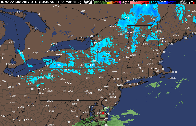
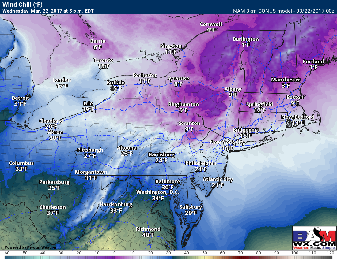
These snow showers will diminish through the morning as they head southeastward, leaving the coastal plain along I-95 dry today. The biggest story today will be the wind and the cold, combining for a very cold feel. Winds will gust up to 50 mph at times this afternoon.
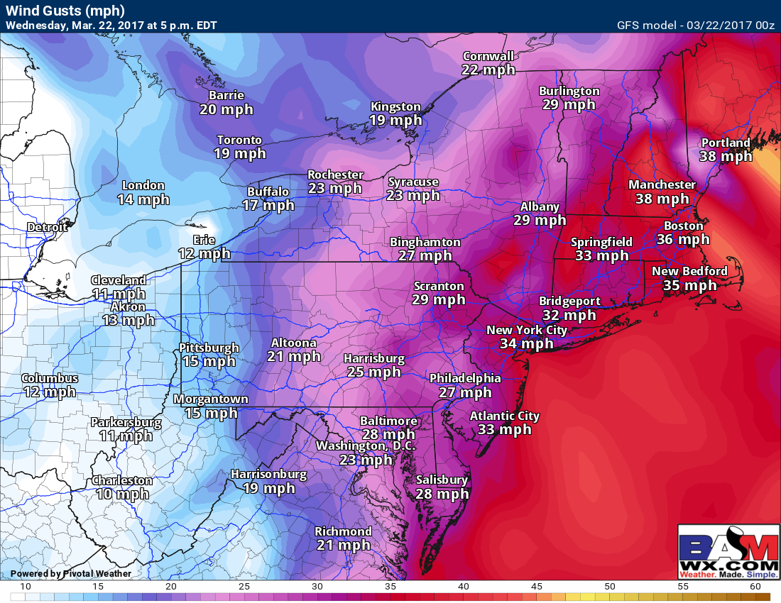
The wind combined with the cold will leading to brutal wind chills for late March – in the single digits and teens for many this afternoon!
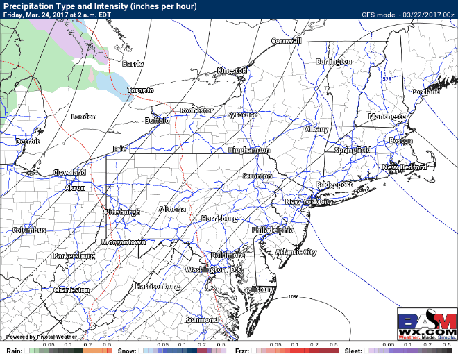
Thursday looks dry and a bit warmer with some sunshine. Our next chance for precipitation is Friday as a warm front moves through. As the precipitation moves in across PA and western New England Friday morning, it may start as some snow or a mix of precipitation before going over to all rain. It looks to be all rain for areas farther south. Here’s the latest GFS model.
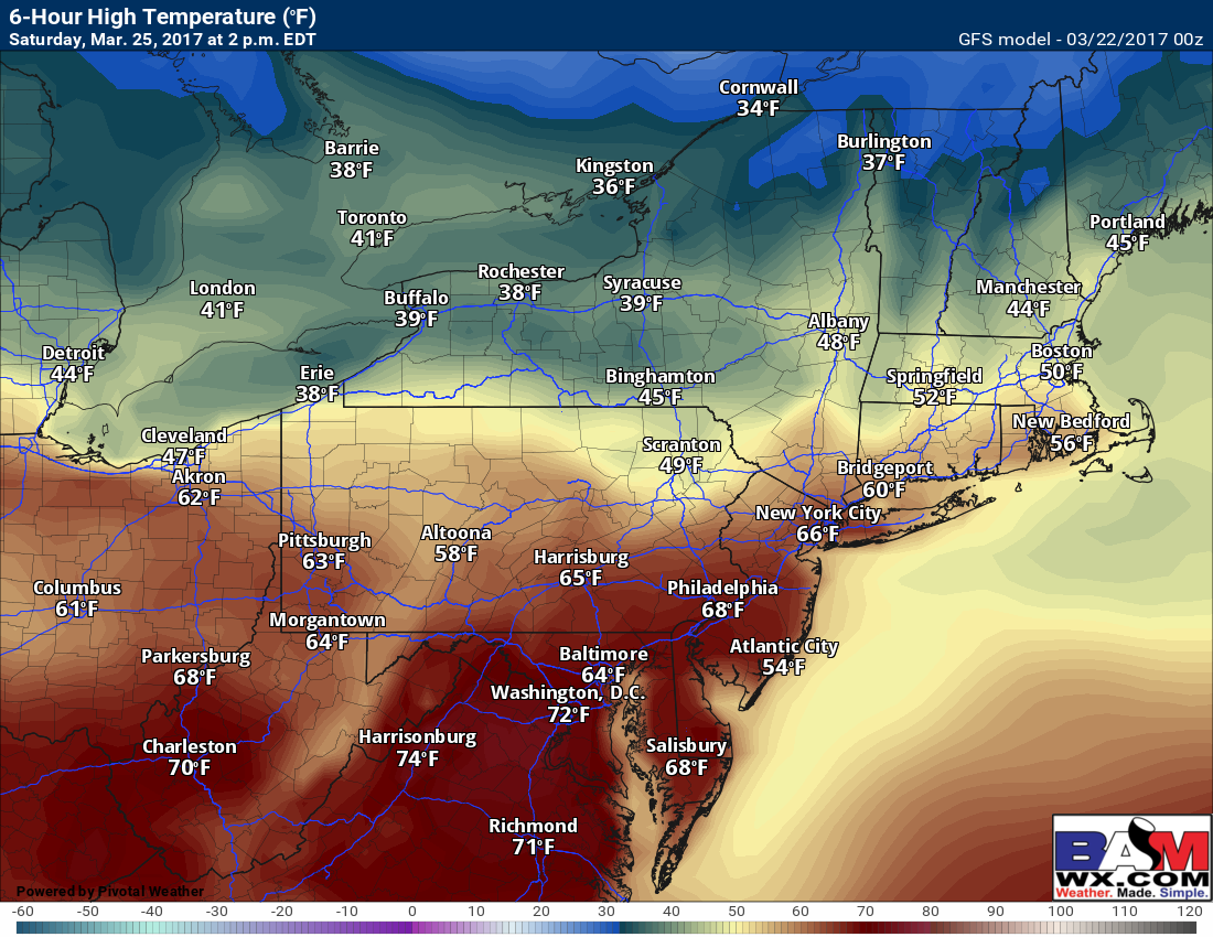
Saturday will feature a warm front draped across the region with plenty of clouds. There will likely be a wide array of temperatures across the region from north to south. Here’s the latest GFS high temperatures.
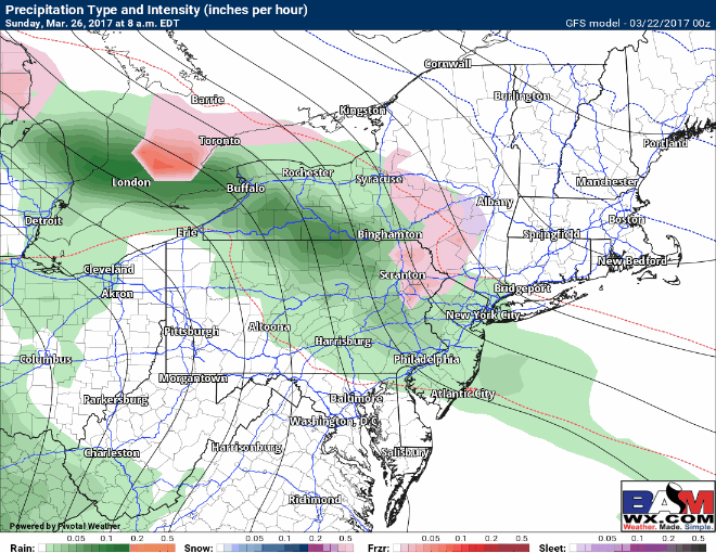
Another system will arrive Sunday into Monday. Precipitation type will be dependent on where the warm front situates itself across the region. The GFS tries to introduce some snow across the interior (especially New England). I’ll watch this in the coming days!
Confidence and Risks:
- High confidence on cold today, moderating toward the weekend.
- Moderate confidence on temperatures this week, with highest confidence on warmth south.
- Low confidence on precipitation type Sunday-Monday – stay tuned!
The video breaks it all down. ~Ed