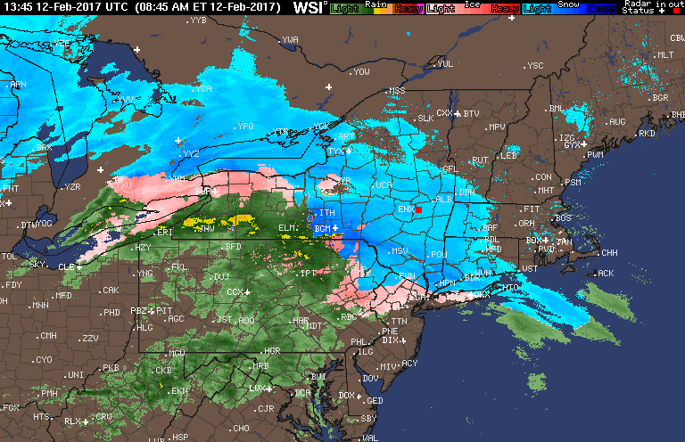
Good day. Quick update on the storm unfolding across the region currently. Latest radar shows sleet and freezing rain the main precipitation types across NYC, northern NJ and eastern PA, while snow is falling from northwestern NJ through the Hudson Valley into southern New England. Meanwhile, its plain rain in much of PA and southern and central NJ. Here’s the radar as of 11 AM.
I still expect the rain line to push slowly northward this afternoon as some warmer air pushes in from the south, but the process will be slow. Here’s the projected radar through the afternoon and evening. Notice north of I-84 in CT and NY will remain snow through this evening. The snow will be dense as temperatures approach freezing later on.

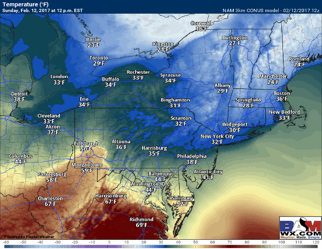
Temperatures will slowly rise this afternoon as southeast flow warms the low levels of the atmosphere. Here’s a look at temperatures through the storm. Notice many even in the interior get close to freezing this evening.
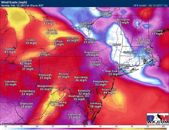
Winds will also strengthen overnight, gusting to 50 mph inland and past 60 mph at the coastline! This may cause localized power outages and downed trees.
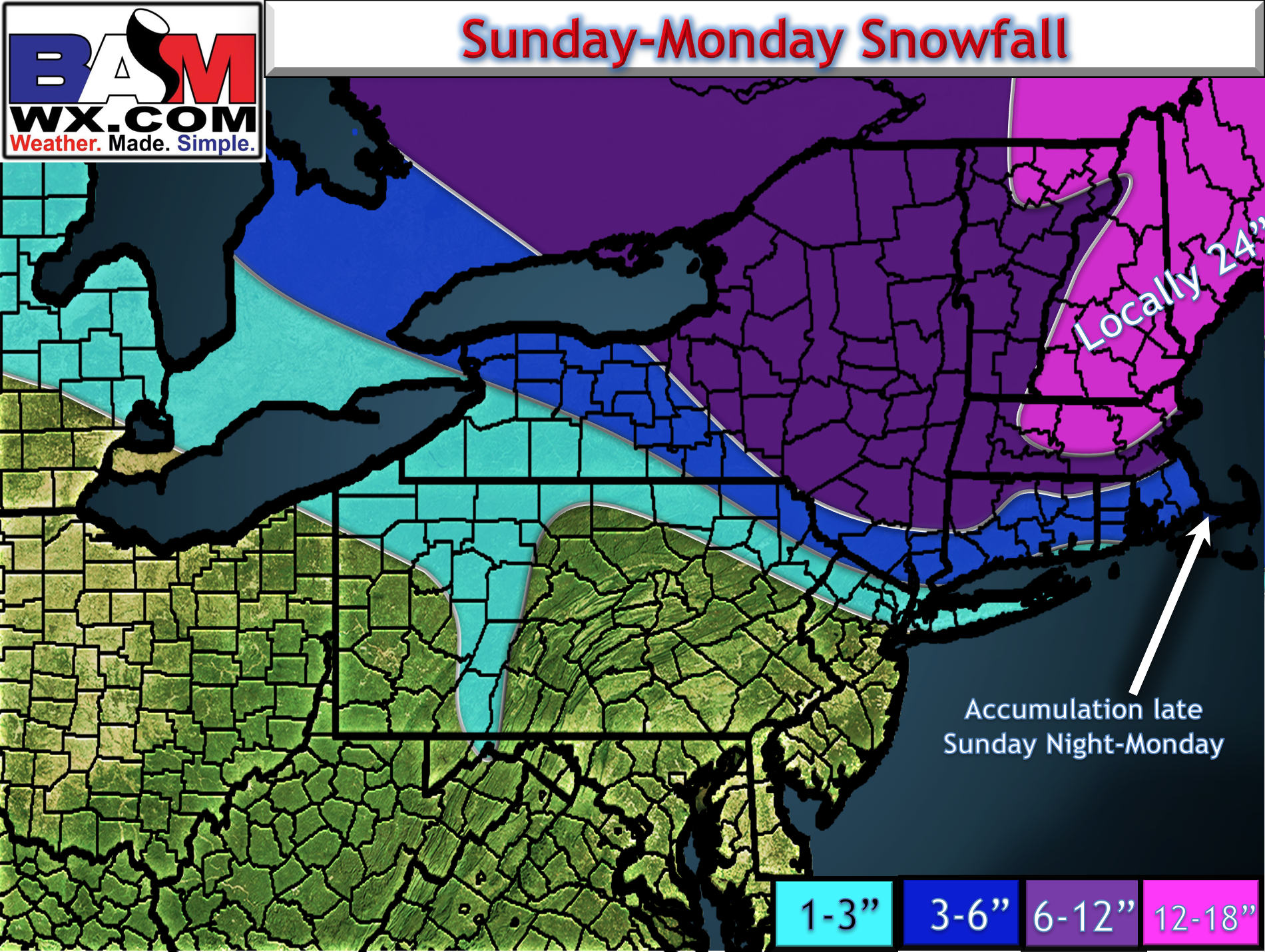
Here’s an updated snow map based on latest information. Not many changes overall. I did take out 12+” in western MA and Albany, but most of those areas probably see close to a foot. The backlash snow will be the snowfall accumulation in southeast Mass late tonight into tomorrow morning.
The video breaks it all down. Have a great Sunday. ~Ed