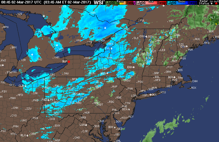
Good morning. We are tracking colder air filtering into the Northeast this morning and with the colder air are a few snow showers acrossNew York, Ohio and northern PA. Here’s the current radar as of 5:50 AM.
The big story through today will be the winds, gusting up to 60 mph through the afternoon! Here’s projected wind gusts.

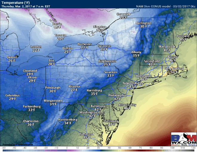
Even with brief high pressure around the region today, temperatures will only get into the 30s across the interior, and low 40s at the coast…much closer to normal for early March! Temperatures likely are at their highs right now in coastal areas and will fall throughout the day.
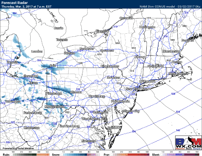
Our next weather maker will be a fast moving storm moving through the Ohio Valley into the Mid-Atlantic late tonight into early Friday. It will be cold enough for snow (even after the incredible severe weather we had the other day!) but it will not amount to much outside of western PA and eastern Ohio where an inch or two can fall. Steep lapse rates (change in temperature with height) will promote snow squalls through the day Friday across the interior, accumulating a quick coating to half inch in some spots. Here’s a look at the forecast radar tonight through early Friday.
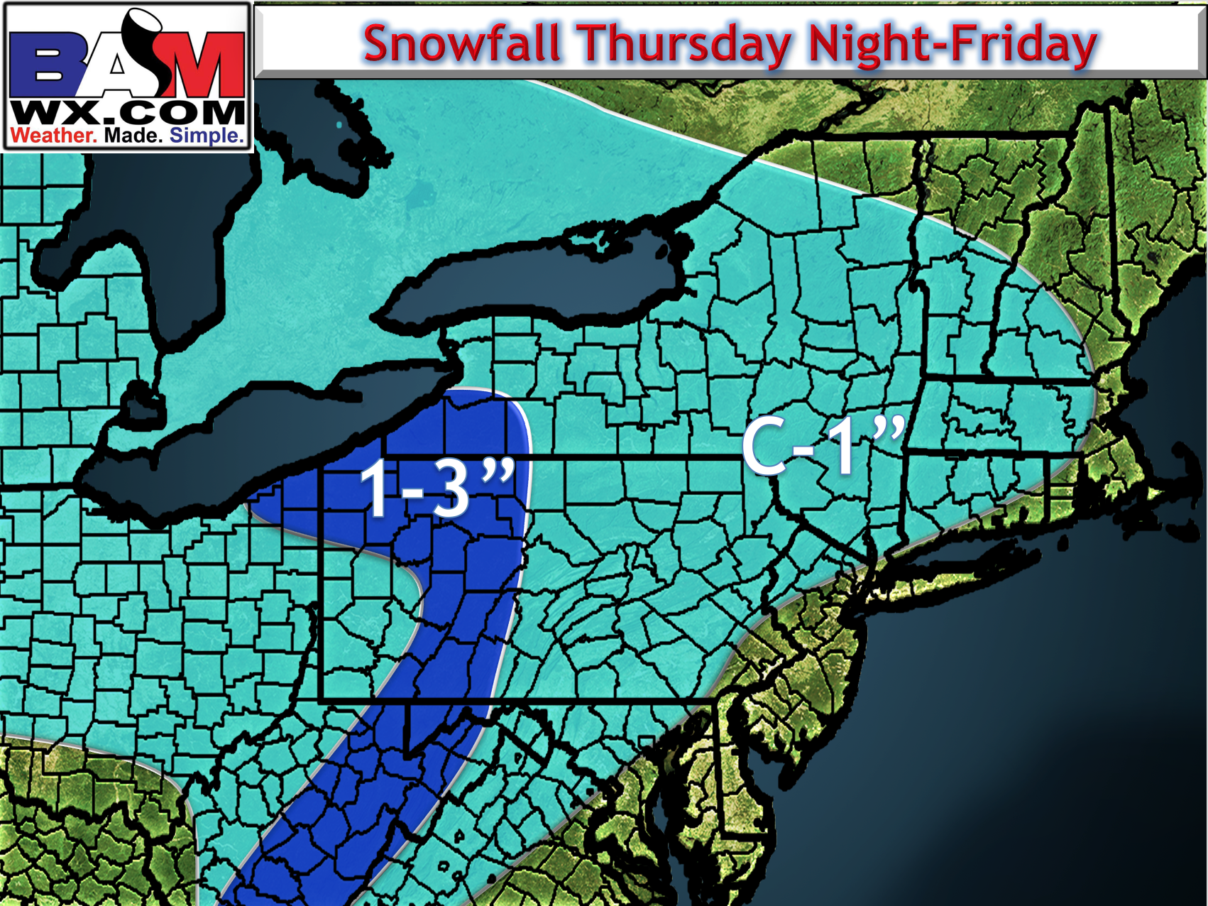
Here’s a look at the expected snowfall forecast. Not much, but enough to make things slippery where it does snow!
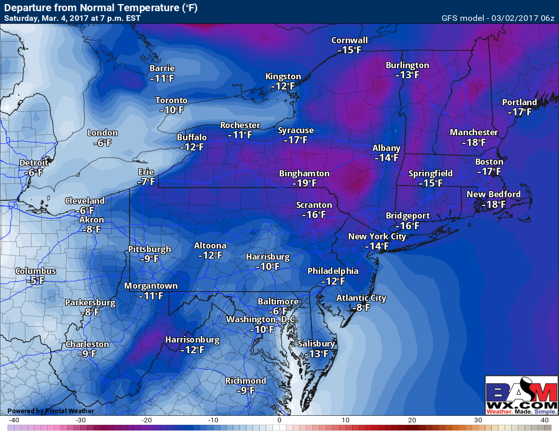
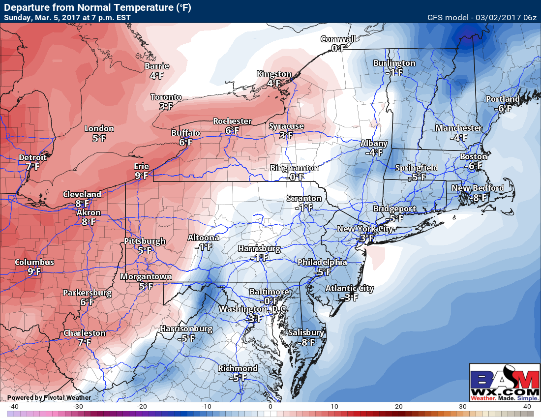
The weekend looks mainly dry, but MUCH colder than past weeks especially the farther east you go. Here’s a look at temperature departures from normal for Saturday and Sunday. Note the average highs this time of year range from 40-45°F across the region.
A storm system will move through the Plains early next week spreading warmer temperatures into the Northeast. This may also comes with some showers Tuesday or Wednesday.
Confidence and Risks:
- High confidence in cold conditions through the weekend region wide.
- Moderate confidence on snowfall through Frida This is a quick moving system and the track of it is a bit uncertain still.
- Moderate to high confidence in warmer temperatures returning early next week ahead of another storm system.
Today’s video is 5 minutes. Have a great day!