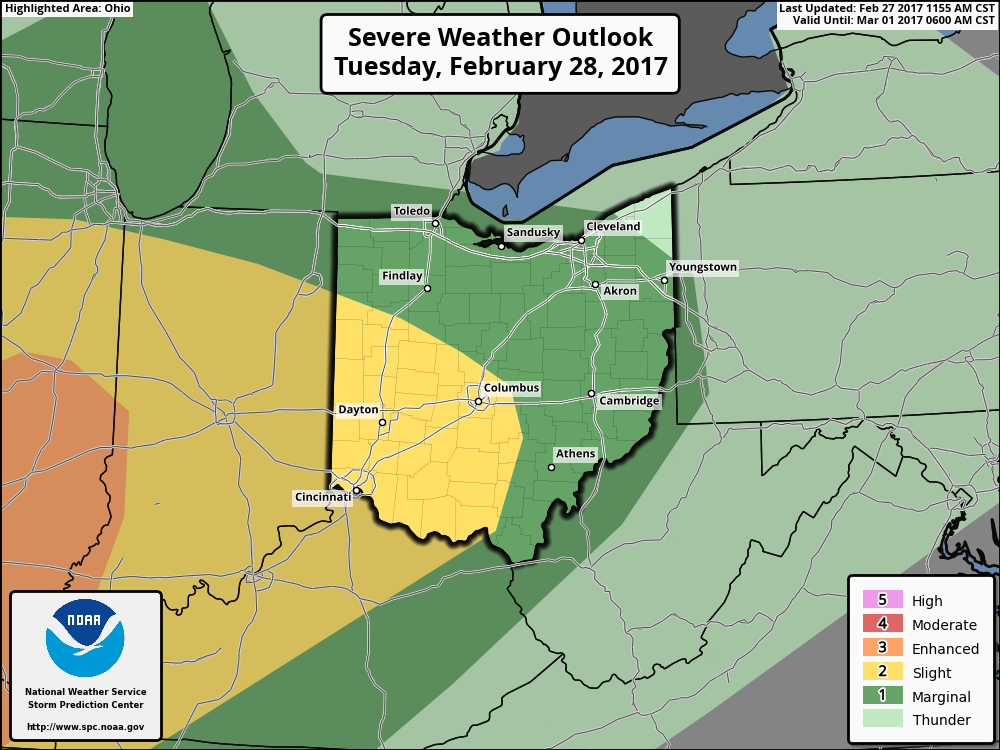
Good afternoon! We continue to monitor a strong warm front that will move through the region Tuesday. This will spark some severe weather Tuesday afternoon and evening across Ohio. Here’s the updated SPC outlook for Tuesday.
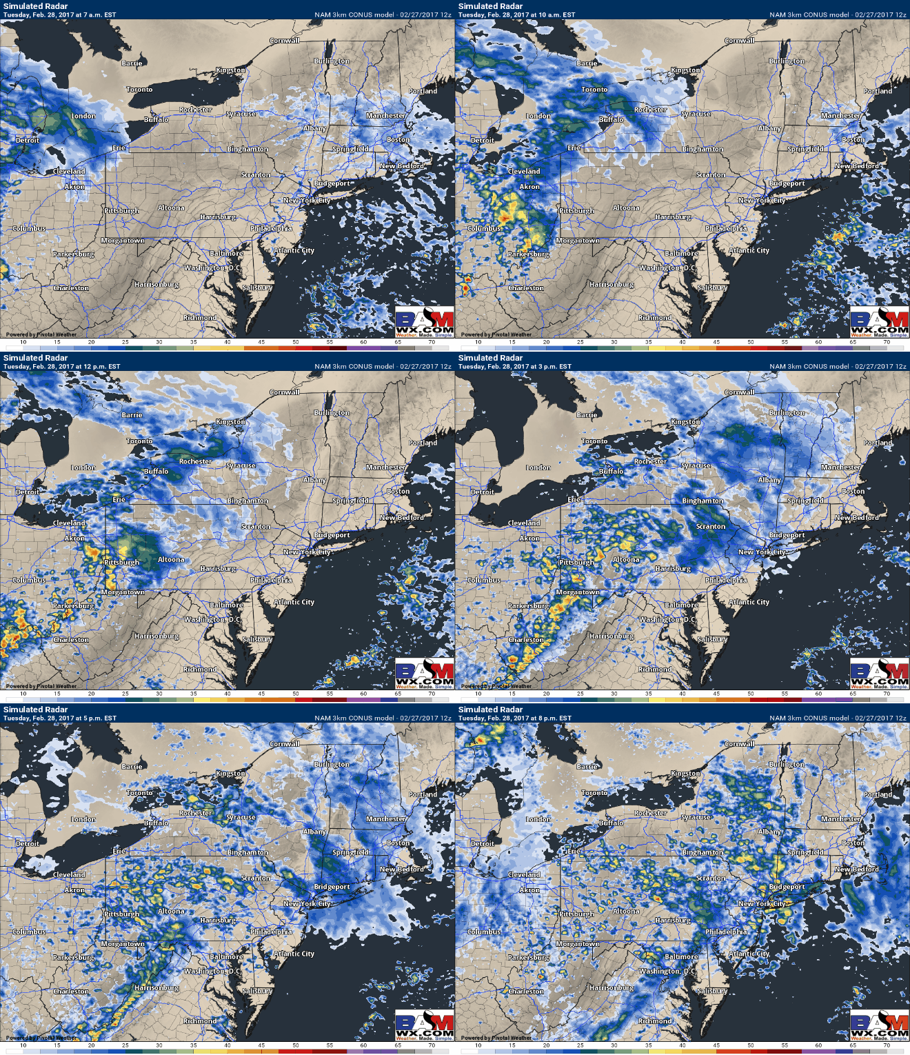
Here’s an updated forecast radar Tuesday. Storms will be strongest across Ohio where there will be more instability and moisture available. Elsewhere further east some showers and embedded rumbles of thunder are expected.
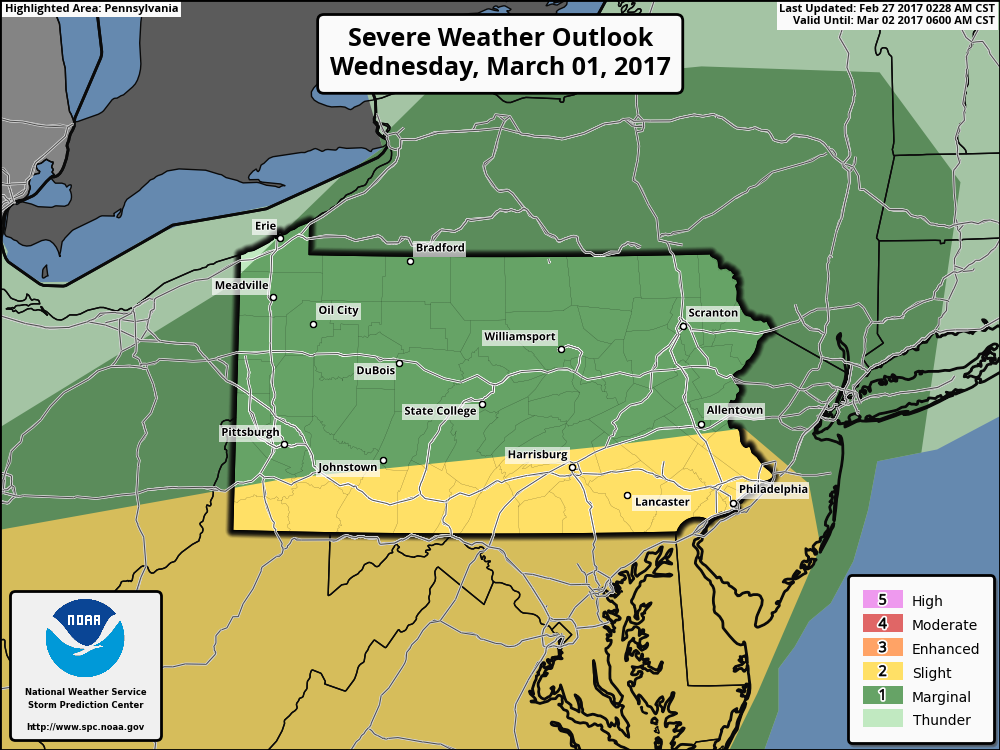
Here is the SPC day 3 outlook from this morning. Given the strong forcing and moisture available I’d expect to see this shifted into western southern New England on the next issuance.
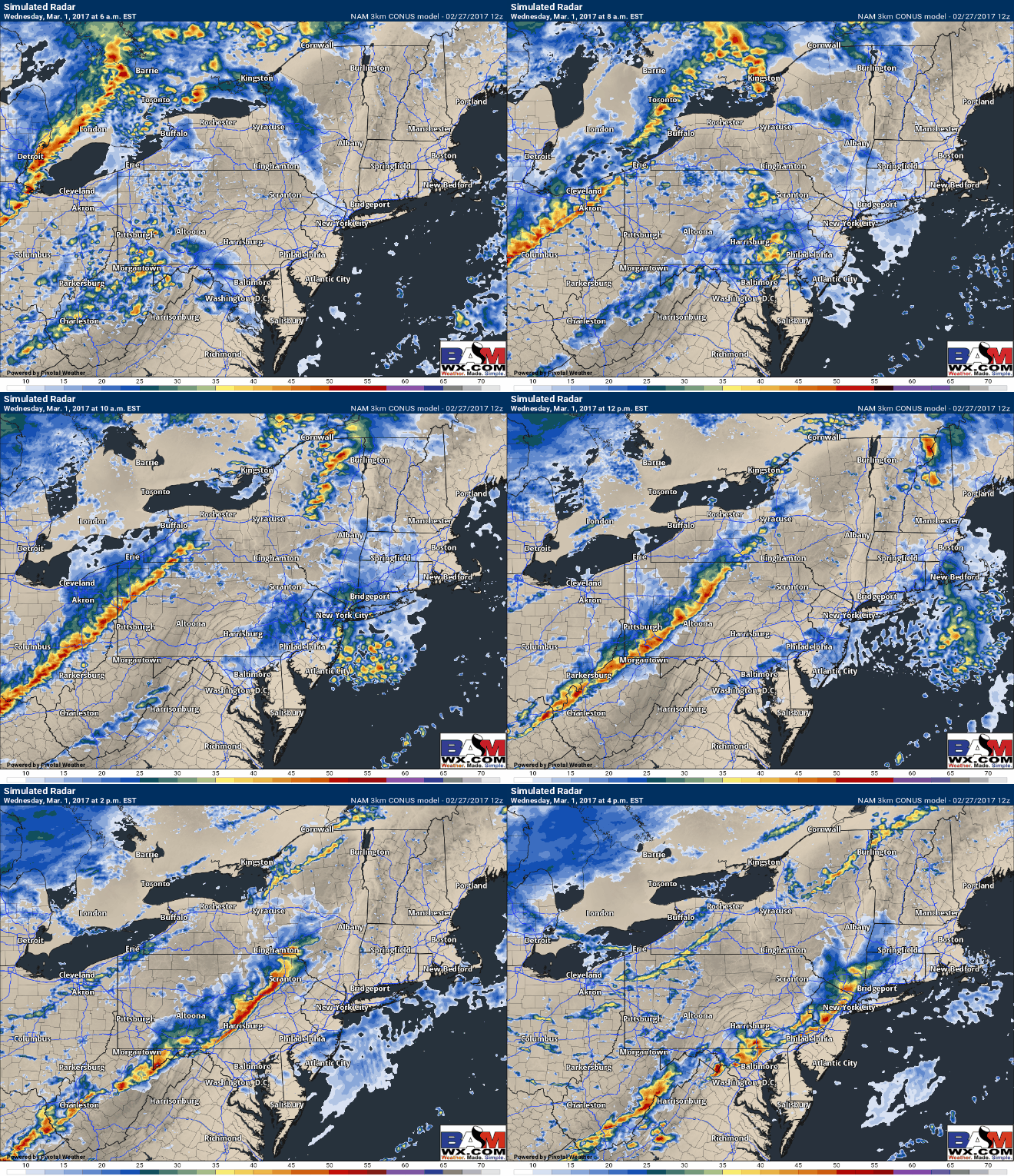
Here’s the latest 3KM NAM, supporting a further northeast risk into E PA, the Hudson Valley, and western southern New England Wednesday afternoon and evening before weakening across coastal areas similarly to Saturday’s event.
I’ll have a full update tomorrow morning by 7 AM complete with an extensive video packed with info. Check back! Have a great evening. ~Ed


