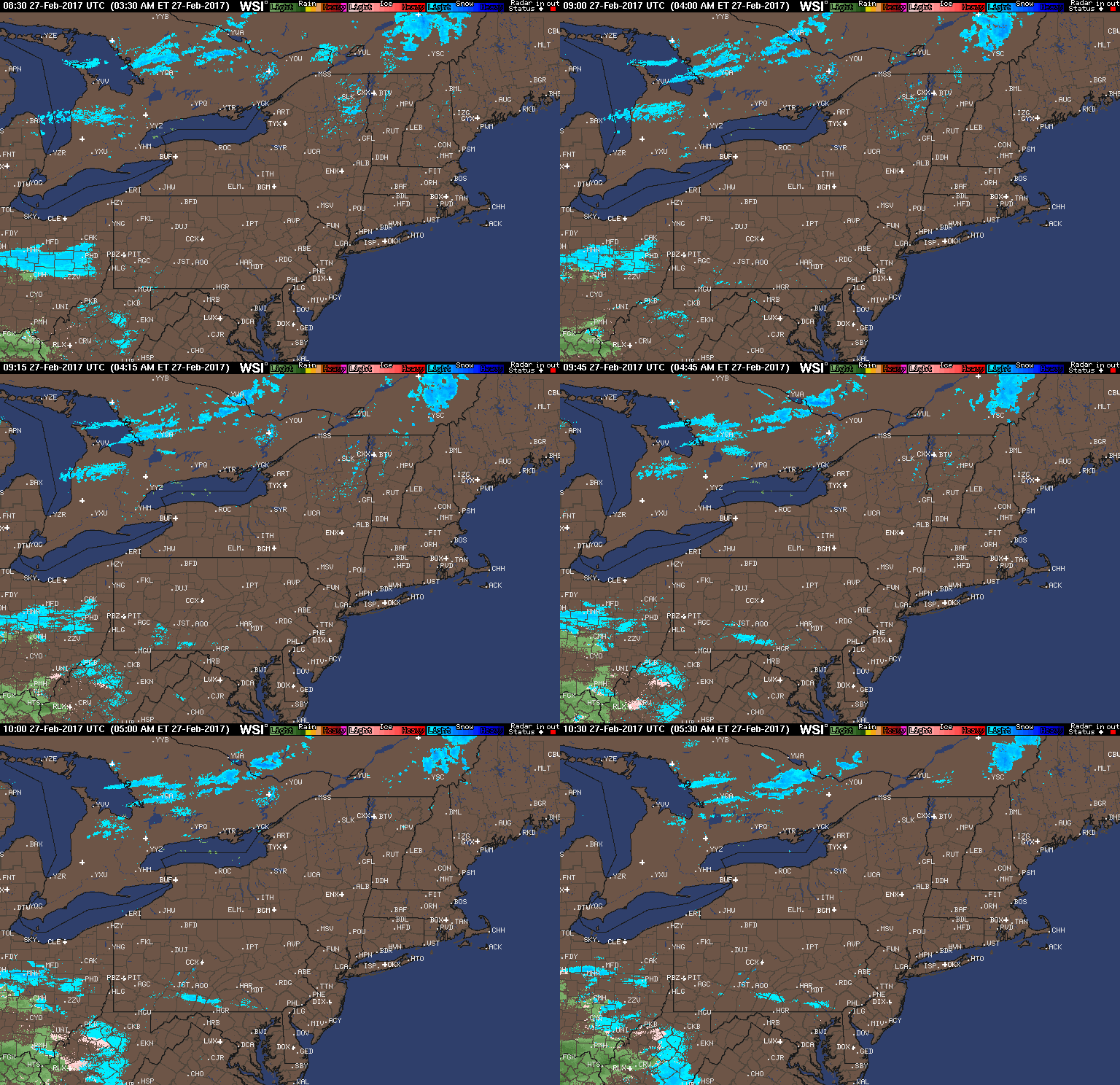
Good morning. Much of the region is quiet this morning. Some light rain and snow showers are falling across Ohio this morning with temperatures mainly above freezing so no accumulations are expected. Here’s the radar as of 5:30 AM.
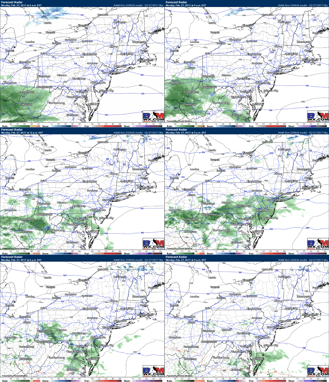
Those will move east as light rain showers through southern PA and southern NJ this afternoon. Temperatures will get into the 40s region wide. Here’s a look at the radar through this evening.
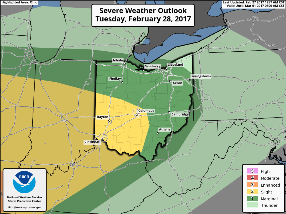
Another strong storm system will move into the Midwest Tuesday spreading a warm front and more warmth into the region. This will increase the risk for thunderstorms Tuesday afternoon, especially west. Here’s the latest SPC outlook – notice a severe weather is definitely a possibility across Ohio, tapering off east where it will be cooler.
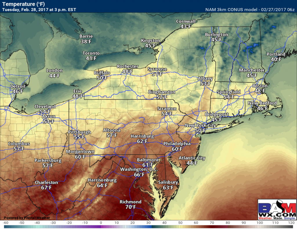
Temperatures Tuesday will soar into the 60s across Ohio and southern PA, and into the 50s across eastern areas. While much cooler than this weekend, this is still 10-20 degrees above normal!
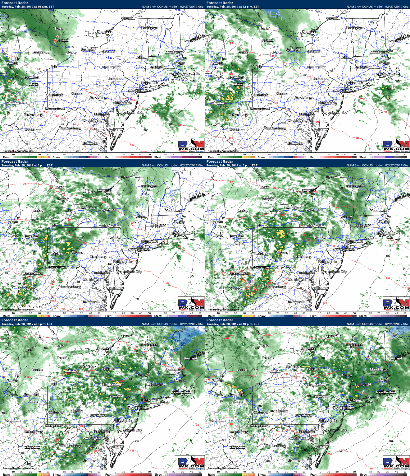
Here’s a look at the projected radar Tuesday. Notice the showers and thunderstorms along the warm front, some of which can contain damaging winds, large hail, and even a tornado across Ohio. Further east, heavy showers with embedded rumbles of thunder are possible all the way into southern New England.
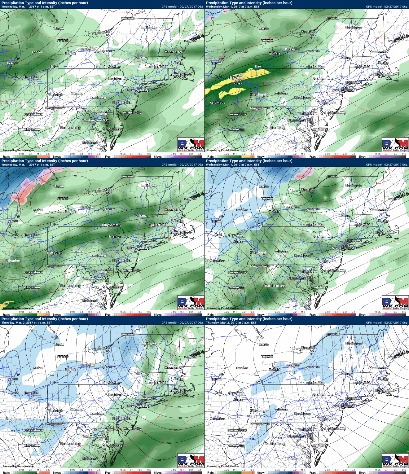
As the storm system moves through Wednesday, severe weather capable of producing damaging winds will be a good bet in southern areas where instability and temperatures are higher. Elsewhere rain and and thunderstorms will persist Wednesday as a cold front approaches. Here’s the GFS radar for Wednesday.
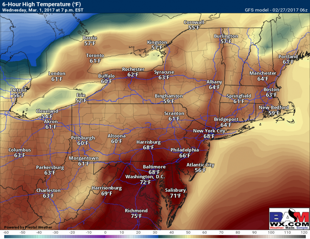
In southern areas, temperatures will likely approach 70 ahead of the front. Further north temperatures should get into the 60s before falling behind the front. Here are expected high temperatures Wednesday.
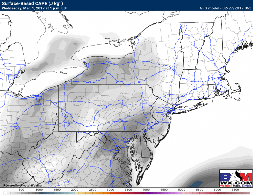
In combination with the warm temperatures, some instability will be present, supporting the formation of thunderstorms. Here’s projected instability Wednesday. While incredibly impressive compared to Saturday’s event, the trigger (a strong cold front) will be plenty to ignite some strong to severe storms.
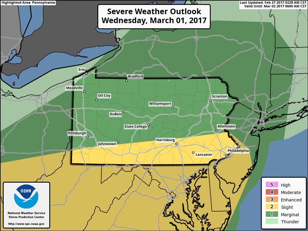
The SPC day 3 outlook highlights the thunderstorm threat across southern areas.
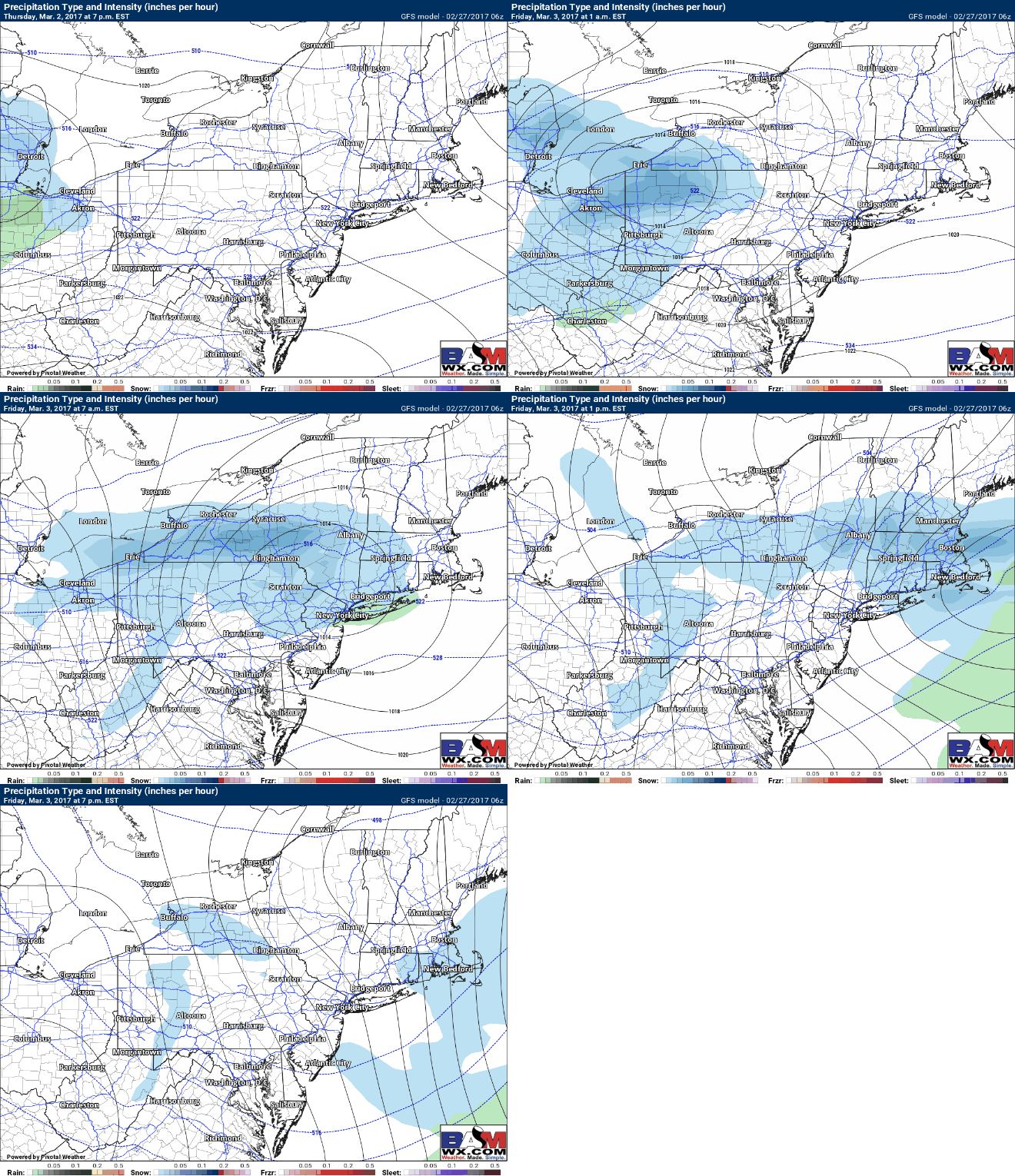
Behind the front, Thursday is much colder in the 30s and 40s with clouds and some sun. Thursday night into Friday may feature some light snow mainly north of I-80 as a quick moving system moves through. Here’s a look at the GFS future radar.
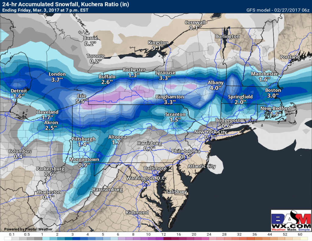
Some snow may accumulate especially across the interior with this system. Here is an *idea* of what the GFS is showing for accumulations. This is 5 days out so take this with a grain of salt and know things remain uncertain.
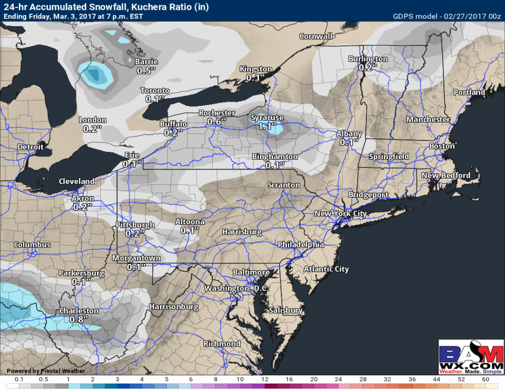
The Canadian shows much LESS snow, so note there is significant uncertainty here.
I’ll have more on this this week!
Confidence and Risks:
- High confidence in warmth coming back into the region today through Wednesday ahead of a cold front.
- Moderate to high confidence in thunderstorms, some severe, Tuesday.
- Moderate confidence on the severe threat for Wednesday south ahead of a cold front.
- High confidence on colder conditions to end the week.
- Low confidence on snow occurrence and accumulations Friday. Track and intensity remain very uncertain.
Today’s video (7 minutes) explains it all! ~Ed
