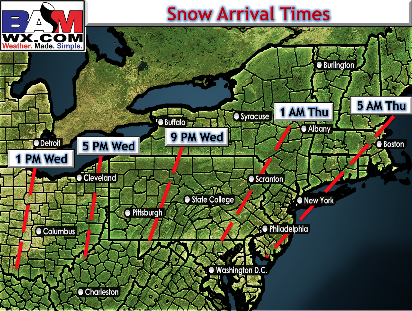
Good evening. Quick update here regarding the snow event expected Wednesday night Thursday. Not much has changed since last update, which is good for forecaster confidence. I expect snow to overspread the Northeast from west to east Wednesday evening across Ohio and Pennsylvania, then overnight across the Mid-Atlantic and southern New England. As a rough guide, here’s my first attempt at start times of snowfall across the region. Note these will be fine tuned through the day tomorrow as new data comes in.
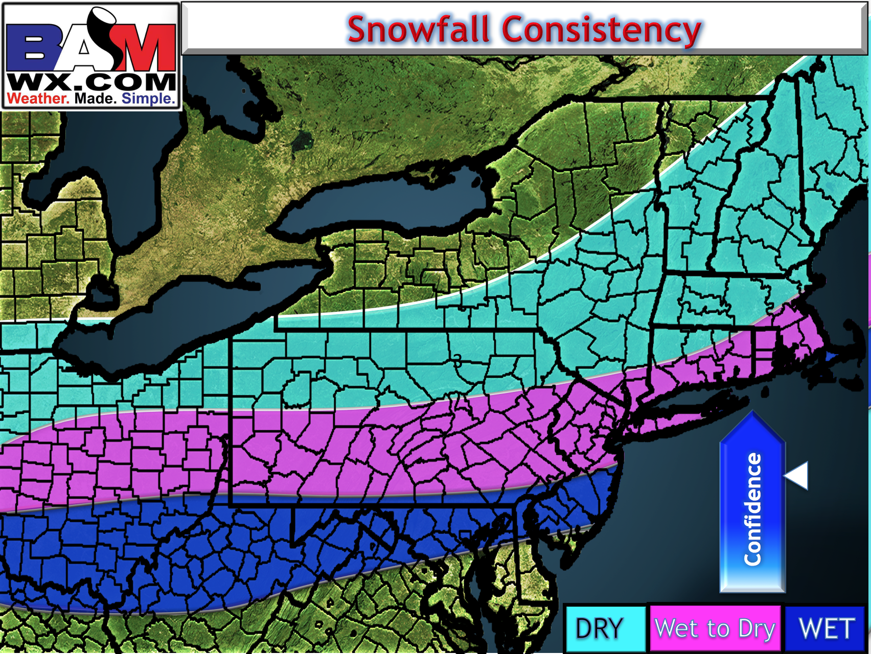
With respect to snowfall consistency for snow removal purposes, snow will start wet early Thursday morning across much of the region as temperatures start close to freezing before falling throughout the storm Thursday morning and into the afternoon. Across southeast MA, southern RI, Long Island, and southern NJ, snow will be heavy and wet throughout the event. Here’s a visual representation.
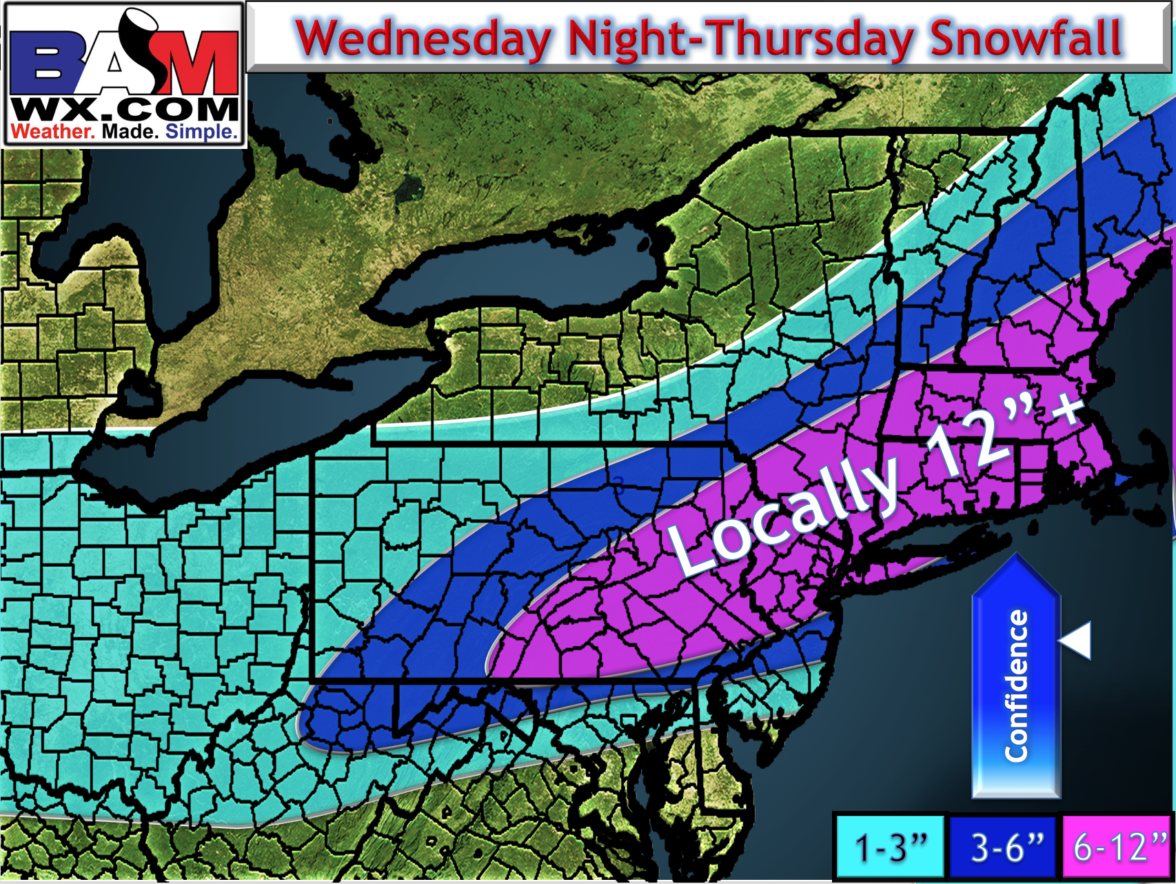
Our snowfall map remains unchanged this evening. I will have a full update published complete with updated graphics, model data, and a video tomorrow morning. Clients with on call options, feel free to reach out with any questions. Have a great night! ~Ed