***Hope you’re having a great week! As a reminder, you will receive all of our products via email, just make sure you’re looking at the right forecast locally; remember, the advantage of having a team of meteorologists at your fingertips can be priceless. With our service you will have access to our team of meteorologists 24/7. Also, make sure to watch the videos in their entirety to get a true sense of the information we provide and how it can be of value to you.
At anytime this week you feel like you have seen enough to make a decision and you’re ready to sign up we will offer you a 20% off discount if you sign up BEFORE your trial expires August 11th. Please do not hesitate to reach out to us at anytime if you have any questions. Have a blessed week! -BAM staff.***
Good Thursday afternoon! In today’s short-term video we take a look at the latest data regarding storm chances this afternoon along with where we target the threat for a few severe storms. Storm risks continue through the day on Friday, aided by a cold front moving through the Ohio Valley. Be sure to watch the video below for all the details, including the latest thoughts on the weekend. Have a great afternoon, and let us know if you have any questions!
Short-term video (8 min):
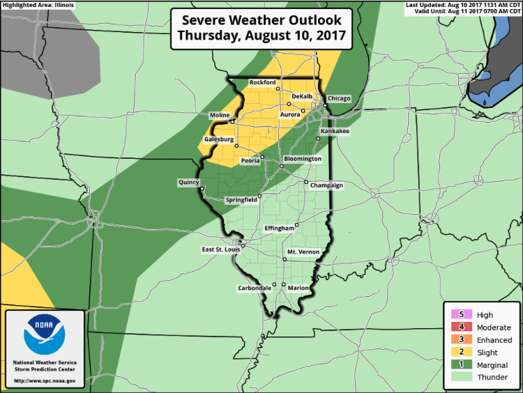
The Storm Prediction Center has upgraded portions of northwest Illinois to a slight risk for severe storms heading into this evening. Damaging wind/hail will be the main threats, but cannot rule out an isolated tornado.
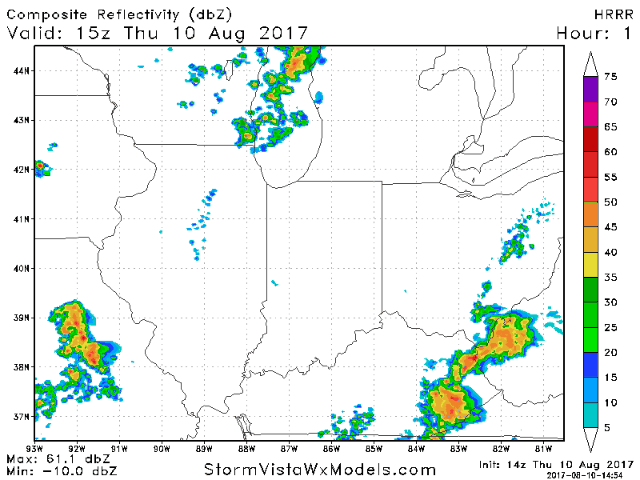
As we head through the afternoon, additional scattered storms are expected across southeast Kentucky into southeast Ohio, and the main area we will be watching is for storms to develop across northwest Illinois by late afternoon through the evening hours along a cold front.
Additional scattered storms are expected on Friday, this time targeting roughly the southeast half of the area as the cold front continues to move south and east. The main time-frame for storms will come during the afternoon and evening with daytime heating.
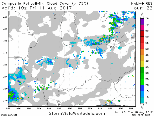
Drier air works in behind the front northwest to southeast Friday night with dry weather expected to build in on Saturday.
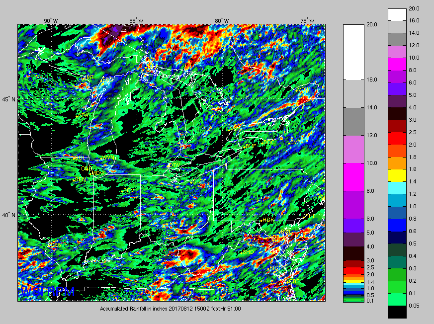
Here is a look at rainfall potential over the next 51 hours. Very hit and miss nature with localized heavy amounts in areas that get under these storms. Some of you won’t see any rain.