A quick note from all of us here at BAM: Thank you so much for participating in our free trial this week – we hope you gained a better insight as to what we provide on a daily basis on the huge value these forecasts would be to your operation. Through end of business today we are still running the 20% off the forecast services, we’d be happy to get you signed up and taking advantage of these on a daily basis! We strive to provide accurate weather info to everyone we serve as well as develop 1 on 1 relationships with all of our clients. Let us know if you have any questions and we would be honored to earn your business. Have a blessed weekend!
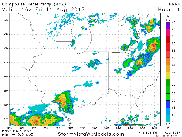
Good Friday afternoon! A cold front is slowly moving through the region today, sparking scattered showers and storms along and ahead of it. There is also a marginal threat for a few stronger storms this afternoon. The video breaks down the details regarding the timing and coverage.
Short-term video (7:53 min):
The Storm Prediction Center maintains a marginal severe risk for the southeast half of Indiana into all of Kentucky and Ohio. Isolated strong wind gusts and hail will be the main threats.
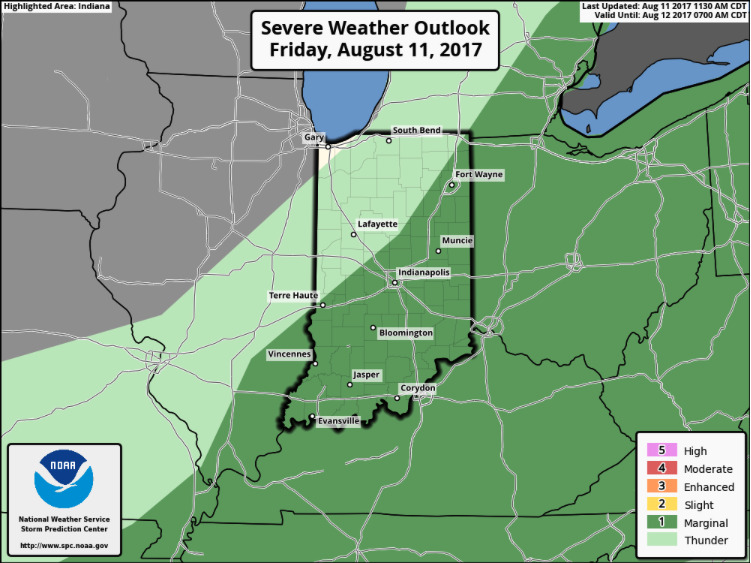
Coverage will remain focused along and south of the I-70 corridor region in IL/IN, with most of Ohio and all of Kentucky still in play for scattered storms. Watch for localized heavy rain as well where these set-up.
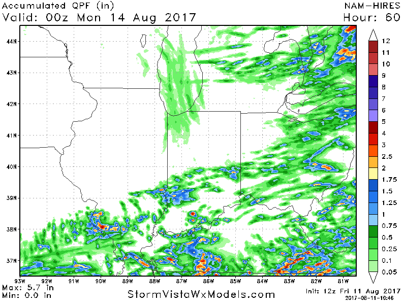
Here is the forecast rainfall….focused mainly along the I-70 corridor and points south. Localized heavier amounts are possible under any storms (1-2″+), but coverage will be hit and miss.