Key Points – Monday, September 4, 2017:
Synopsis: Good Monday morning, and happy Labor Day! The main focus today will be a strong cold front that moves through tonight, bringing a line of thunderstorms which could pack a punch. Severe storms will be possible, with damaging winds and hail the biggest threat. Still targeting a big cool-down after today, and watching the latest trends on Hurricane Irma. Detailed analysis in todays video. Have a blessed day, and let us know if you have any questions!
Today’s video (6:58):
The latest Storm Prediction Center Outlook places an enhanced severe risk across much of north-central Indiana into northwest Ohio, with a slight risk across much of Illinois, Indiana, and Ohio. Bottom-line, everyone in this area needs to be aware of some strong to severe storms working through this evening.
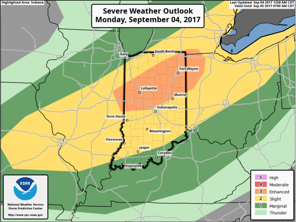
Storms look to initiate ~2-4pm across northern Illinois, northwest Indiana, and southern Michigan, then forming into a line as they work southeastward into the Ohio Valley this evening.