Key Points – Tuesday, September 5, 2017:
Synopsis: Good Tuesday morning! A cold front continues to push through the region this morning, which will usher in much cooler temperatures for the rest of the week. This front brought locally heavy rainfall overnight. Seeing a few storms along the Ohio River this morning moving southward along the front. A few lake-effect showers can be expected over the next few days, mainly in the northern/eastern half of the region. Overall, it’s a very nice forecast heading through the upcoming weekend with increasing sunshine and very pleasant temperatures. Will hurricane Irma have any impacts on the area next week? Details in today’s video. Have a blessed day, and let us know if you have any questions!
Today’s video (6 min):
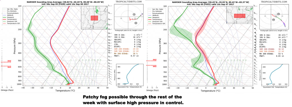
Patchy fog potential will be in the forecast for the rest of the week with surface high pressure building in, more numerous where we keep the skies clearer across western/southern portions of the area.
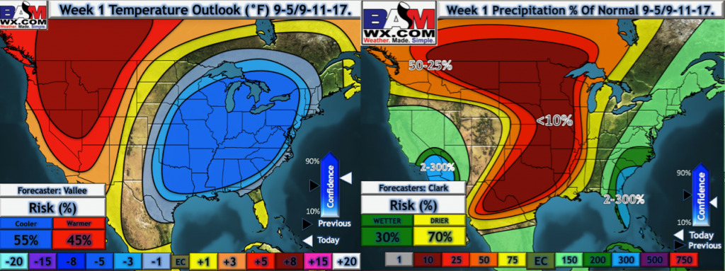
Latest week 1 temperatures and precipitation from normal.
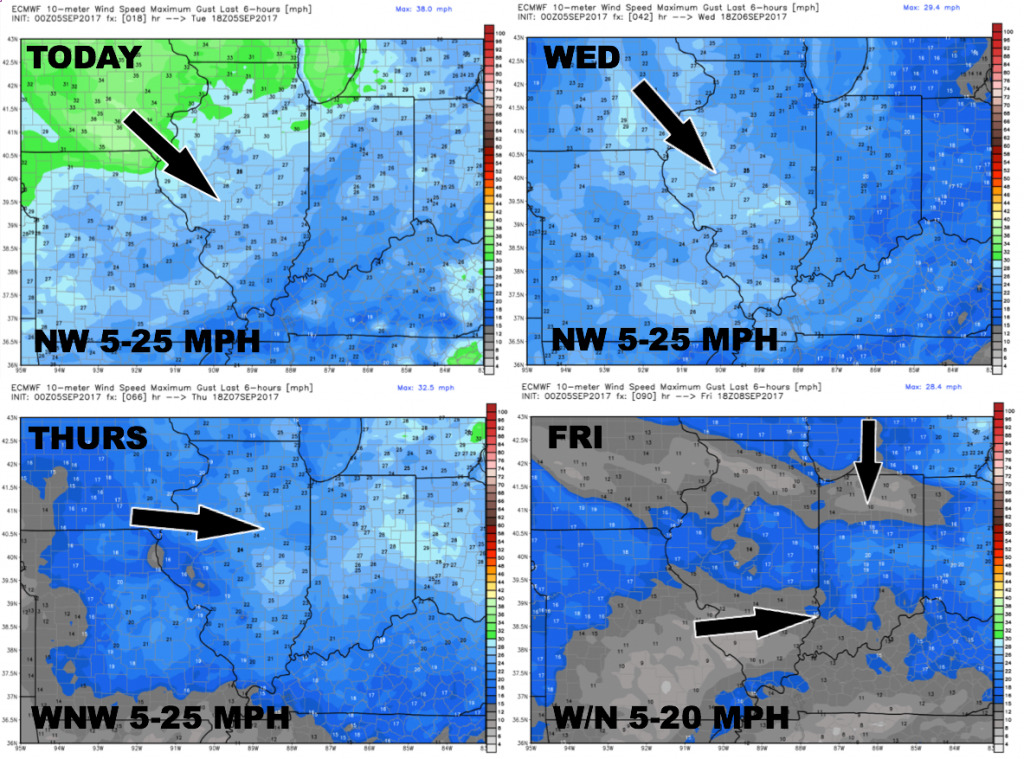
Wind forecast over the next 4 days:
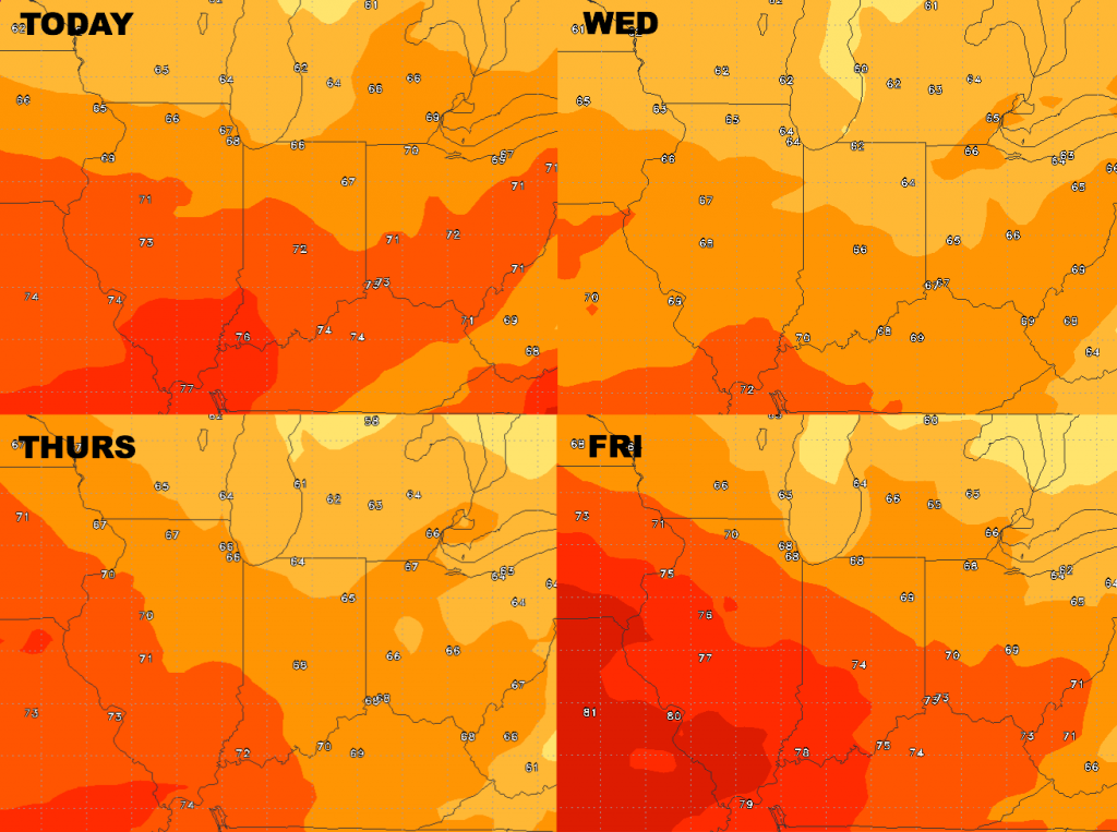
High temperature guidance over the next 4 days is shown below. Many areas in the 60s for highs Wednesday and Thursday!
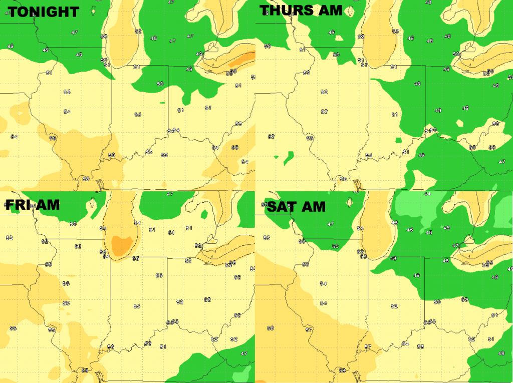
Low temperature guidance over the next 4 nights:
Dewpoints from normal…very dry, fall-like air mass through the rest of the week.
