Key Points – Wednesday, August 16, 2017:
Synopsis: Good Wednesday morning! Today we discuss the increasing chances for showers and storms moving east over the next 2 days as a warm and cold front moves into the Ohio Valley (some of these may be strong with localized heavy rainfall). We clear out for a nice day on Friday before another shot of isolated showers moves east on Saturday (mainly north of I-70 looking right now – not widespread). If you have any questions please let us know, have a blessed day!
Today’s video (7 min):
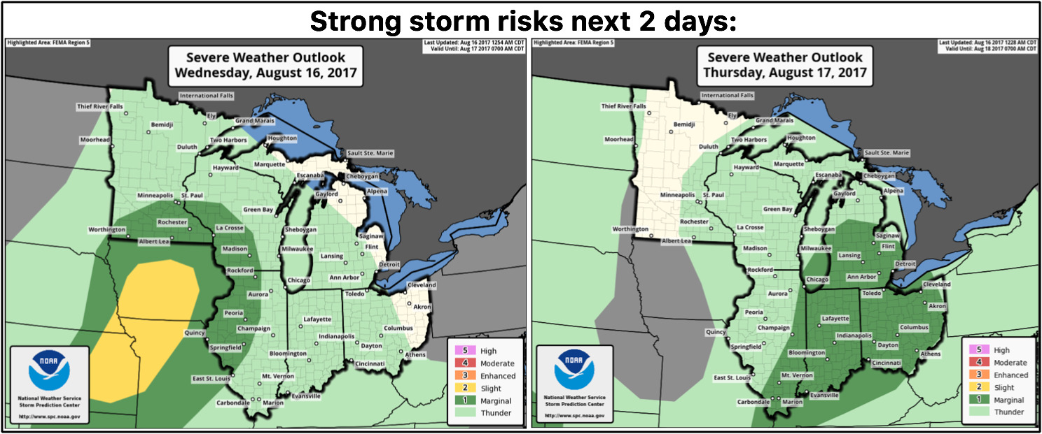
Strong storm risks over the next 2 days is below…a few gusty storms with localized heavy rainfall will be possible as the warm and cold fronts push east across the Ohio Valley into Thursday:
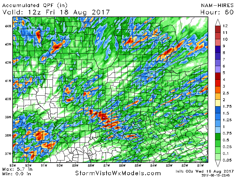
Rainfall guidance from the 0z NAM-3k shows the widely scattered nature of the storms over the next 2 days…not everyone cashes in on the much needed rains unfortunately, but those that do 0.5-1.5″ with localized higher amounts are possible with elevated atmospheric moisture conditions present.
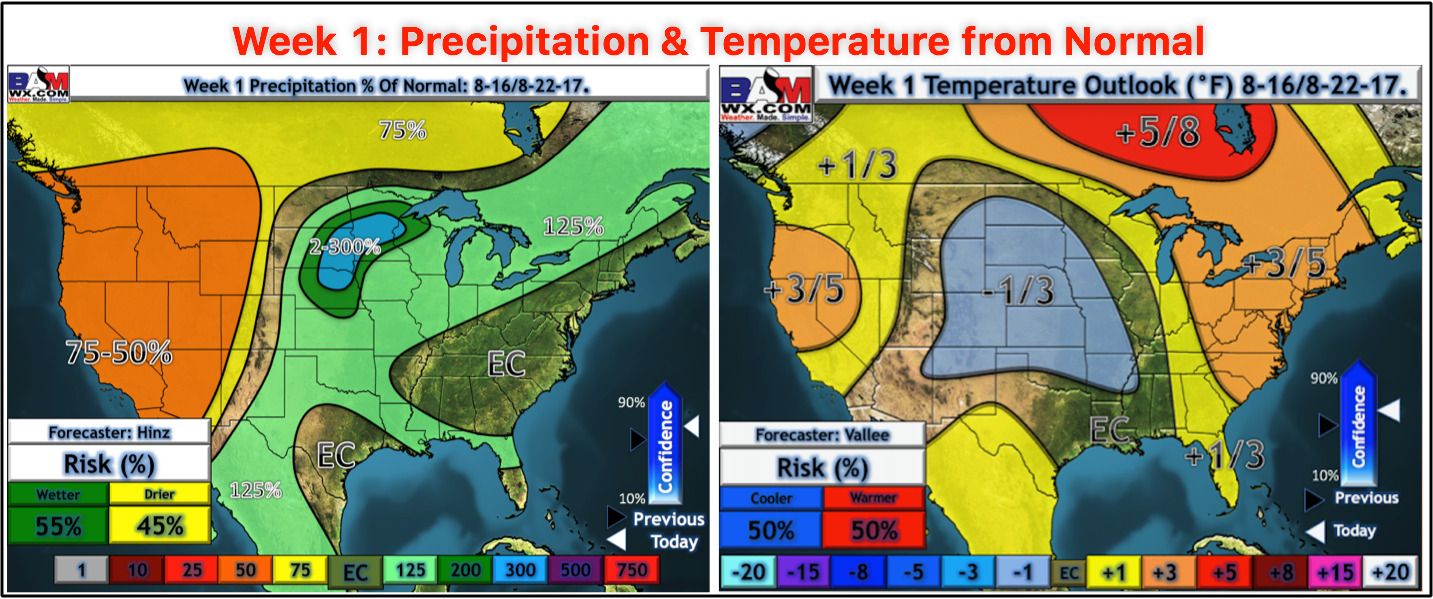
Updated week 1 precipitation and temperature outlooks are below…we’ve slightly warmed up the Ohio Valley here as we enter that more “seasonal” period in mid-August:
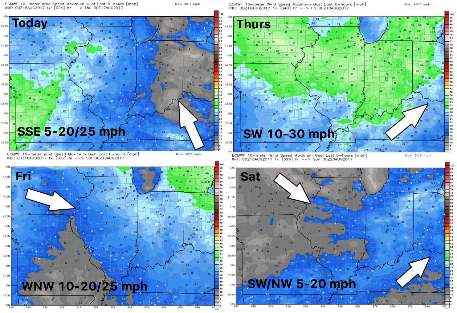
Wind forecast guidance into the weekend…get gusty on Thursday as the cold front sweeps east:
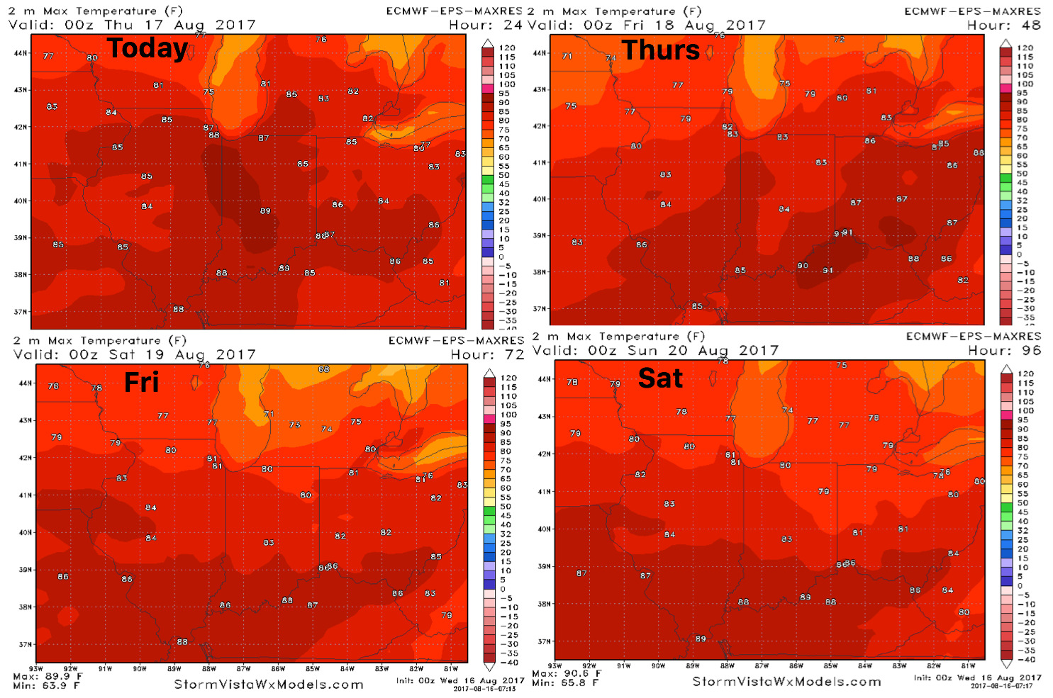
High temperature guidance over the next 4 days:
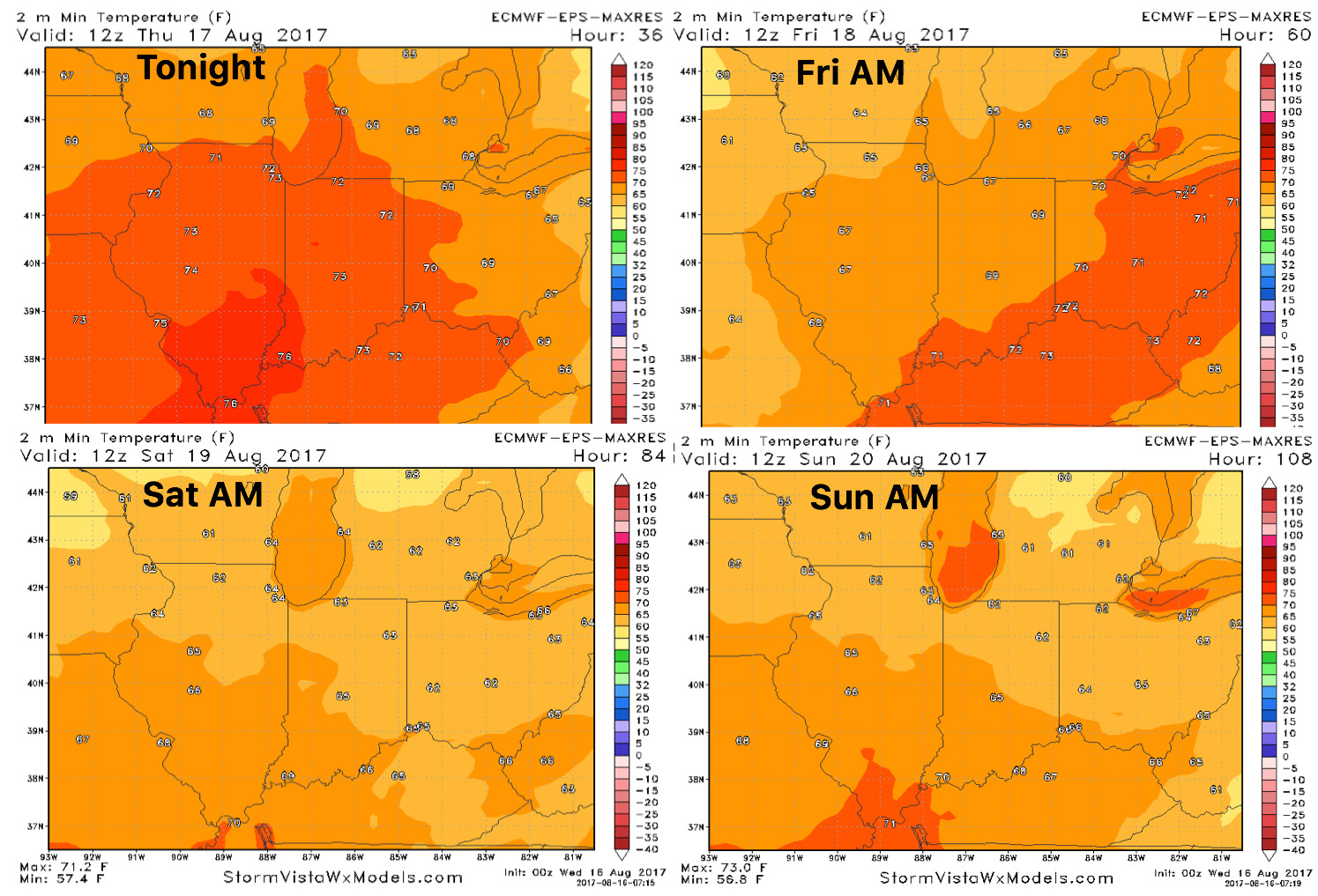
Overnight low temperature guidance over the next 4 days:
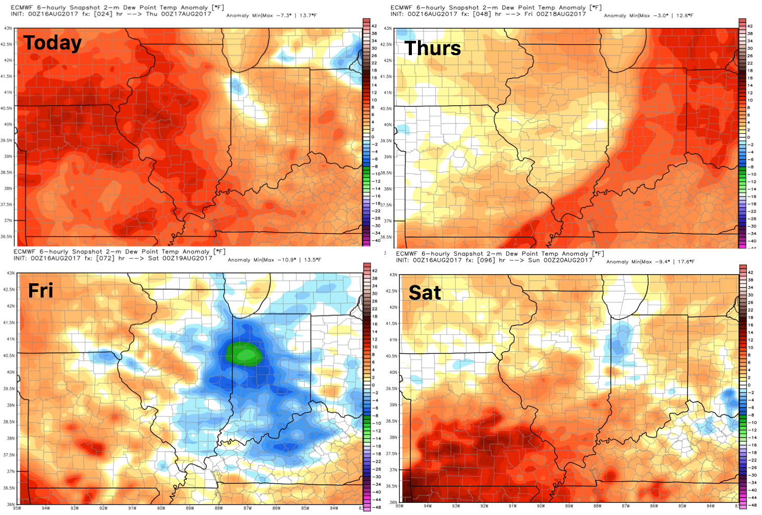
Dew points from normal show the overall more humid air spread across the Ohio Valley this week: