Key Points – Monday, September 11, 2017:
Synopsis: Good Monday morning! Clouds will gradually be on the increase from south to north today as the remains of Irma will gradually move closer to the region, and give us a good deal of clouds this week. Showers will be in the forecast for mid-week, with the best focus south of I-70. Not expecting heavy rain. We also target a warm-up coming late week and through the weekend, with a hint of summer returning! More active pattern down the road? Details in today’s video. Have a blessed day, and let us know if you have any questions!
Today’s video (5:52):
Expect another nice day today with clouds on the increase from south to north. Showers will start to creep into southern Kentucky tonight, working northward on Tuesday up to around I-70 and southward. Showers will decrease in intensity/coverage with northward progression. As the system sits overhead on Wednesday, expect additional scattered showers. Focus will shift further east across the area on Thursday.
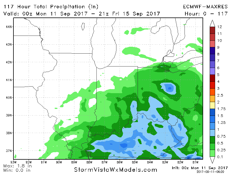
Here is the rainfall accumulation through late week. Best focus across the southeast Indiana, Ohio, and Kentucky where 0.5″-1″ of rain is possible, totals decrease rather quickly to the northwest. This will not be the solid soaking that central Indiana needs.
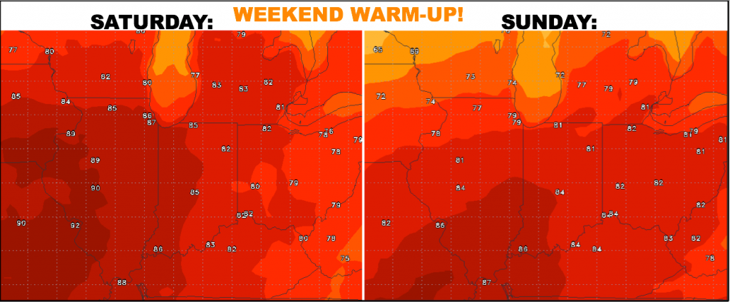
Once this system pulls out late week, temperatures will warm rather significantly this weekend! Highs soar well into the 80s, some 90º readings possible west on Saturday.
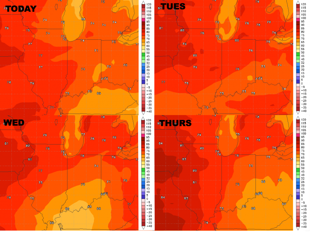
High temperatures over the next 4 days:
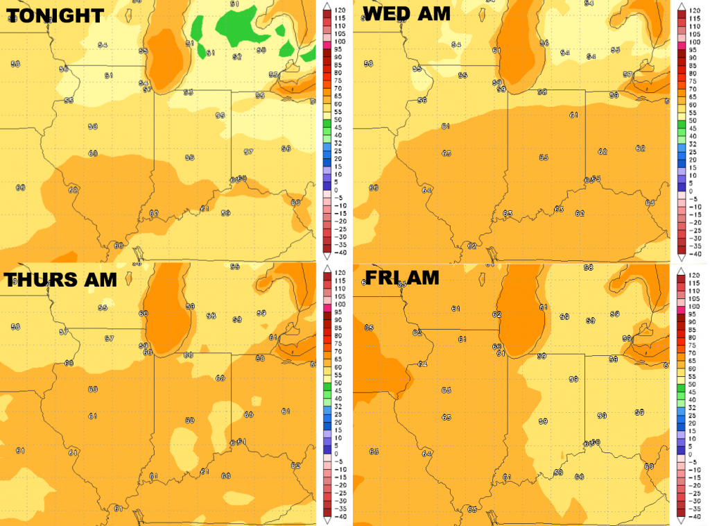
Low temperatures this week will stay elevated due to mostly cloudy skies and a few showers:
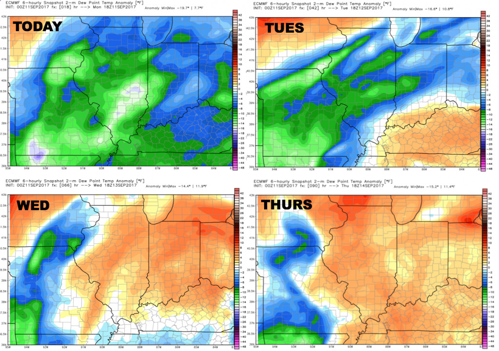
Dewpoints from normal:
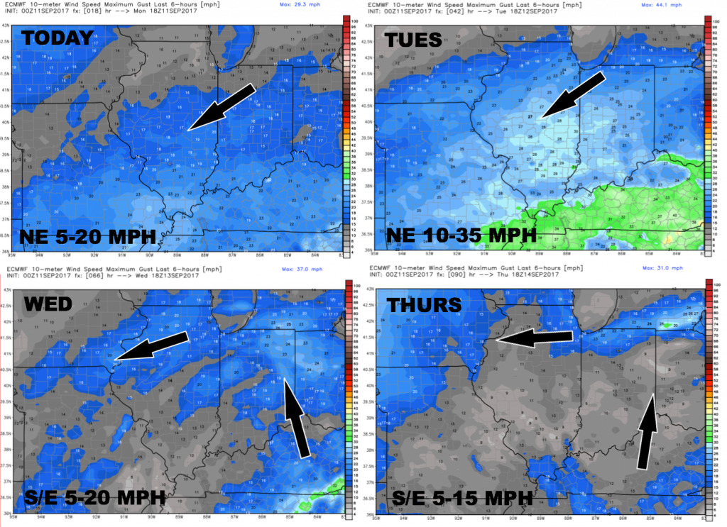
Wind forecast over the next 4 days: