Key Points – Tuesday, August 8, 2017:
Synopsis: Good Tuesday morning! High pressure is overhead with drier conditions across the Ohio Valley through mid-week with mostly sunny skies expected; some patchy fog (and stagnant air) will be possible throughout the forecast area each morning through the end of the week as well…all models by lunch time each day dissipate these inversions, however. Seeing a chance for rain Thursday evening and again Friday afternoon…these will be ~30% coverage. The front looks to come through west to east Saturday evening mainly I-70 south…areas to the north stay drier than normal (which is reflected in our outlooks). If you have any questions please let us know, have a blessed day!
Today’s video (7:50 min):
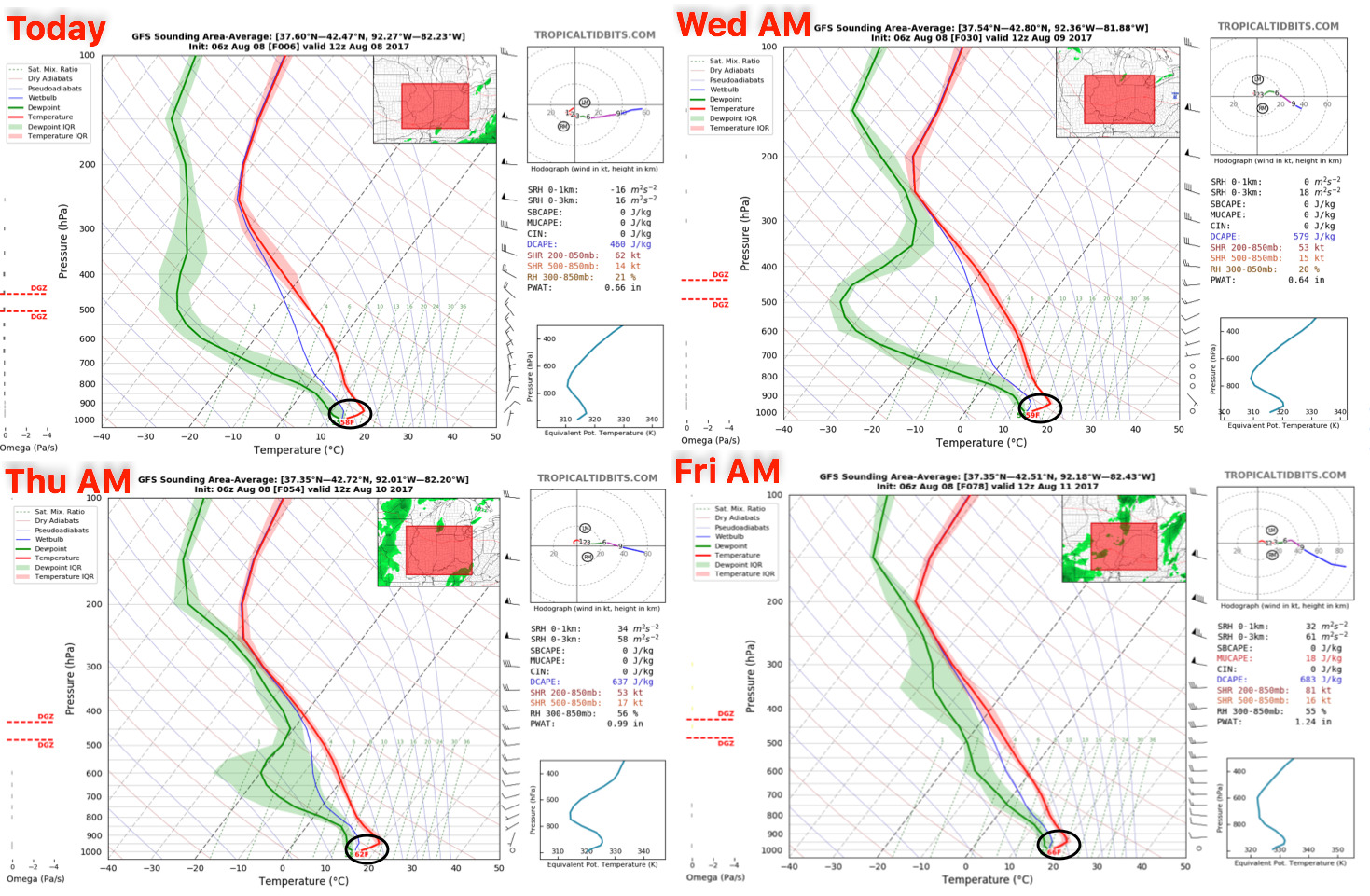
Watching for temperature inversions (patchy fog / stagnant air) each of the next 4 mornings…these inversions will burn off by lunch time, however.
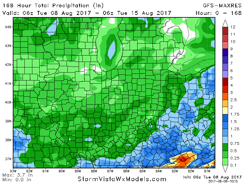
Drier than normal conditions expected over the next week…in the video we discuss scattered rainfall chances late week and a front moving east through the weekend…expected rainfall mainly I-70 south here Saturday night into Sunday ~0.5″.
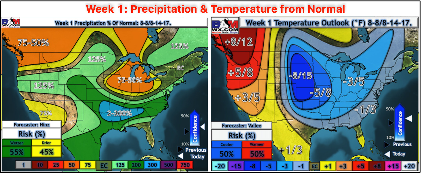
Week 1 temperature and precipitation from normal outlooks updated this morning…overall cooler regime continues as well as drier than normal across the Ohio Valley.
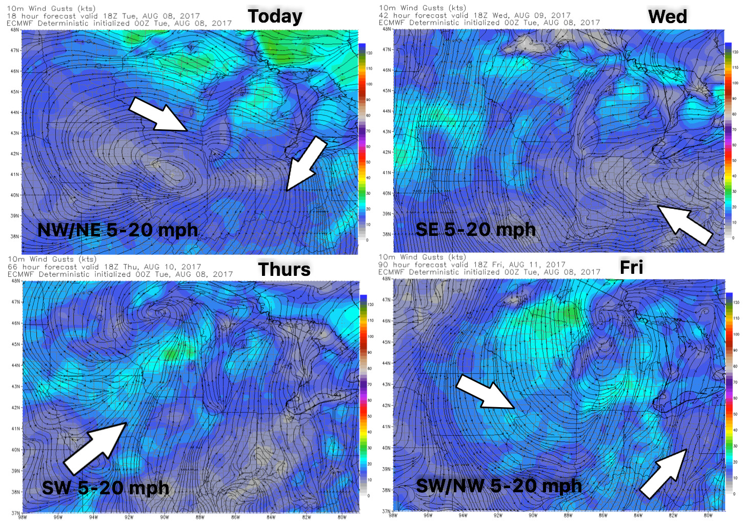
Wind forecast guidance over the next 4 days:
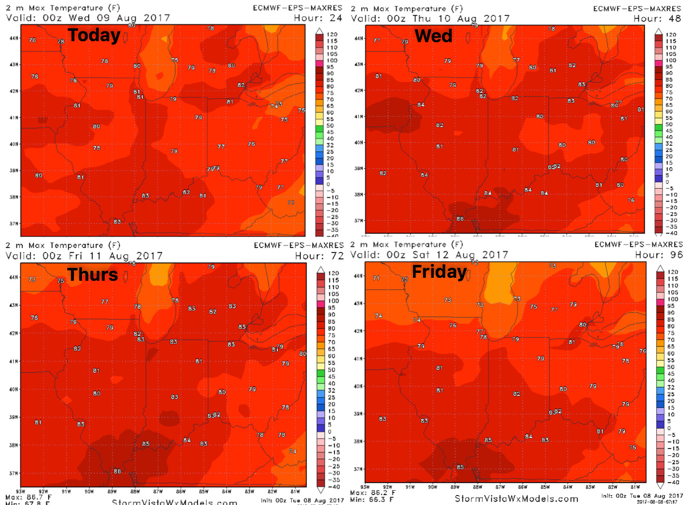
High temperature guidance into late week:
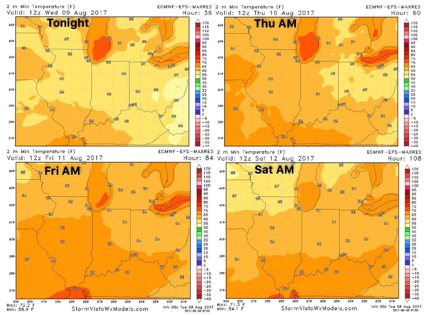
Overnight low temperature guidance:
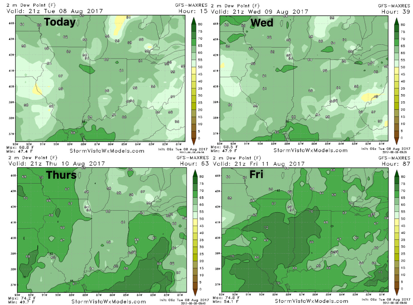
Dew points over the next 4 day guidance: