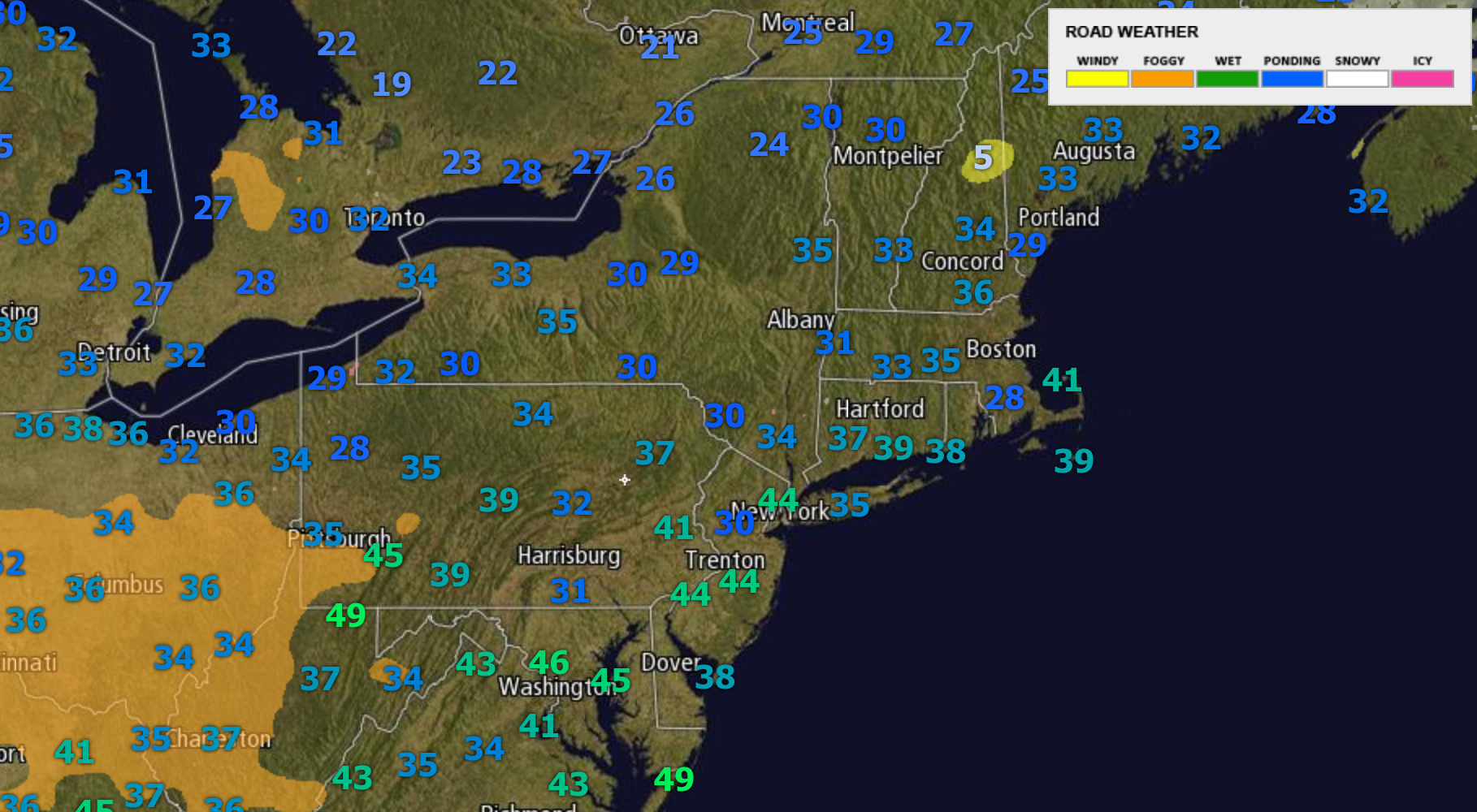
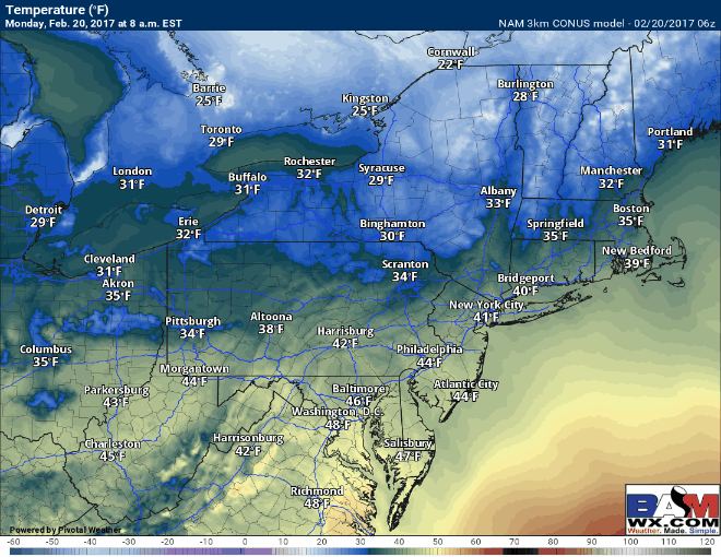
Good morning! Another quiet weather day is in store across the region today as a backdoor cold front sneaks into eastern areas. Temperatures are variable this morning depending on if winds were calm in any one location or not. Where winds were calm, some 20s and low 30s are found, while in areas where wind stayed up temperatures are closer to 40. Some fog is impacting parts of Ohio and Pennsylvania this morning producing some limited visibilities for your morning commute. This will burn off by mid-morning. Here’s a look at current temperatures and hazards.
Temperatures today will be dictated by the backdoor cold front and will range from near 40 in eastern areas, to near 60 in parts of Ohio! Here’s a look at what we expect today along with some sunshine.
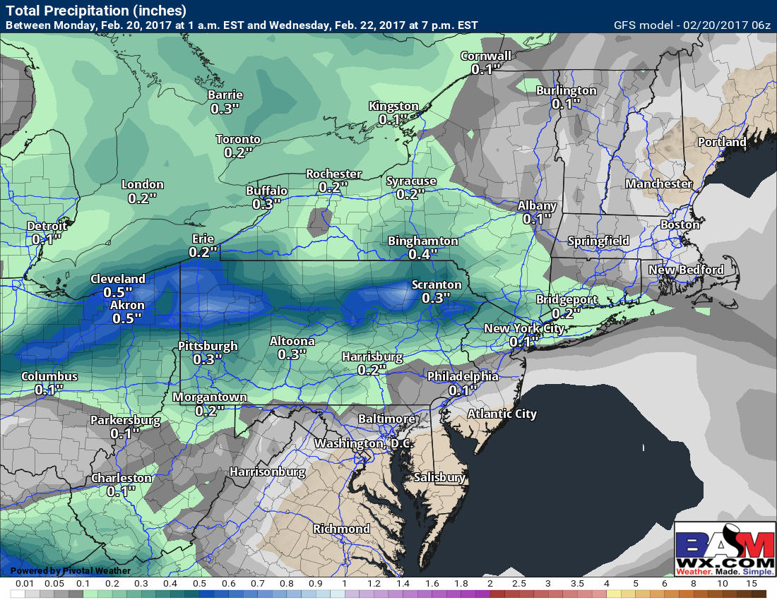
A decaying cold front will push toward the region tomorrow afternoon into the overnight with some showers. Overall, this will not be a big precipitation event, but compared to past days, it will not even be close to as nice with plenty of clouds around. Here’s a look what the radar will look like Tuesday afternoon through Wednesday morning.
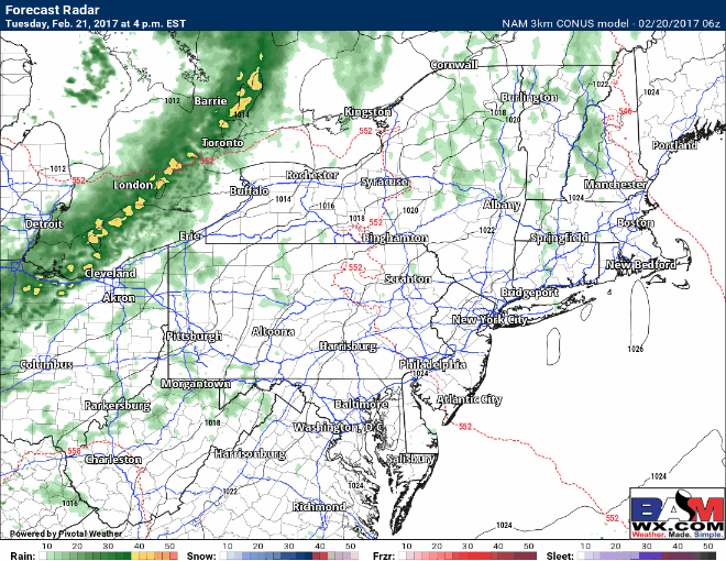
Notice the radar precipitation type is attempting to paint a bit of freezing rain in parts of the Hudson Valley and New England late Tuesday night and early Wednesday morning. Temperatures will be close to 32, but largely above freezing I think, so only a few widely scattered icy spots are expected. Total rainfall looks relatively minor, but some places in PA and Ohio may see about 0.50″, tapering as one heads eastward.
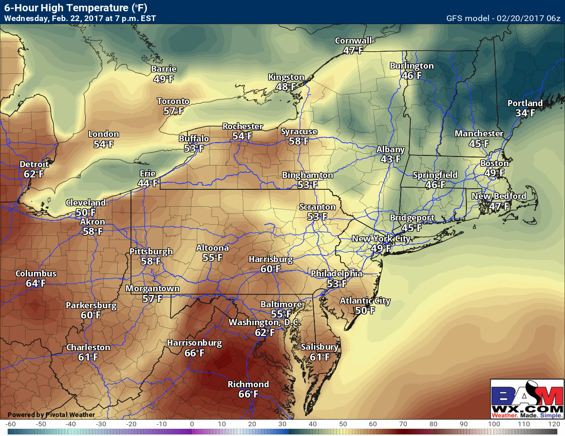
Clouds will give way to some sunshine Wednesday with warmth spreading back into western and central areas. Even eastern areas warm up a bit. Estimated high temperatures Wednesday.
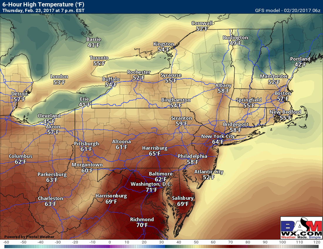
While some clouds will be around Thursday ahead of a cold front, it will likely be the warmest day of the week with many places getting into the 60s!
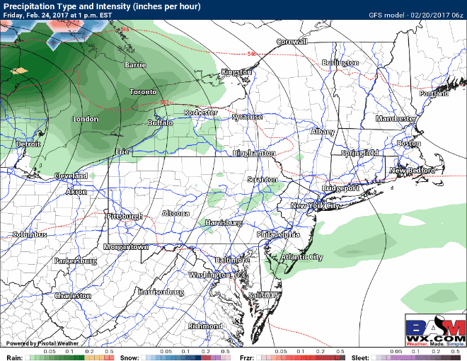
A strong storm will push into the Ohio Valley Friday and will move eastward through Saturday. This will end the incredible warmth across the region and provide some additional rainfall and maybe even a few rumbles of thunder. Here’s a look at the GFS model through Saturday night.
Confidence and Risks:
- High confidence on cooler temps in New England behind the backdoor front today and tomorrow.
- High confidence on some rain Tuesday into very early Wednesday with generally 0.50″ of rain or less region wide.
- Low confidence on any icy spots in the northern Hudson Valley and western MA early Wednesday morning. Not likely, but not impossible either.
- High confidence on warmth returning to end the week with many into the 60s!
- Moderate to high confidence on some rainfall Friday into Saturday with a cold front. Cooler temperatures likely behind this as well.
Today’s video covers it all! ~Ed