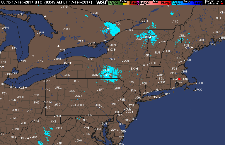
Good morning! For the first time in over a week, the radar is quiet this morning as warmer air slowly works into the region. Here’s the radar as of 5:50 AM.
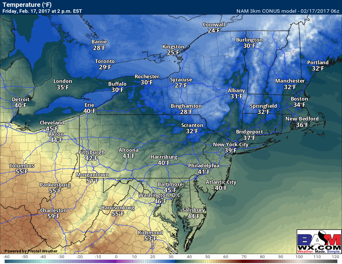
Warmer air will be on the move today with western areas getting into the 40s and 50s. Areas in New England will once again be cooler, stuck in the 30s.
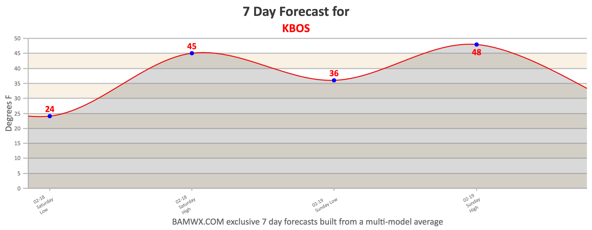
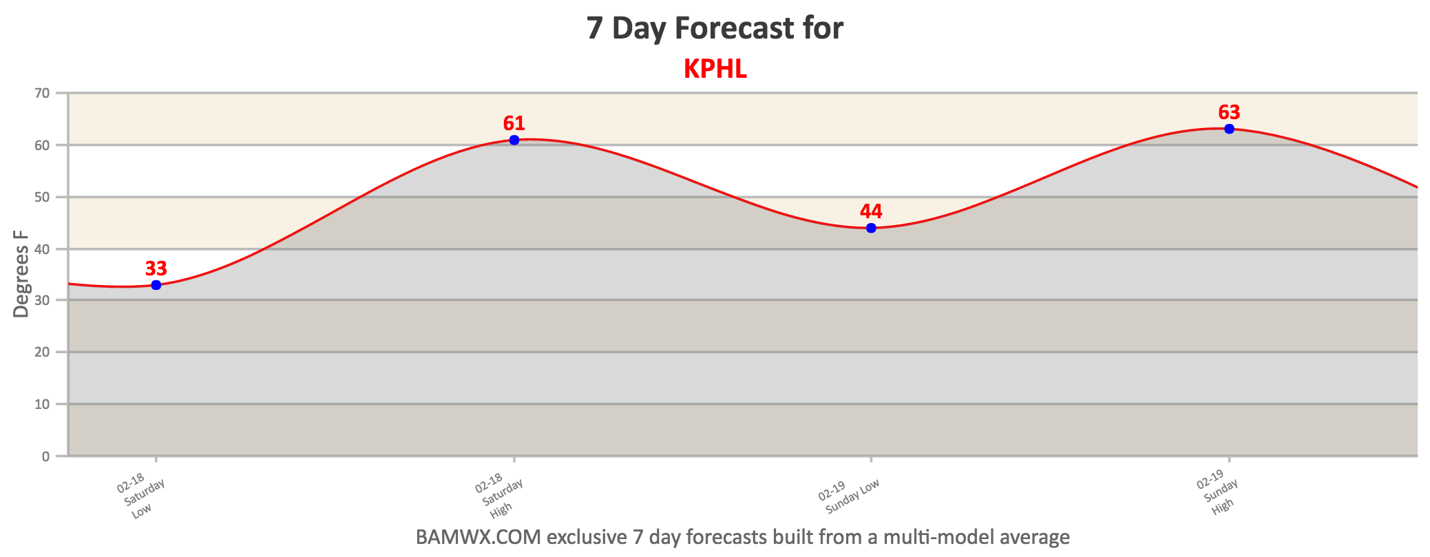
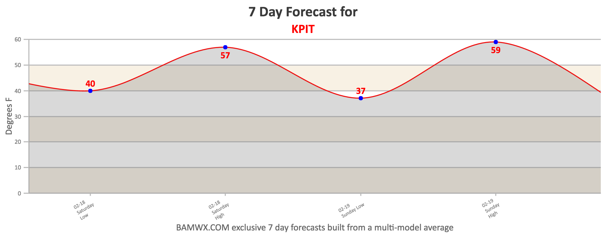
Dry times are expected this weekend for areas of north of I-80 with warming expected both days. Here’s a look at high temperatures Saturday and Sunday for a few select cities.
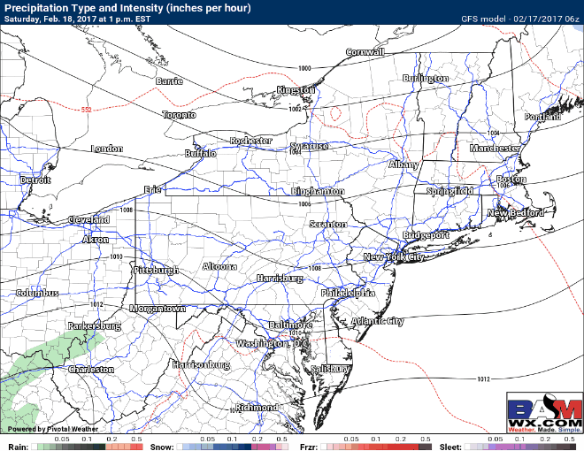
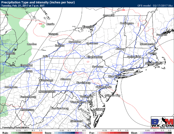
Some showers associated with a very weak disturbance may impact southern areas late Saturday into Saturday evening, but they appear very light. Here’s a look at the projected radar Saturday evening and Saturday night on the GFS.
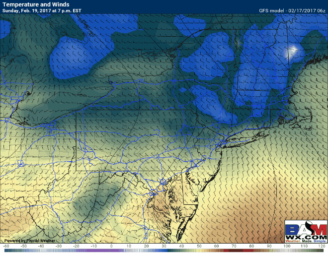
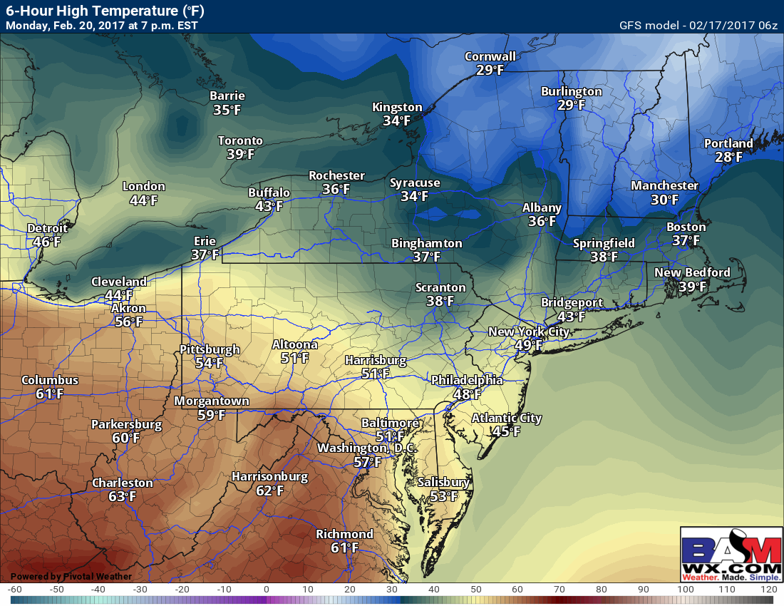
A backdoor front will approach New England Monday bringing a return to colder conditions, however much of PA and Ohio will remain Spring-like. Here’s a look at the backdoor front moving in via temperatures Monday.
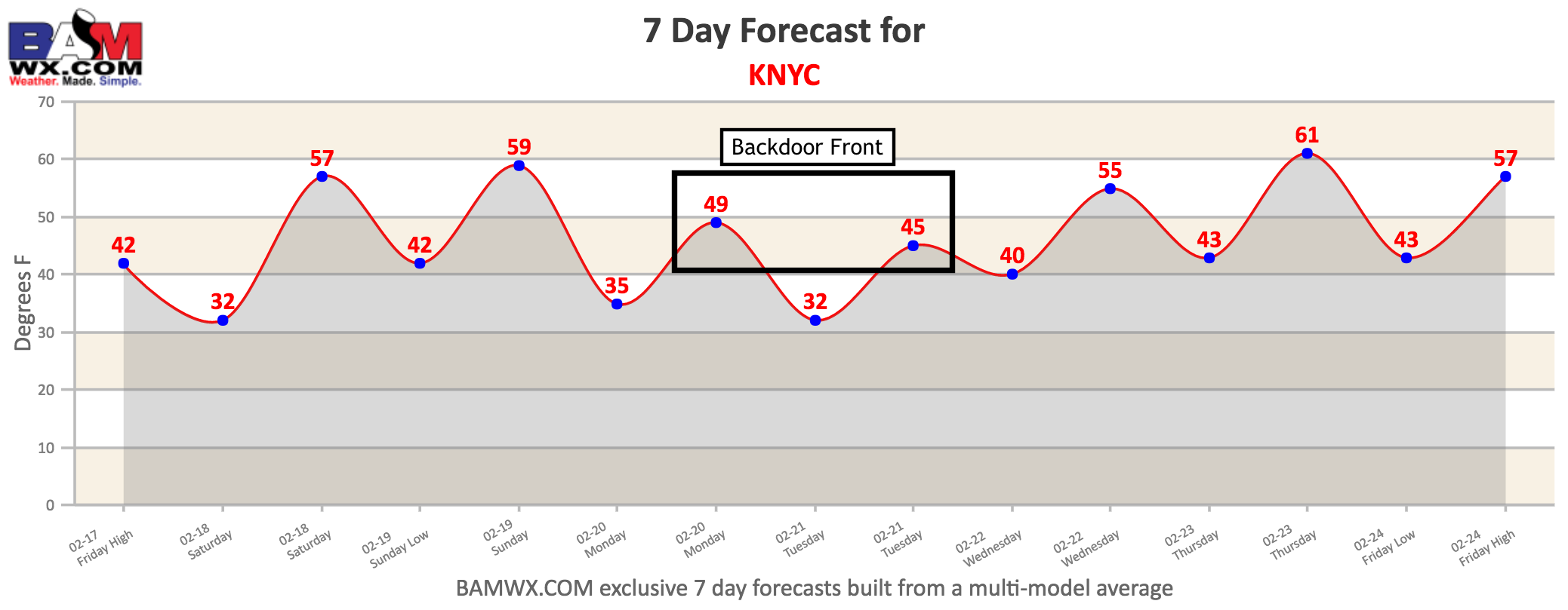
This is shown well on the NYC 7 day forecast, with Monday and Tuesday being about 10-15°F colder than surrounding days thanks for the backdoor front and easterly winds.
Wednesday and Thursday look warm ahead of a cold front, which will bring an end to the extremely mild conditions. This will be accompanied by a few showers Wednesday, but model guidance remains weak and uncertain with the extent of any precipitation. Here’s a look at what may occur mid-week next week.
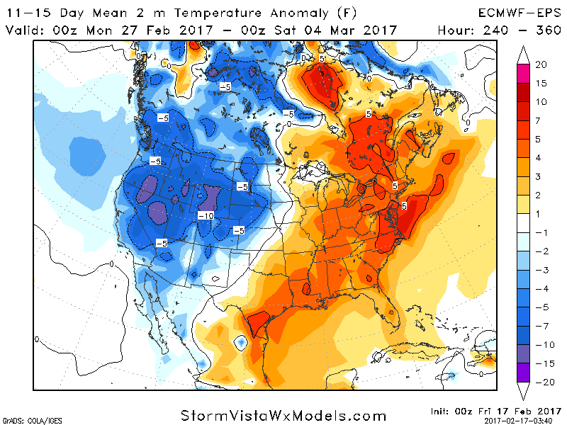
Even beyond this, temperatures in the long range remain mild compared to normal, though not as warm as this warm stretch coming up. Here’s a look at the 11-15 day temperature anomalies. The start of March does look cooler and may feature some snow chances especially away from the coastline. It’s still a bit early to pinpoint any exact threats, however.
Confidence and Risks:
- High confidence on warmer times through early next week.
- Moderate confidence on a bit of rain in southern areas this weekend, but uncertainty remains high on how far north it comes.
- High confidence on a backdoor front bringing a return to colder conditions in New England Monday and Tuesday.
- Moderate to high confidence for more warmth Wednesday and maybe even Thursday ahead of a cold front.
- Moderate confidence on a “cooler” pattern late next week into the start of March, but how cold and if there will be any snow remains to be seen.
Today’s video is 4 minutes. Have a great day! ~Ed