Northern Plains Update: Variable Severe Risks Into This Weekend. E.
Key Points: August 24, 2017
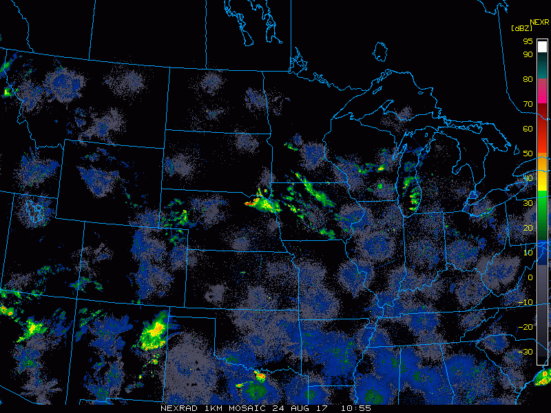
Synopsis: Good Thursday morning! Radar is clear this morning, but we are watching for an increasing threat of thunderstorms (some severe) this afternoon and into the weekend. Temperatures look to remain below normal in the eastern portion of zone 9 through next week with near normal temperatures expected across the Dakotas. Multiple cold fronts are expected next week bringing bouts of showers and cooler weather especially east as well. This is all covered in the video! Have a blessed day.
Today’s Video (5 min):
Current radar:
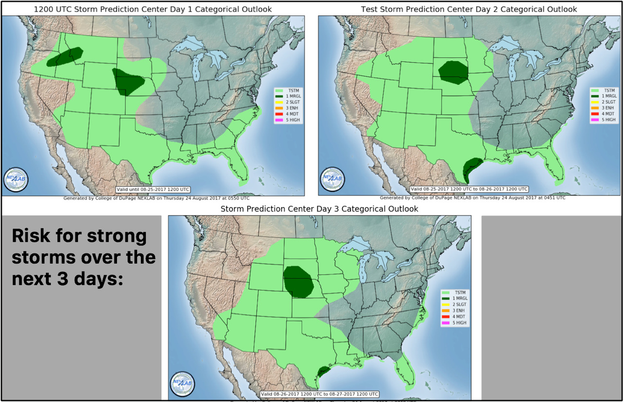
SPC outlooks outline storm risks into the weekend.
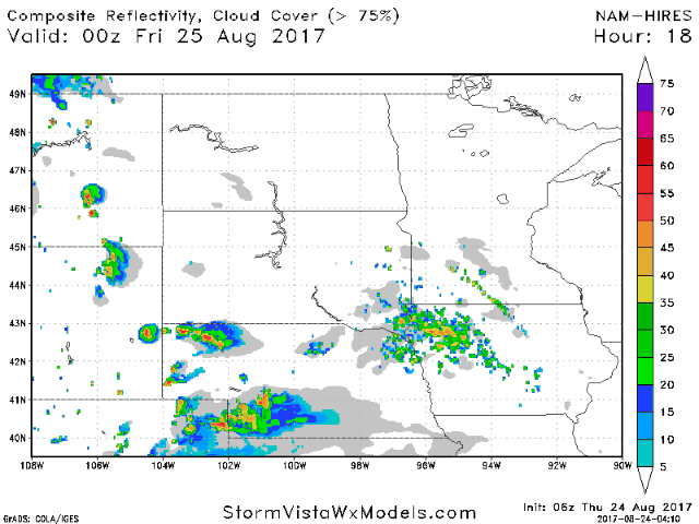
Projected radar through Saturday morning.
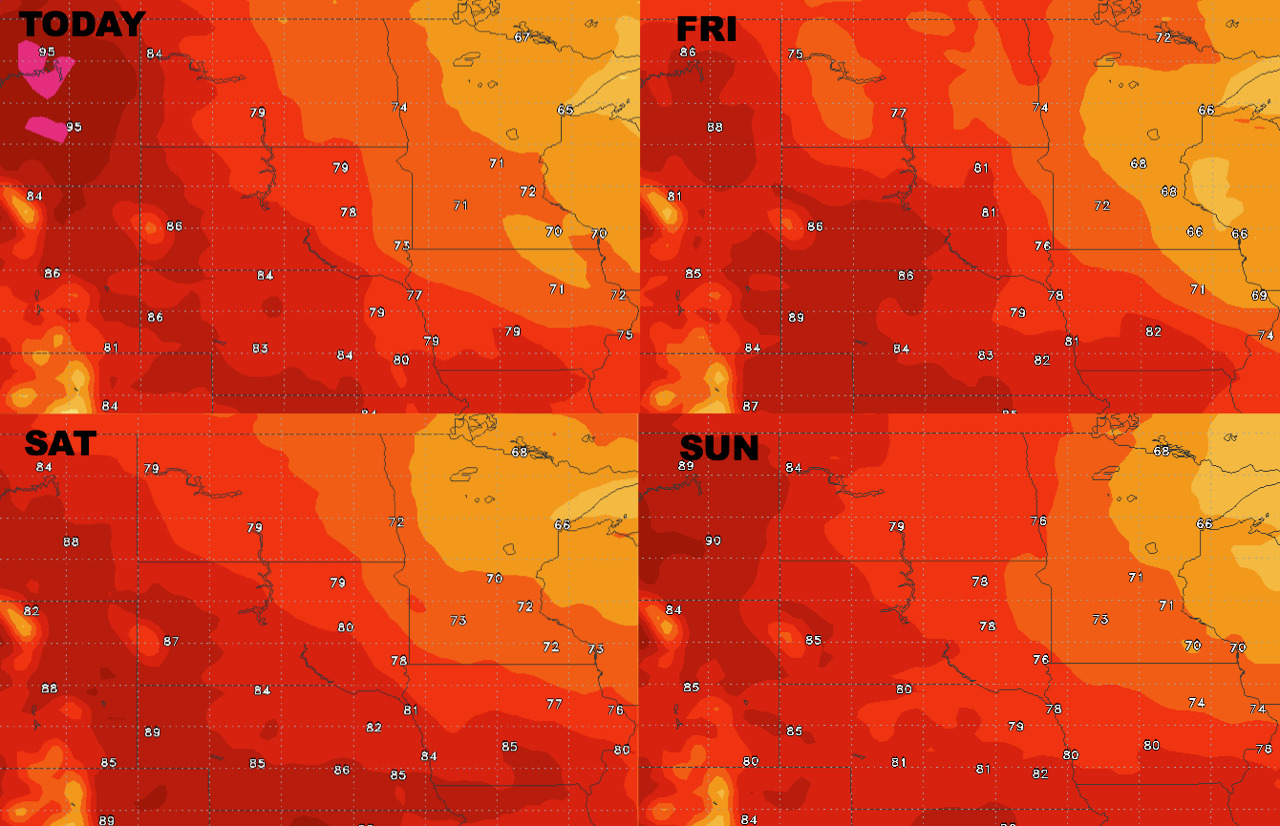
High temperatures next 4 days.
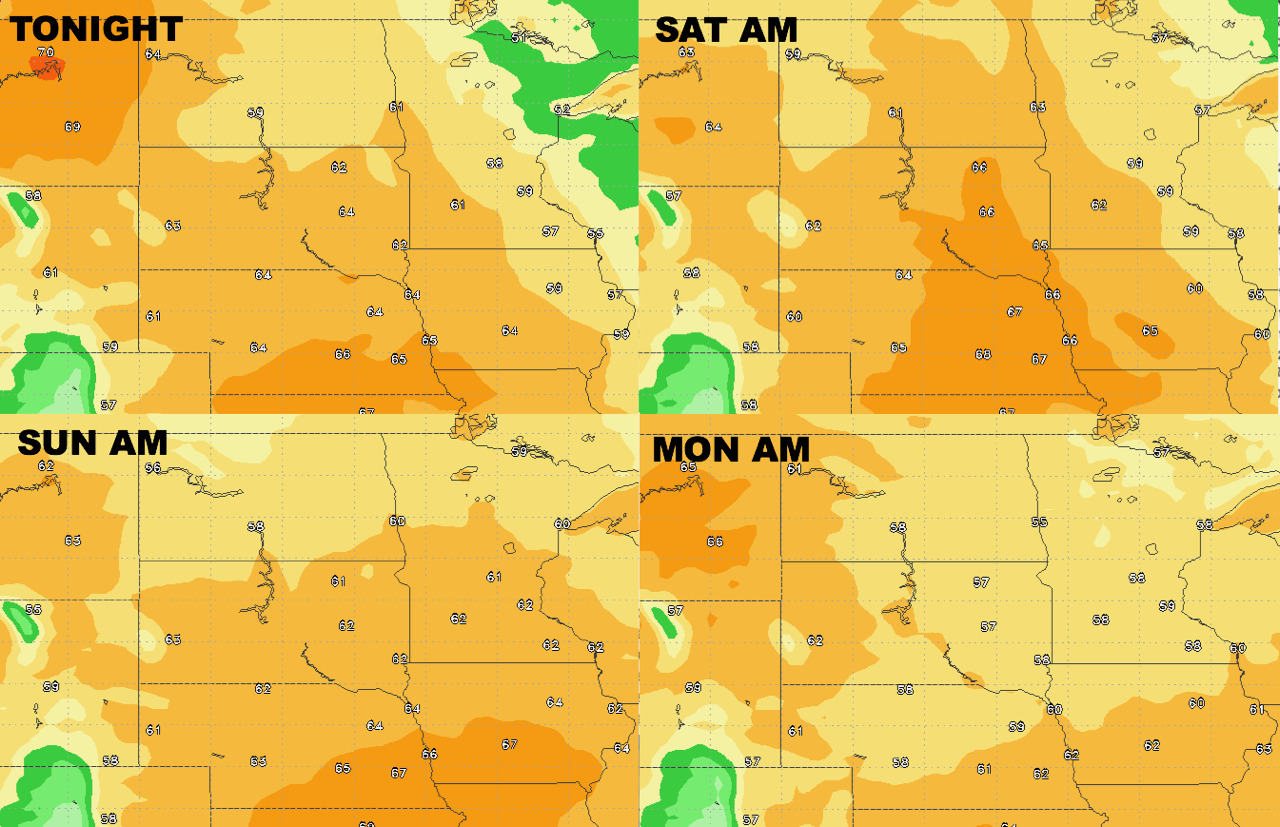
Low temperatures next 4 days.
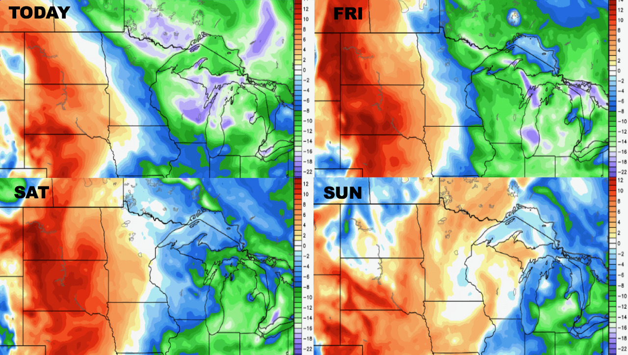
Humidity remains above normal west through the weekend.
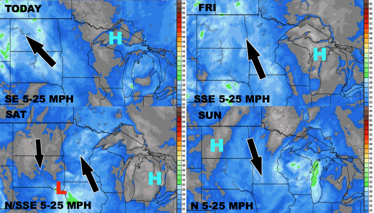
Winds over the next 4 days is shown below.
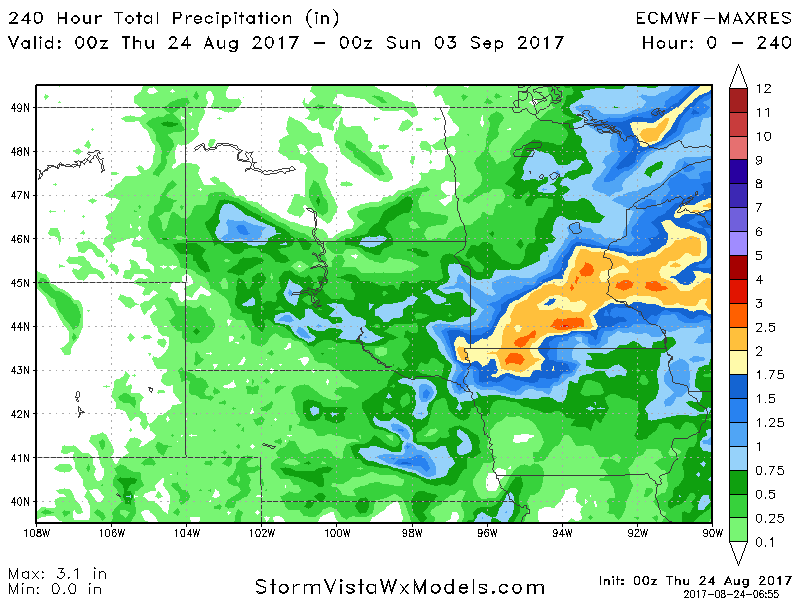
Total precipitation expected over the next 10 days.