Key Points: October 6, 2017
Synopsis: Good Friday morning! We are tracking heavy rains moving into southeastern South Dakota this morning. This rain will move into southern Minnesota and Wisconsin today and tonight leading to some heavy rainfall amounts and localized flooding. Drier conditions are expected Sunday into early next week along with seasonable conditions. Our next threat for any significant rainfall looks to come toward the end of the next work week as a disturbance pushes on through. Have a blessed day and weekend!
Today’s Video (7 min):
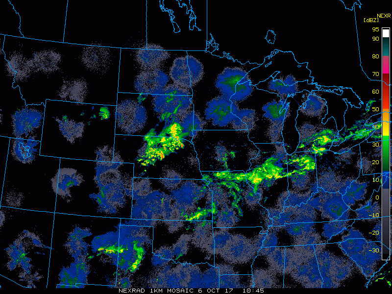
Current radar shows the advancing rains in South Dakota, soon to impact Minnesota and Wisconsin.
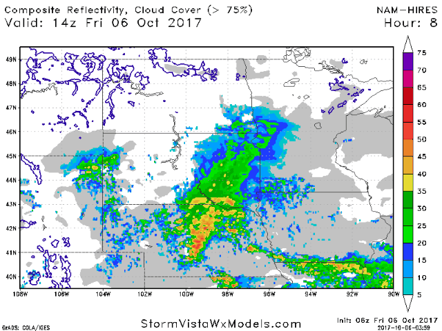
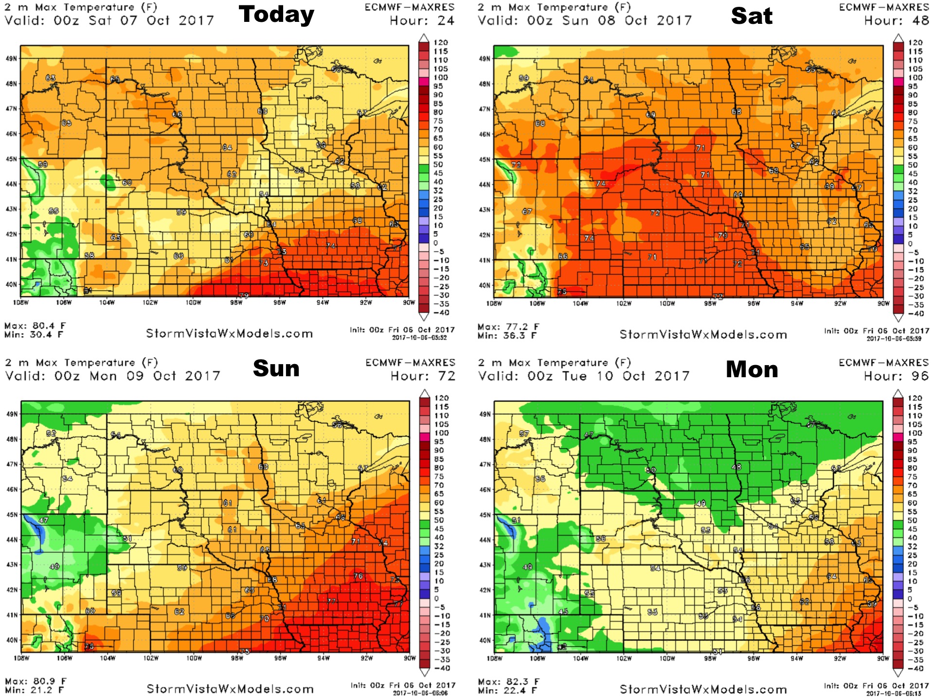
As we move through today and into tomorrow, rains continue south and east while the Dakotas dry out quickly! Projected radar is below.
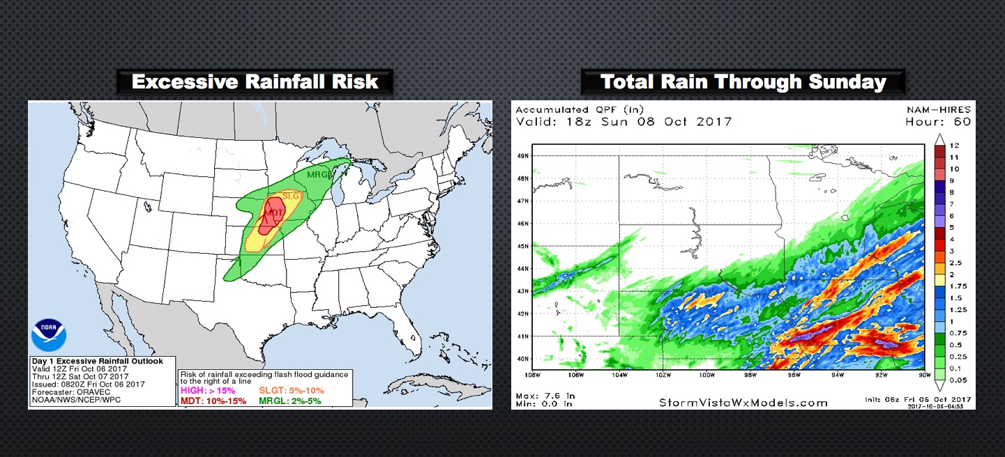
An excessive rainfall risk is anticipated in extreme southeastern portions of zone 9. Total rainfall also shown through Sunday below.
Temperatures will be up and down as a weak cold front moves through Sunday.
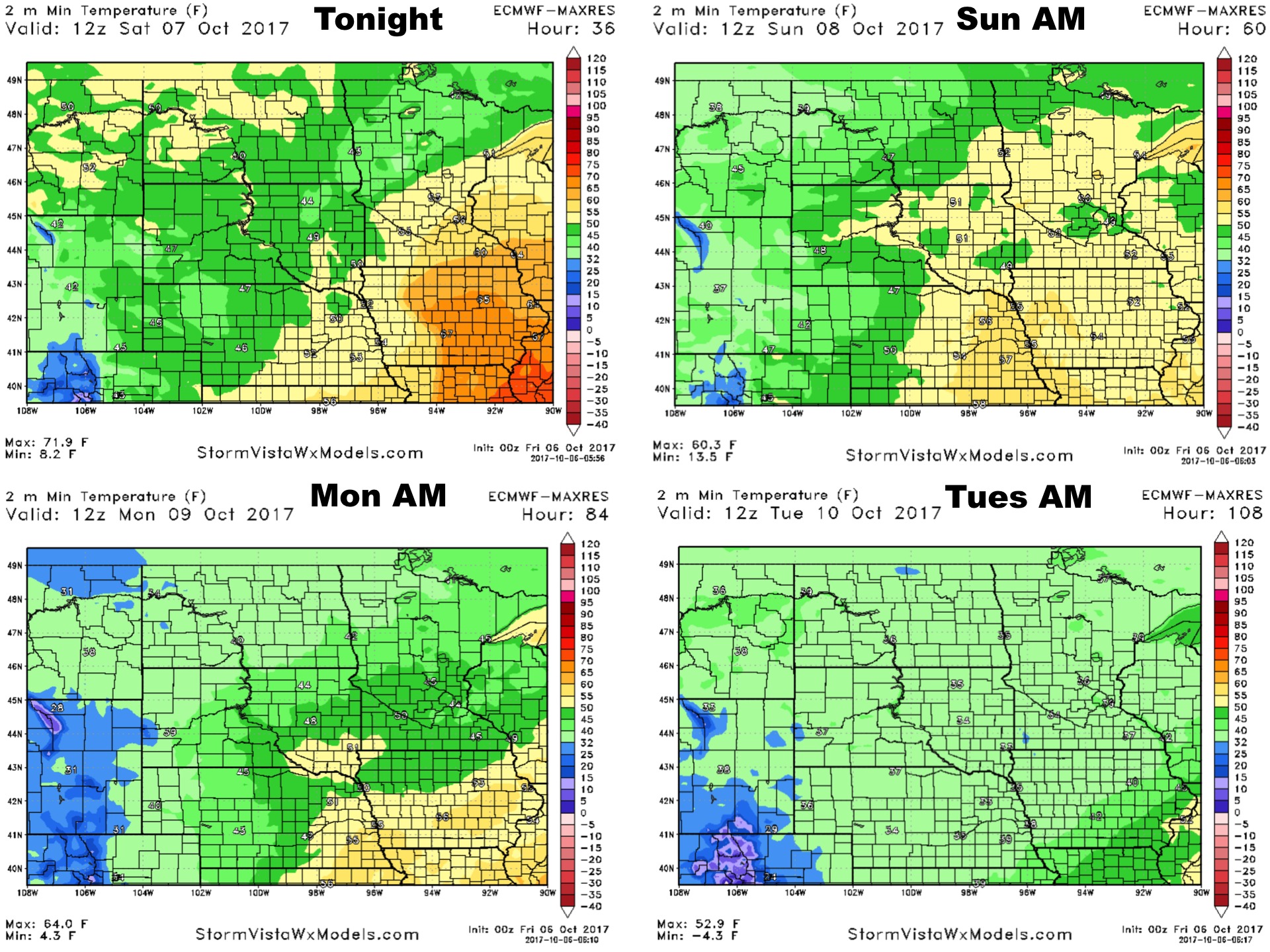
Low temperatures look frosty north and west through the weekend!
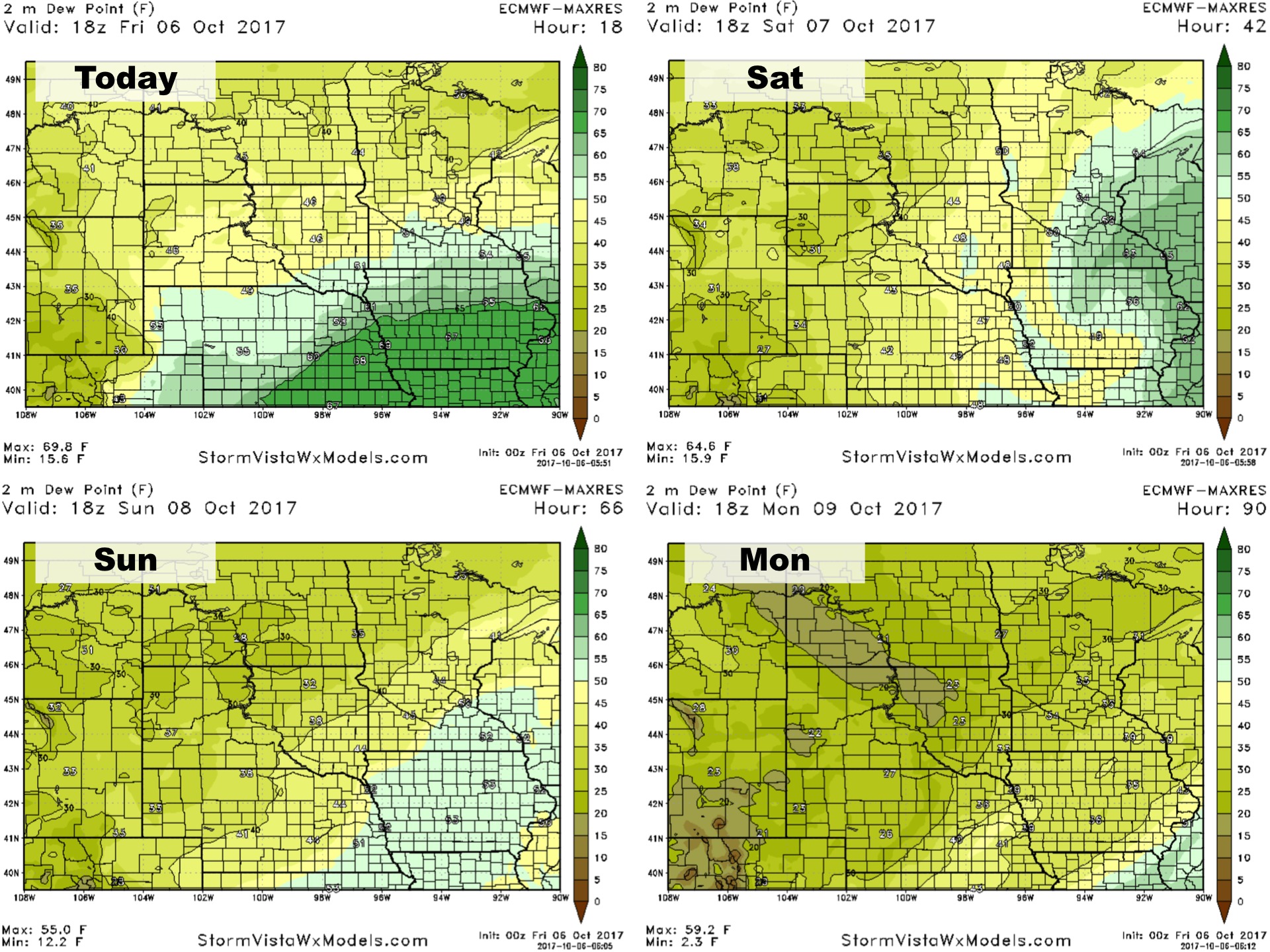
Dew points will also drop behind this system!
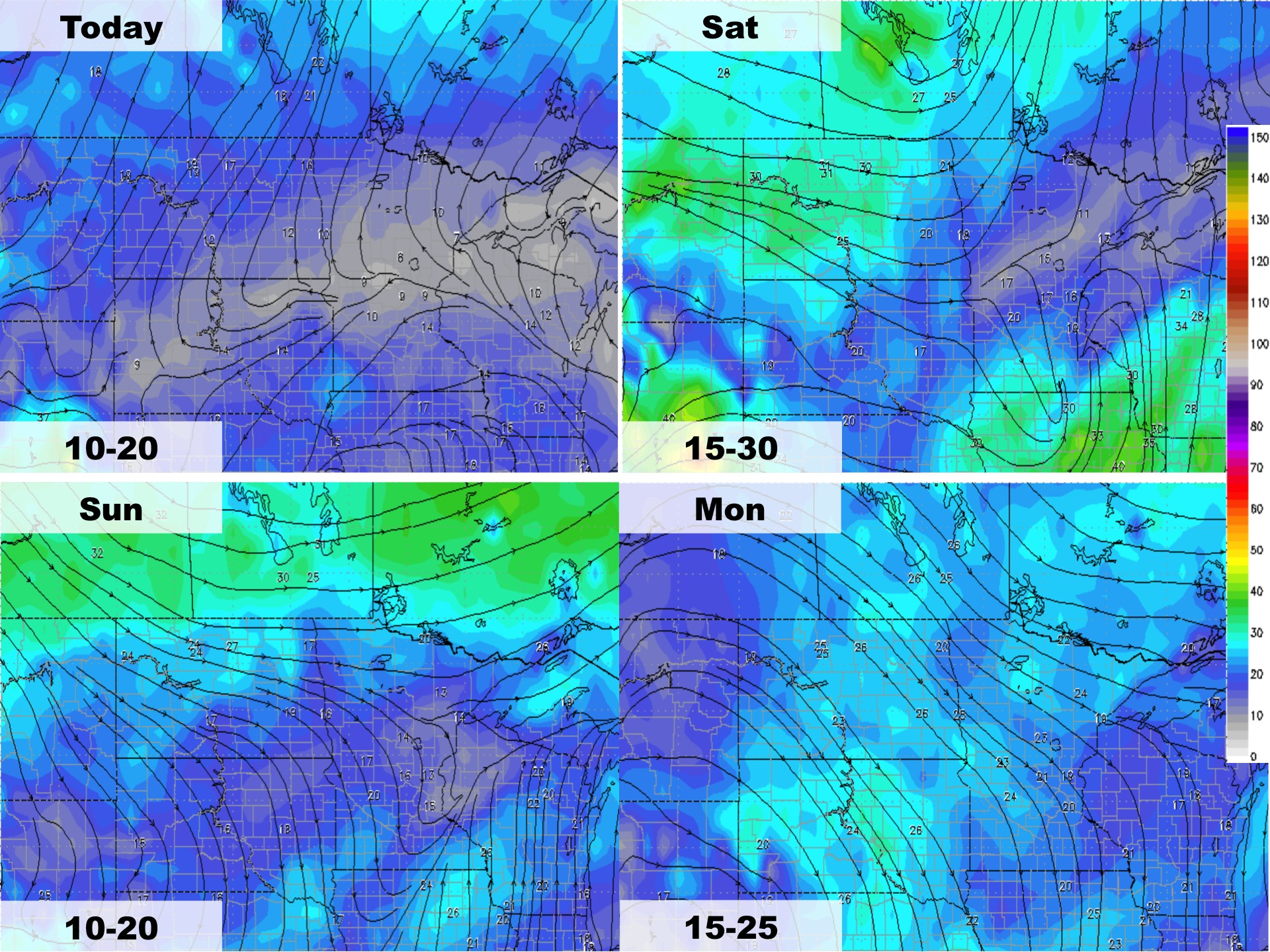
Wind forecast over the next 4 days is below.
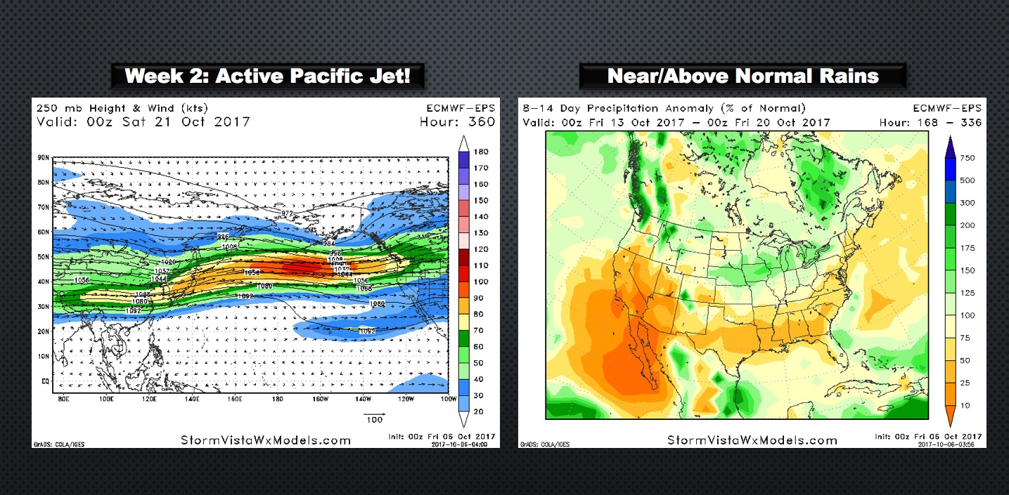
While the pattern relaxes, an active pacific jet may keep things slightly wetter than normal into week 2.