Key Points: September 29, 2017
Synopsis: Good Friday morning! High pressure has allowed some in North Dakota and Minnesota to drop near freezing. Some spotty frost likely around this morning! Warmer conditions return this weekend along with unsettled conditions. Zone 9 will be in the thick of a temperature battle zone with warmer temperatures east and cooler conditions west. In between will feature an active storm track leading to above normal rainfall chances at least through the middle of October. Have a blessed day and weekend!
Today’s Video (4:30):
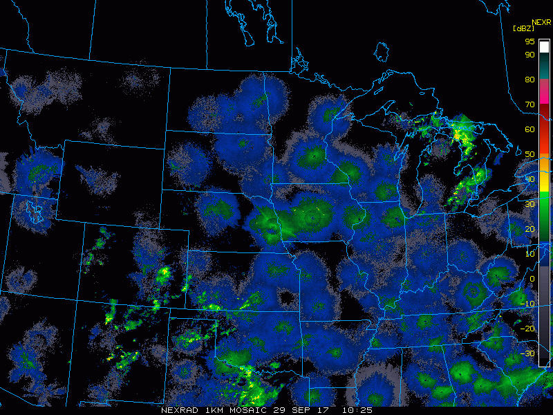
Current radar scanning clear this morning.
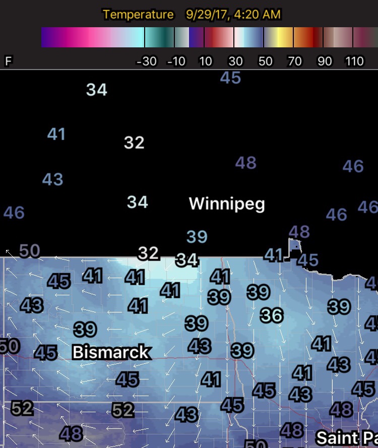
Even still, it sure was chilly earlier this morning! Temperatures from 4:20 AM below.
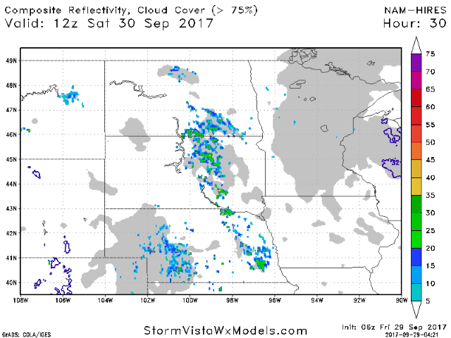
Rain looks to return this weekend. The projected radar Saturday into Sunday is shown below.
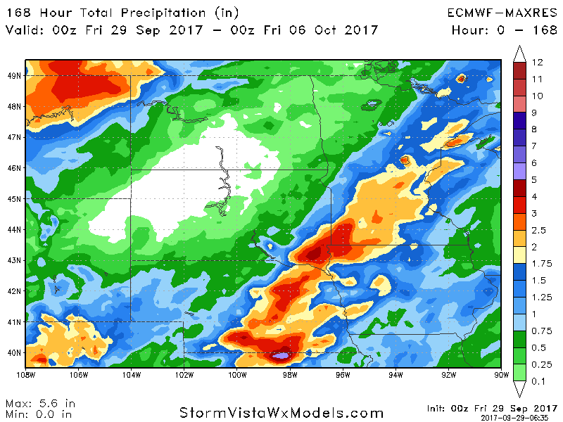
Rain looks to stick around through much of next week. The video covers the details. 7 day rainfall amounts are shown below.
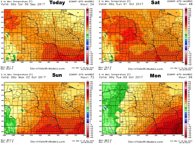
High temperatures over the next 4 days are shown below.
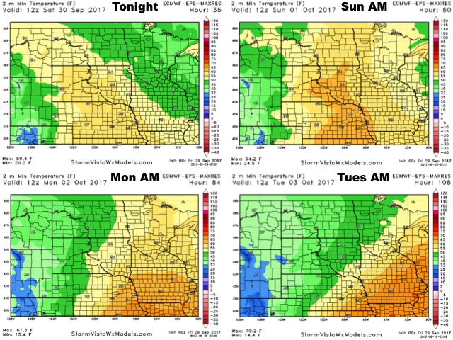
Low temperatures over the next 4 days are shown below.
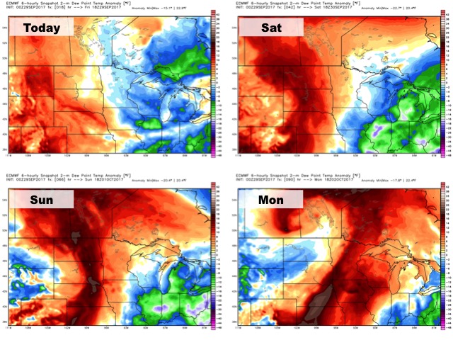
Humidity compared to normal shown below.
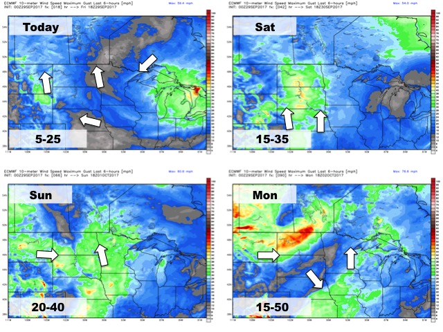
Wind forecast through Monday is below.