Northern Plains Update: Temperature Roller Coaster into Next Week, Frost Risks Still on the Table. E.
Key Points: August 30, 2017
Synopsis: Good Wednesday morning! A weak cold front is moving through the region today, but coverage of showers and storms will be low. A warm front looks to move through the Dakotas, then Minnesota late this week bringing a renewed chance for rainfall. This looks likely Thursday night into Friday for the Dakotas, then Friday into Saturday across Minnesota. Warmer air comes in behind this system, then a strong cold front looks to blast through the zone early next week. Behind this front, low temperatures in the 30s and 40s are expected region wide, meaning some frost is possible late next week. Have a blessed day!
Today’s Video (5 min):
Current radar:

High temperatures next 4 days show the temperature roller coaster well.

Low temperatures over the next 4 days.

Humidity looks higher than normal especially west this week.

Wind forecast over the next 4 days looks breezy west through the start of the weekend.

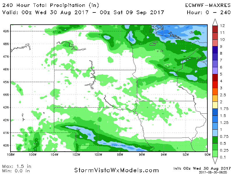
Total precipitation over the next 10 days looks very light for most, with the exception of northern Minnesota.