Northern Plains Update: Spotty Storms West Saturday, Warmer Into Early Next Week. E.
Key Points: September 8, 2017
Synopsis: Good Friday morning! High pressure has led to another chilly but dry morning out there this morning. As we move through the weekend, that cool airmass will give way to a warmer one, and with that comes a threat for a few storms tonight into tomorrow across the Dakotas. Outside of this, a drier pattern is developing into next week before another cold front brings a return to normal temperatures later next week and into next weekend. This will also bring a better chance for rainfall across the region as we head into week 2 and beyond. Have a blessed day and a blessed weekend.
Today’s Video (4:30):
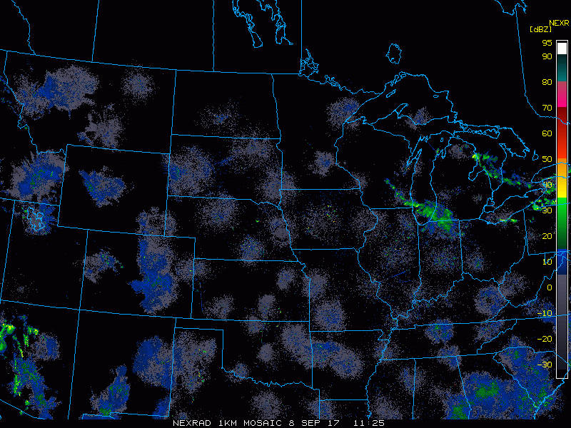
Current radar is scanning clear this morning.
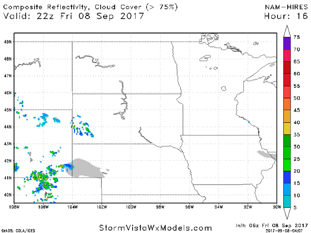
A few storms are possible tonight into tomorrow across the Dakotas. Projected radar:
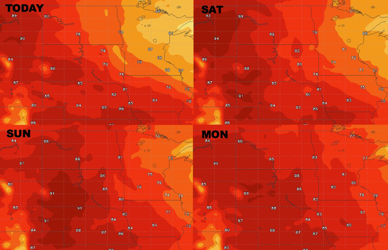
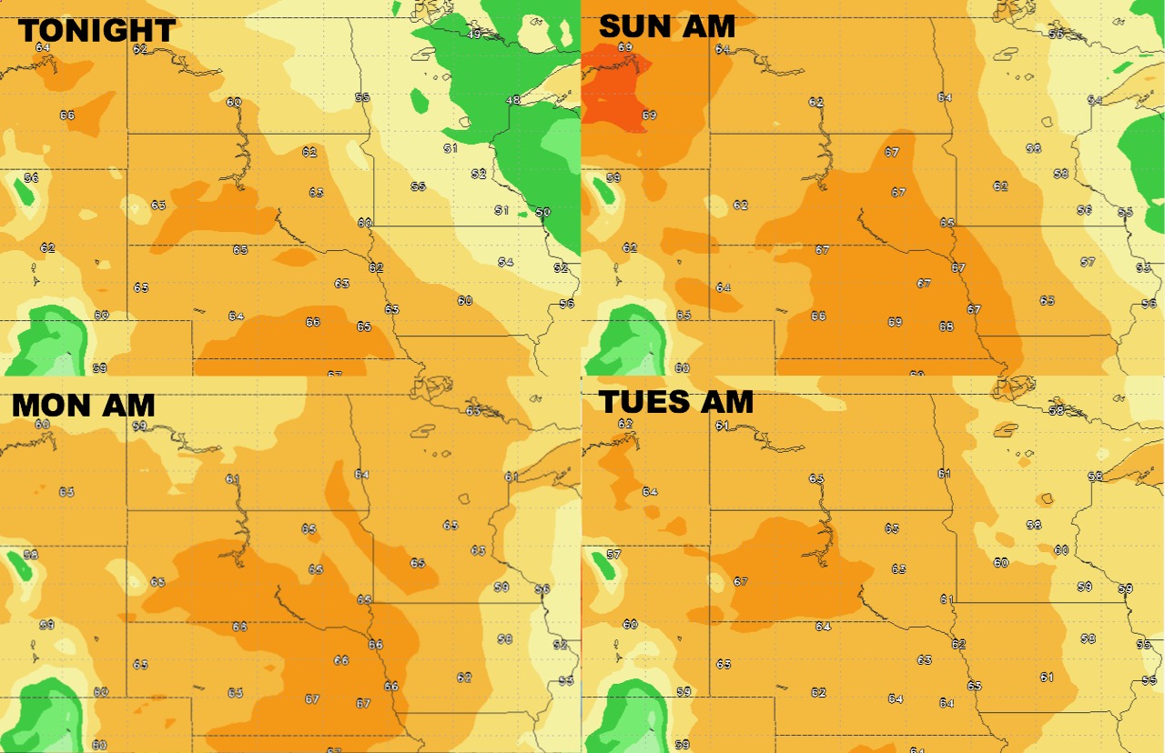
High temperatures over the next 4 days.
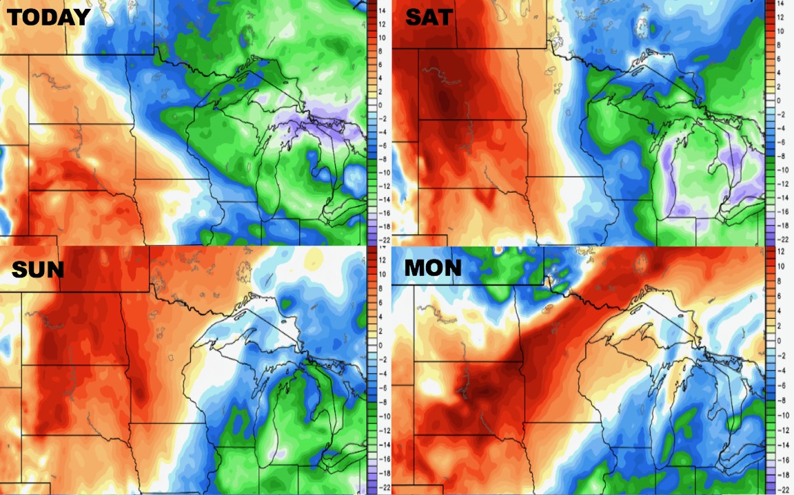
Low temperatures over the next 4 days.
Humidity looks to rise across the region into the weekend.
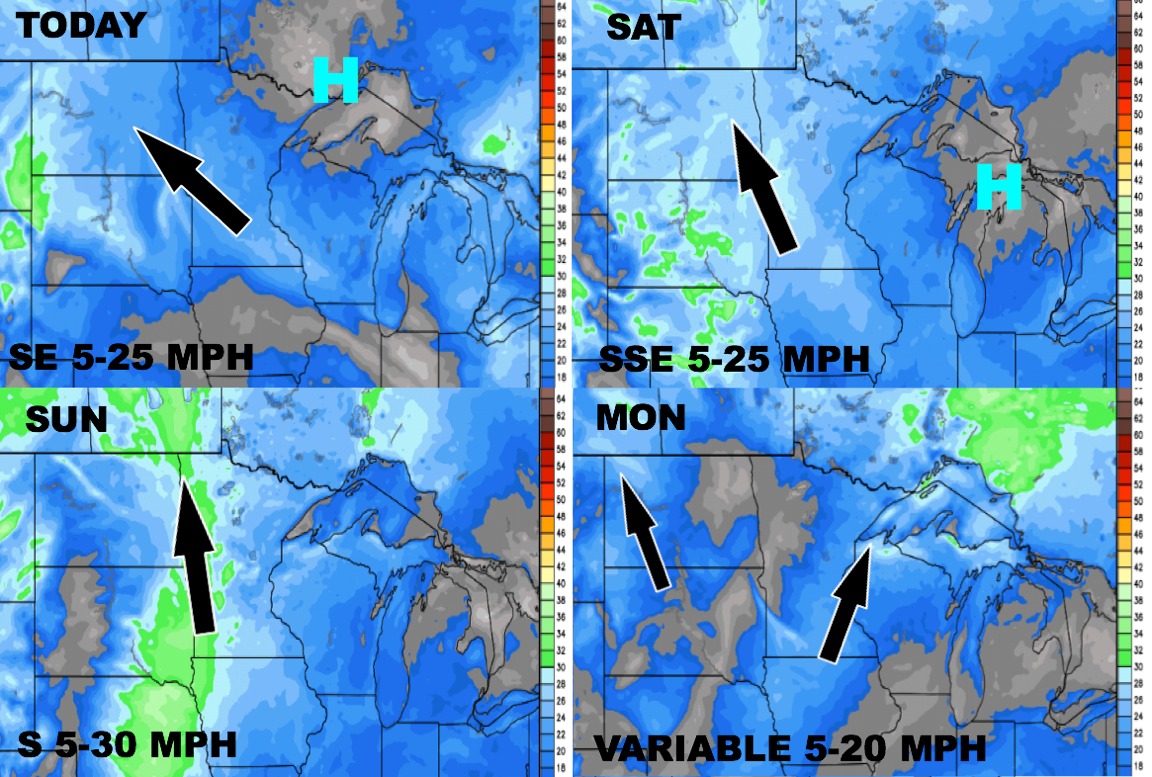
Wind forecast over the next 4 days is below.
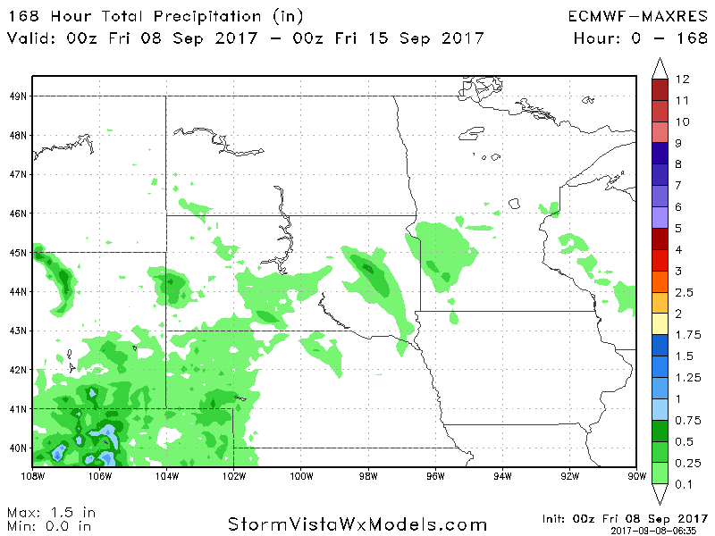
Total precipitation over the next 7 days.