Key Points: September 19, 2017
Synopsis: Good Tuesday morning. We are tracking some weak showers associated with a warm front moving through the Dakotas. This will lead to warm, humid air in place ahead of a cold front this afternoon setting the stage for severe weather in the Dakotas and western Minnesota this afternoon and evening. The biggest threats with these storms will be strong winds, large hail, torrential rains, and even a few tornadoes possible. Drier, cooler air returns for Wednesday and Thursday, but another strong cold front will bring rainfall chances especially west and north through the weekend. Have a blessed day!
Today’s Video (5 min):
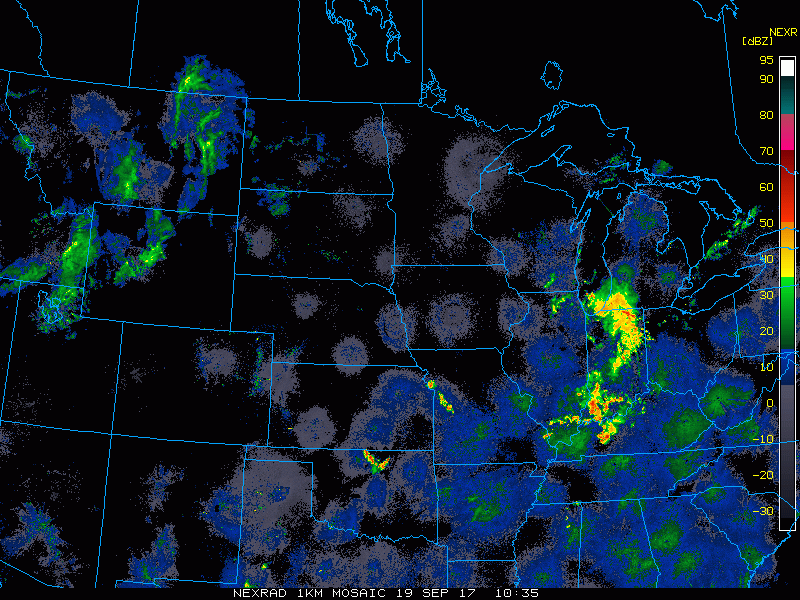
Current radar shows the warm front moving through the Dakotas with a few showers.
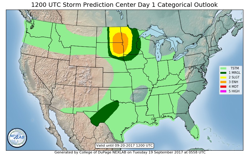
Severe risk is very real this afternoon across the eastern Dakotas and western Minnesota.
Projected radar times things out for you through tonight.
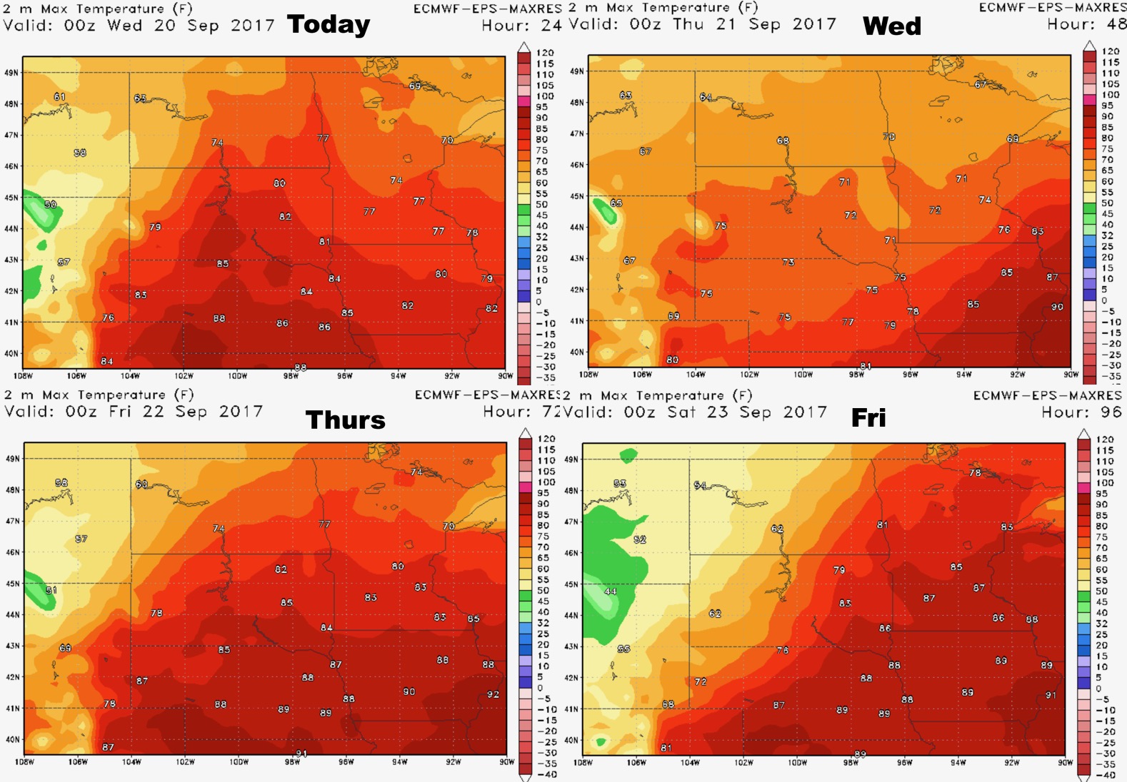
High temperatures next 4 days shows the cold front progressing southeast.
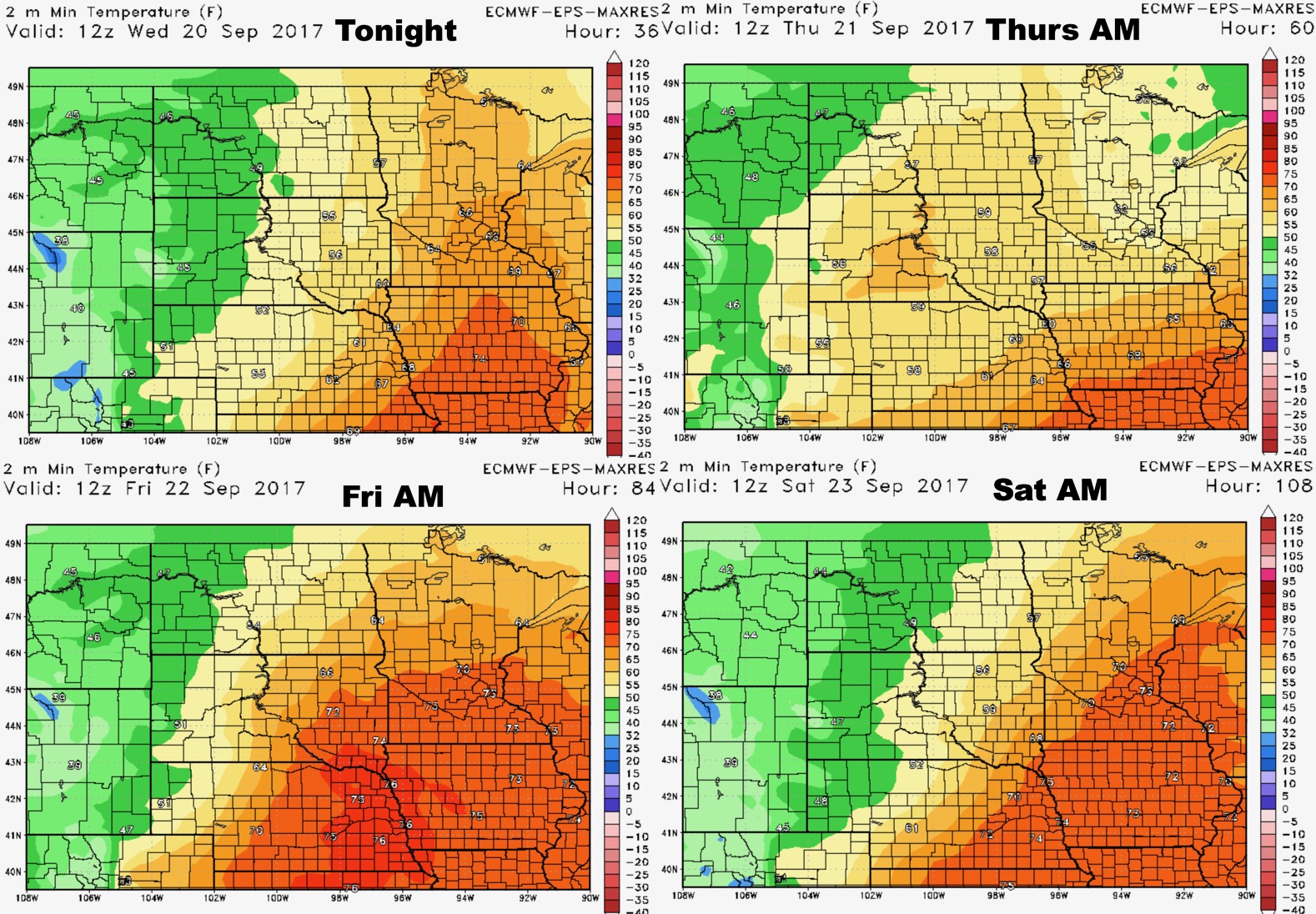
Low temperatures are similar.
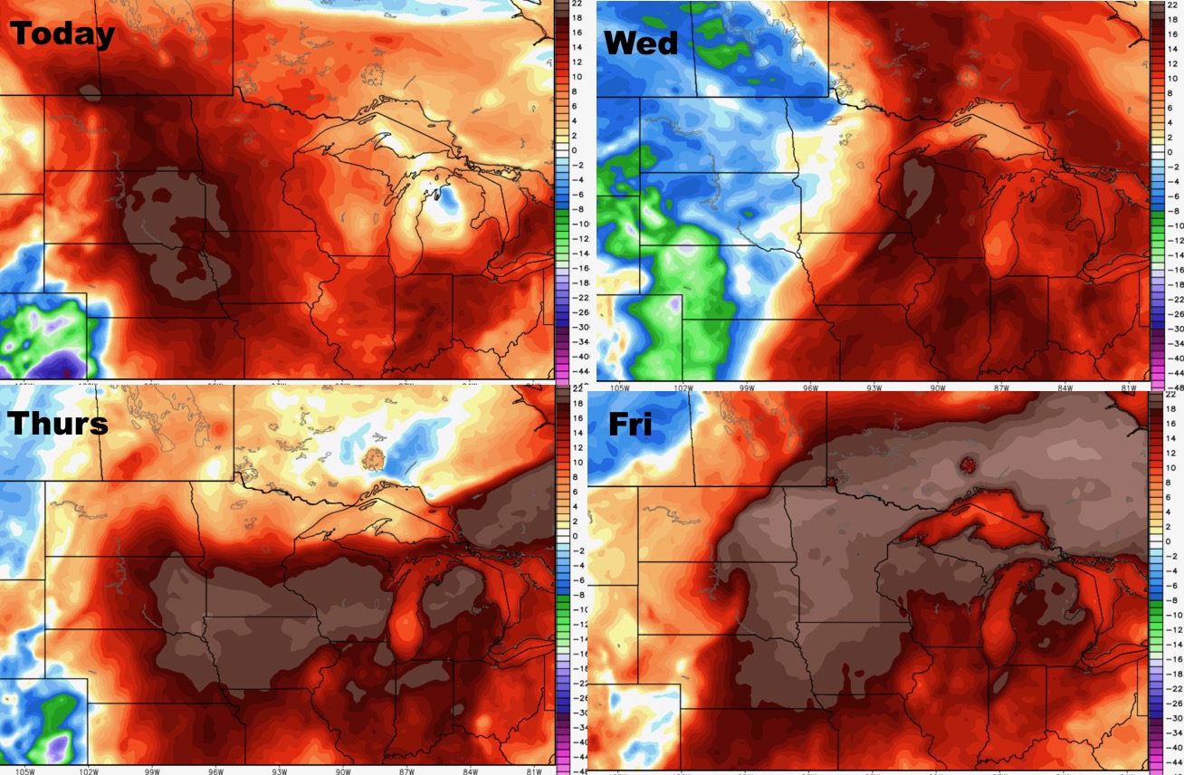
Humidity stays higher than normal for much of the region.
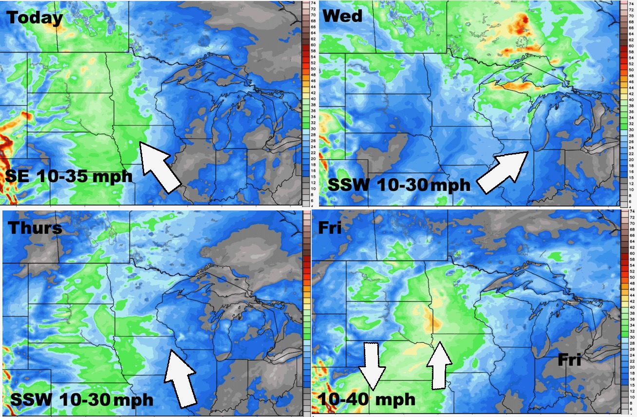
Wind forecast next 4 days is below.
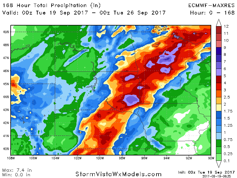
Total rainfall is impressive over the next 7 days, with some possibly seeing over 6″!